Many people who come to Lake Tahoe plan on hiking bigger and more iconic trails such as Mount Tallac, Freel Peak, or Mount Rose. However, those hikes are all-day affairs. And sometimes you just don’t have the time or energy to tackle the longer hikes of Lake Tahoe.
Or, there’s too much snow in the higher elevations. So in those challenging and dangerous cases, you might actually need technical gear such as ice axes and crampons. In addition, you may often find yourself traveling with younger or older companions who can’t hike for very long distances.
Regardless of your reason for choosing a short and easy hike in South Lake Tahoe, there’s sure to be at least one trail on this list that’ll provide your nature fix for the day.
Support Tahoe Trail Guide with a financial contribution via PayPal (single contribution) or Patreon (reoccurring contributions). Your support of Tahoe Trail Guide is very much appreciated!

Notes about South Lake Tahoe Locations
This list of short and easy hikes in South Lake Tahoe is a collection of my personal favorites. The majority of these short trails are located on the south shore of Lake Tahoe, hence the article’s title.
Keep in mind, however, that most people, including myself, consider South Tahoe as being a relatively broad area. It includes the community of Meyers, the City of South Lake Tahoe, and Stateline, NV. It also includes locations slightly further south such as Hope Valley and Carson Pass.
Additionally, some of these short hikes are located on the east and west shores of Tahoe. Although, they’re just slightly north of South Lake Tahoe.
Distances of Short and Easy South Tahoe Hikes
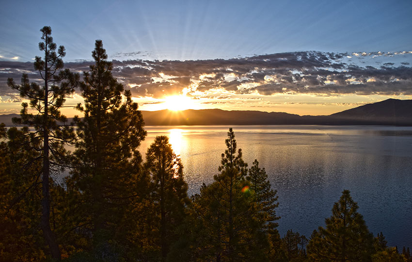
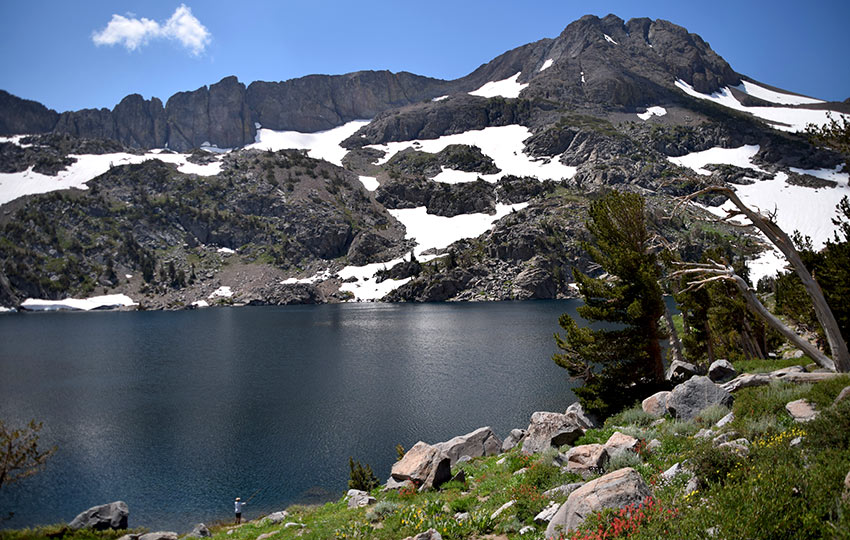
Despite their short distances, many of these easy South Tahoe hiking trails boast stunning views of Lake Tahoe. This is especially evident when hiking them at sunrise or sunset.
These short South Tahoe hiking trails feature distances of five miles or less. They also generally feature total elevation gains of less than 500 feet.
If you’re interested in longer and more strenuous day hikes, read Best Day Hikes of Lake Tahoe.
There are still benefits to hiking the trails on this list that don’t include panoramic scenes of Lake Tahoe. Those hikes can offer memorable views of wildlife, wildflowers, and other natural wonders of Tahoe.
Ideally, you’ll want to hike these shorter South Tahoe trails in the summer and fall.
For parking directions and travel considerations about these short and easy South Tahoe hikes, click their respective links.
A Quick Note About Snow
You could hike many of these trails during the spring and winter if it’s a low snow year at Tahoe. But you probably want to wear heavier duty footwear to deal with snow, runoff, or mud. Also, you may want to consider having some type of foot traction device in case it’s icy.
I present a more thorough discussion about hiking at Lake Tahoe when snow is present in some related articles. Those articles are titled Considerations for Spring Hiking and Backpacking at Lake Tahoe and Tips for Spring Hiking in the Mountains of Lake Tahoe.
Lastly, if you don’t ski but there’s still snow on the ground, consider snowshoeing. For more information, read my article about snowshoeing in South Tahoe. And if you’re new to snowshoeing, read about the basics of snowshoeing and the five reasons I love to snowshoe.
Hiking Meek’s Creek Falls (West Tahoe)
Easy parking, a nearly flat trail, and a waterfall makes hiking Meek’s Creek Falls truly worthwhile. Additionally, you’ll be traveling near a creek and adjacent meadow. So, you’ll have plenty of opportunities to spot diverse Sierra Nevada wildflowers and birds.
Please note that this short and easy hiking trail is located slightly north of South Tahoe along the west shore.
- Distance: 4 miles
- Elevation: 50 feet
Hiking Vikingsholm Castle
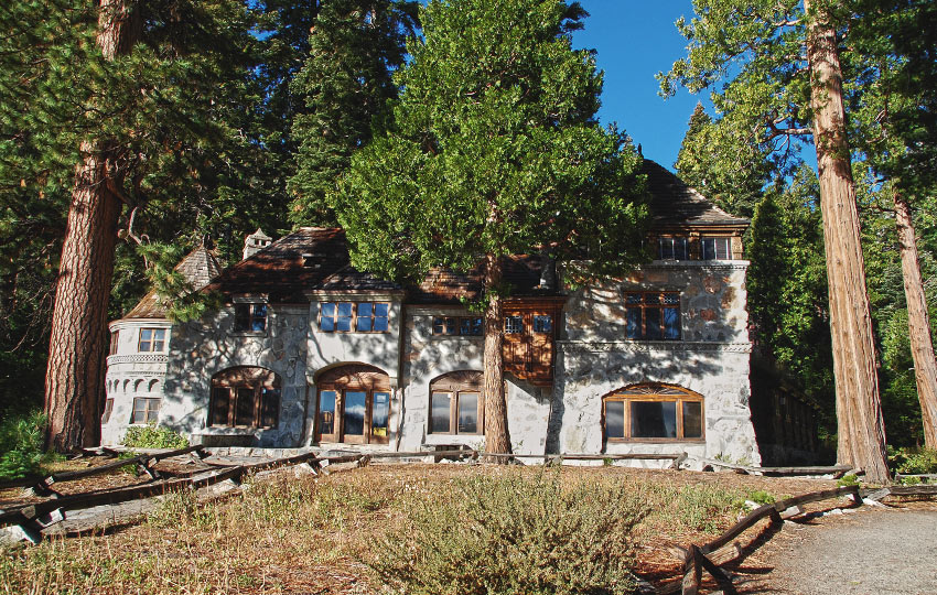
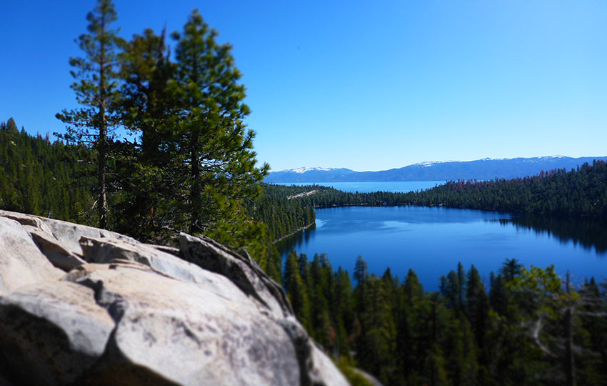
Hiking down to Vikingsholm Castle at Emerald Bay is a must-do Lake Tahoe hike, even though it’s short and easy. Vikingsholm Castle is arguably one of the most popular and quintessential locations to visit at Lake Tahoe.
Please note that hiking around Vikingsholm Castle is free (other than the cost of parking), but I highly recommend taking a tour if you have the time to do so.
- Distance: 2 miles
- Elevation: 500 feet
Hiking Emerald Point
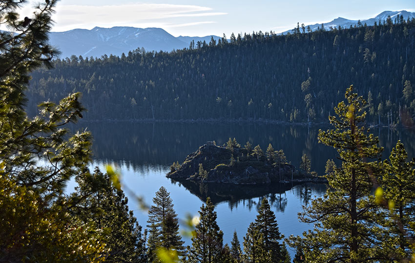
Hiking to Emerald Point follows the established trail on the north side of Emerald Bay. In addition, it features just a dash of off-trail adventure. For example, in order to reach actual Emerald Point, you’ll need to do a little route finding through the forest at the turnaround point for this short and easy South Lake Tahoe hike. And, since this trail contours half of Emerald Bay, you’ll have plenty of opportunities to see diverse Sierra Nevada wildflowers and bird populations.
- Distance: 5.5 miles
- Elevation: 500 feet
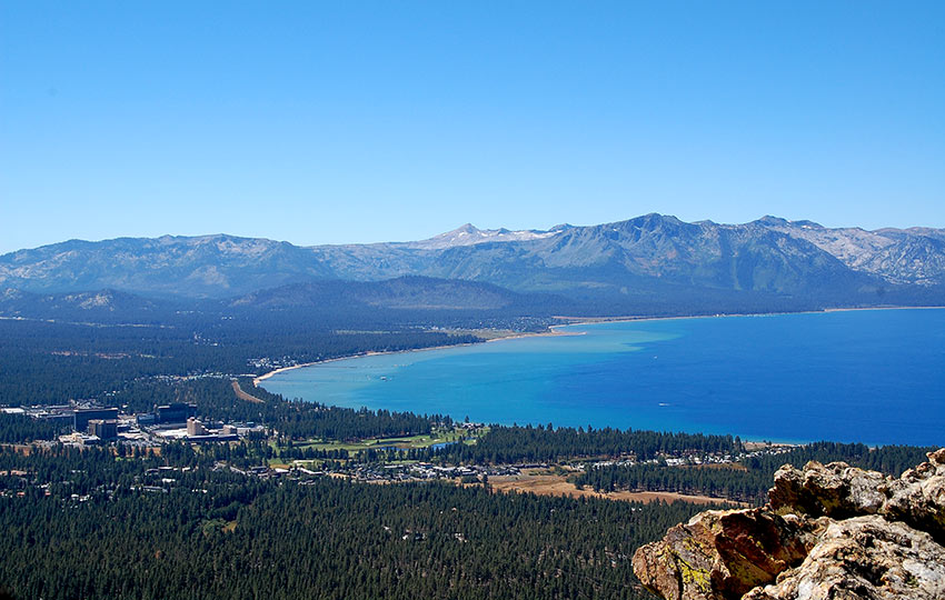
Hiking Eagle Point Campground and Overlook Trail
The hike to the Eagle Point Campground and Overlook Trail is super short and travels through the actual campground. So, I agree that this doesn’t sound like a very sexy hike. However, the end point on the Overlook Trail features incredible panoramic views of Lake Tahoe looking east. I often like to wake up early and go to this easy and convenient location in order to watch the sunrise.
You could extend this hike further (if it’s too short for you) by hiking along the south side of Emerald Bay in the direction of Vikingsholm Castle.
- Distance: 1.25 miles
- Elevation: 50 feet
Hiking Cascade Falls
During this hike, and once you reach the actual Cascade Falls, you’ll be treated to panoramic views that include Cascade Lake and Lake Tahoe. What more could you want from a short and easy hike in South Lake Tahoe?
My main concern with this short hike is that the trail is rocky. There are obviously rocks on every trail in Tahoe, but the hike to Cascade Falls always seems to me to have more tripping hazards than other well-worn trails.
- Distance: 2 miles
- Elevation: 350 feet
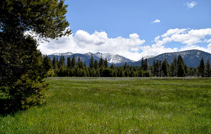
Hiking Cathedral Meadow
Hiking Cathedral Meadow is a relaxing meander through the woods. Since you’ll essentially be traveling to the east side of Fallen Leaf Lake you’ll be rewarded with nice views of the lake at the turnaround point. Additionally, you’ll be hiking through and around Cathedral Meadow so you’ll have the chance to see many varieties of Sierra Nevada wildflowers and birds.
- Distance: 2.5 miles
- Elevation: 100 feet
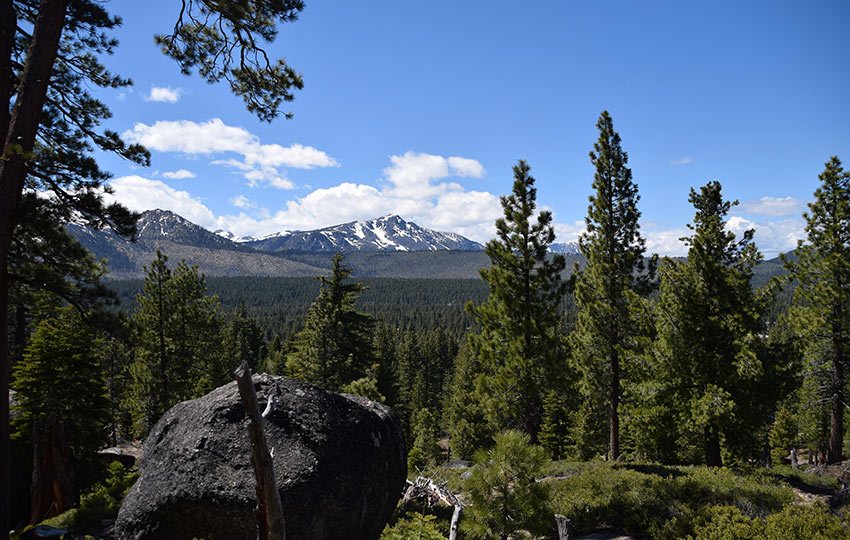
Hiking Fallen Leaf Lake (East Side)
There are many short hiking trails at Fallen Leaf Lake, but this east side trail is one of my favorites. Why? Because very few people travel it compared to the numerous social trails at Fallen Leaf Lake. This trail isn’t the most dynamic hiking trail at Lake Tahoe, so don’t plan your whole day around it. But it provides an immersive nature experience, various access points to Fallen Leaf Lake, and the opportunity to spot some diverse wildlife and plant life (so long as you’re paying attention!).
- Distance: 2.5 miles
- Elevation: 200 feet
Hiking Washoe Meadows State Park
In spite of it being a part of the CA State Park system, Washoe Meadows State Park sees relatively little traffic. For that reason, hiking Washoe Meadows State Park is a locals’ favorite. For example, you’ll often see less than a handful of people traveling through the park at any given time. That is, unless Tom Cruise is filming a movie there! I love this park for spotting diverse Sierra Nevada wildflowers and birds.
- Distance: 3 miles
- Elevation: 100 feet
Hiking Cowboy Hat Hill
Hiking Cowboy Hat Hill is another locals’ favorite because it’s an out-of-the-way location and exceptionally short hike. That is to say, locals love their longer hiking trails. However, the hike to Cowboy Hat Hill is a rather quick one to do before or after work. That said, just know that the “trailhead” is located within a neighborhood so parking is extremely limited. The turnaround point offers a nice view of Mount Tallac and the area is peppered with Sugar Pine trees.
- Distance: 1 mile
- Elevation: 200 feet
Hiking Cold Creek Trail
Hiking Cold Creek Trail is my least favorite short and easy hike in South Lake Tahoe. That is to say, this trail is mostly uphill and doesn’t offer any long views. However, it’s a great hike through the forest and along a creek. It also connects with Powerline Trail and continues higher up the mountain to High Meadow.
The main reason I recommend this short hiking trail is because many people who visit South Tahoe stay near Pioneer Trail and the Cold Creek area. Consequently, this trail is right in their (temporary) backyard.
- Distance: 2.5 miles
- Elevation: 300 feet
Hiking Lam Watah Historic Trail at Rabe Meadows
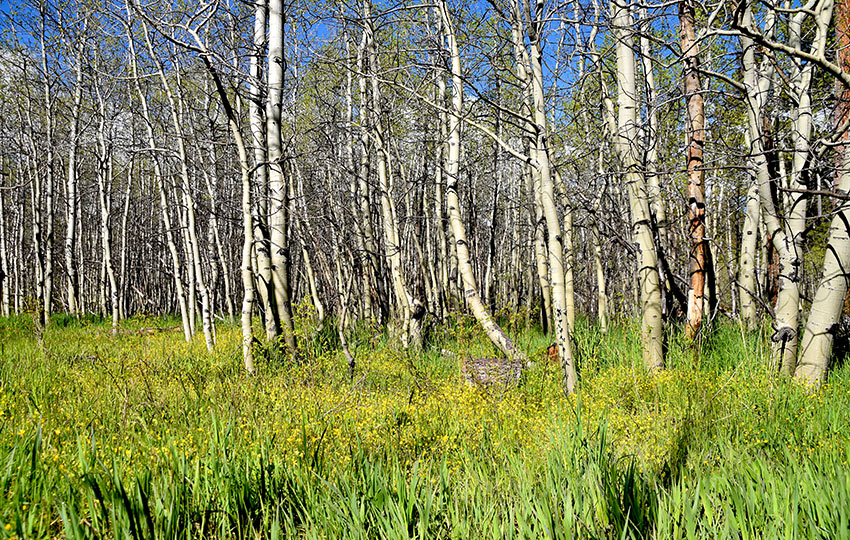
Hiking the Lam Watah Historic Trail through Rabe Meadows is probably the most “civilized” trail on this list of short and easy hikes in South Lake Tahoe. Most likely this is due to the fact that much of it travels along an asphalt walkway. Although the trail is located so close to Stateline, NV, it features diverse wildflowers and bird populations due to its proximity to wetter terrain. Additionally, you’ll see Aspen groves, walk through a Jeffrey Pine forest, and have the opportunity to take a pit stop at Nevada Beach along the way.
- Distance: 3 miles
- Elevation: N/A (flat)
Hiking Castle Rock (East Tahoe)
According to Tahoe Trail Guide analytics, hiking Castle Rock is the most searched for trail on this list of short and easy hikes in South Tahoe. I agree that the hike is great. But it’s not that great. Therefore, I can’t say why it’s so popular other than it’s close to VHRs on Kingsbury Grade and casino hotels down in Stateline. Despite its popularity, though, I’ve always found myself alone when hiking this trail.
The trail travels through the forest and then rewards you at the top with panoramic views of the south shore of Lake Tahoe. Keep in mind, though, that if you want to see the best views there’s some actual rock scrambling to negotiate at the end.
- Distance: 2.25 miles
- Elevation: 525 feet
Hiking Logan Shoals Vista Point (East Tahoe)
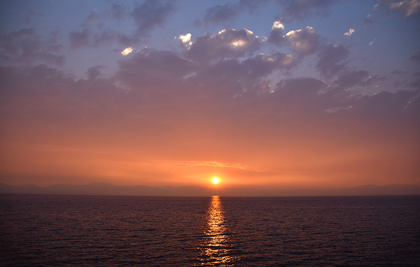
Less of a hike and more of experiencing a living panoramic image, visiting the Logan Shoals Vista Point is a no-brainer. Just pull over in the large parking area for the lookout. Then, you can see for yourself why Logan Shoals Vista made this list of short and easy hikes of South Lake Tahoe.
At the lookout, you could just take in the views and read the interpretive signs. Or, you could walk down the paved path and scramble around some boulders for a photo op. I recommend doing that, as well as hiking down to the old dirt road for more views of Lake Tahoe. The best time to visit this location is at sunset since the location is west-facing.
- Distance: 2 miles
- Elevation: 175 feet
Hiking Spooner Lake (East Tahoe)
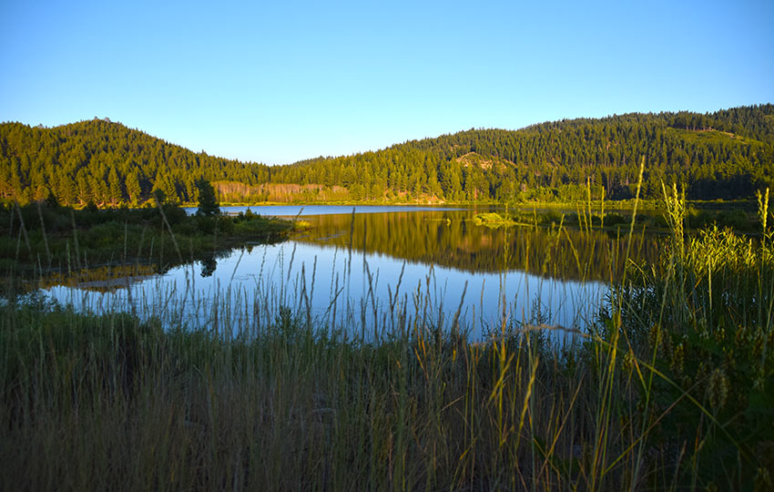
The hiking trail around Spooner Lake is flat and features interpretive signs with information about local and natural history. And because the trail circumnavigates Spooner Lake you’ll have the opportunity to see various wildlife populations. Additionally, you may even see the rare and elusive Tahoe Rim Trail thru-hiker 🙂 I never recommend feeding wildlife. However, feel free to give those thru-hikers some snacks if you’re packing extras.
- Distance: 3.5 miles
- Elevation: 250 feet
Hiking Frog Lake (Carson Pass)
The bulk of the hiking trail to Frog Lake is essentially uphill. However, that distance is relatively short at about 1 mile. And the payoff is worth it because you’ll be treated to 360 degree panoramic views around the Carson Pass area, which includes Round Top, Caples Lake, Red Lake Peak, and Hope Valley. In addition, Frog Lake is an excellent place in which to find many varieties of Sierra Nevada Wildflowers. Fun for all ages and athletic abilities!
- Distance: 3 miles
- Elevation: 350 feet
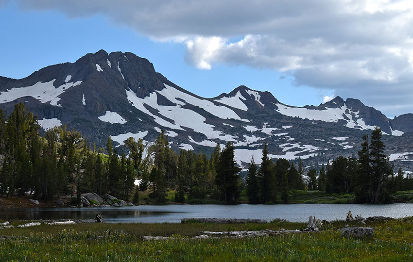
Hiking Winnemucca Lake (Carson Pass)
The hike to Winnemucca Lake is a bit more challenging than many of the hikes on this list. On the other hand, I’d be remiss for not including it here because it’s such a quintessential South Lake Tahoe hike. Incredible landscape views are a given. But arguably the biggest draw for people hiking to Winnemucca Lake in the summer is the volume and variety of wildflowers on display. Let’s put it this way … even A-list celebrities know its the place to see wildflowers as evidenced by my chance encounter with Helen Mirren in 2019 on her way to Winnemucca Lake. What a treat that was!
- Distance: 5 miles
- Elevation: 600 feet
Keep in mind that this list is a work-in-progress. Therefore, I’ll continue to add short and easy hikes based in the South Lake Tahoe area over time.
Again, if you’re looking for longer and more strenuous day hikes, read Best Day Hikes of Lake Tahoe.
Which short and easy hikes of South Lake Tahoe have I missed?
Share your recommendations in the comment section below so that others may enjoy short and easy hikes in South Lake Tahoe 🙂
I love hiking in South Lake Tahoe! Can’t wait to explore these trails. Do you have any tips for beginners?
Hey Cecilia,
Thanks for taking a look at my website, and for reaching out 🙂
I don’t have any specific hiking tips for hiking any of these shorter trails other than getting to the more popular trailheads earlier in the day (to avoid the potential for crowds). All of town is busy right now as it’s the height of summer. That, and just be prepared for changing weather. We’ve been having some afternoon thundershowers this week that are isolated, and have only lasted for an hour or two, but having a rain jacket could be helpful. Otherwise, all the same basic hiking principles apply (proper clothing, sunscreen, water, snacks…).
Let me know if you have any specific questions about any of the trails listed on this page 🙂
Jared
Really appreciate your list! Thank you,
You’re welcome, Peggy! Thank you for the kind words 🙂
Perfect for a leisurely day outdoors!
Indeed they are. Thanks again 🙂
Hi Jared, Great info. Your compilation and descriptions are very much appreciated (particularly the directions). Wondered if you’d considered Tahoe Paradise Park and the trail up or down along the Upper Truckee River for a fairly easy hike, though you’d have to set the limits on length. I saw an American Dipper there today! Also Lake Baron, though I did not walk there.
Hey Susan,
Thanks for the kind words 🙂
The directions seem to be, in my opinion, the most important part of any trail description. I find way too many Tahoe-related hiking websites that offer stripped down versions of directions/parking, and it seems like they always offer just enough information for a person to get lost. haha.
Your recommendation for the trail adjacent to the Upper Truckee River near Tahoe Paradise Park and Lake Baron is a good one. I’ll definitely include it sometime in future (when I carve out some time!).
Glad you saw an American Dipper! I see them them relatively frequently in and around that aspect of the Upper Truckee River, and further north into Washoe Meadows State Park by the golf course. Such a fun bird to watch. I’ve also observed Spotted Sandpipers along the river. And, earlier this summer (of 2021) I saw my first Belted Kingfisher in the area. Super fun to see all the birds around this part of South Tahoe.
Thanks again for the suggestion!
And the Belted Kingfisher was there again yesterday!
Awesome! I’ve always suspected they were around, so I’m glad for the multiple confirmations. Such beautiful birds 🙂
Hi! Ok maybe I missed it, but is the mileage round trip or one way? Thanks for the amazing info!
Hey Susan,
Thanks for reaching out! I may not have been super clear in the introduction to this list of hikes but, yes, the mileage featured for each hike is the total (aka round-trip) miles. Essentially, I wanted to compile a list of South Tahoe hikes that were 5 miles or less in distance.
Thanks for checking out the site. And, let me know if you have any other questions!
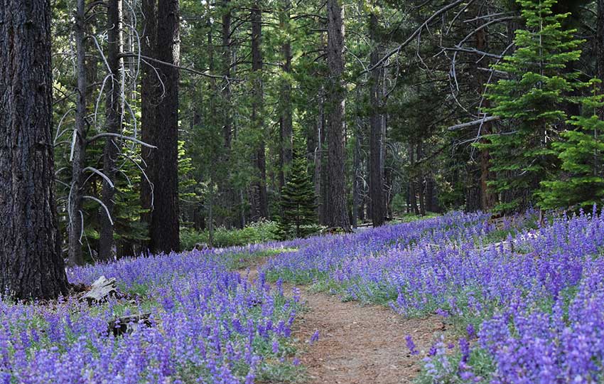
Hi Jared~ what trail is the cover pic with the Lupines? Any info you could provide would be greatly appreciated. Thank you!
Hey Amy,
Thanks for reaching out. The trail through the lupine is on the south end of Washoe Meadows State Park. It’s much closer to the bottom end of the loop featured in my XC skiing/Snowshoeing article about Washoe Meadows State Park (https://tahoetrailguide.com/cross-country-skiing-and-snowshoeing-at-washoe-meadows-state-park/). Keep in mind that I took the photo on July 2, 2019, which was the summer after the epic Tahoe winter of 2018/19. So, I wouldn’t expect to find so many lupine blooming all at once on a typical year.
Anyway, hope that helps! Let me know if you have any other questions.
How about the Taylor Creek Visitor’s Center and stream profile hike, along hwy 89 veer west at the “Y”. Paved Ada/family-friendly trail through meadow, aspens, along Taylor Creek and underground into a stream profile chamber where you can look underwater into the stream. Also, a separate dirt trail Down to a beach at the lake. Is it still there? Is it open? Haven’t been there in years. But used to take the kids there when they were little.
Hey Barb,
Thanks for the recommendation! Yes, the Taylor Creek area is definitely on my to-do list for writing another short and easy South Lake Tahoe trail article. I’m honestly not sure about the specific details about their current operations (due to the coronavirus situation), but I believe the parking lot is now open for day-use. I know it’s open to foot traffic as well, as I hiked in and did some birding at Taylor Creek and Kiva Beach on May 26 (2020).
Thanks again for the suggestion 🙂
April 17, 2020 – Please note that with the current Coronavirus/COVID-19 pandemic environment we’re facing, traveling in the backcountry is not recommended as it places a potentially unnecessary strain on emergency medical services (that could be focusing on COVID-19). For the time being, use this list of Tahoe hikes for planning while you shelter-in-place. Thank you.
Thank you so much for your detailed response about hiking in Tahoe in January. I forgot to mention that I am Austrian, and so are 4 more people of the group of 6 I mentioned. So before I moved to the US (15 years ago) I was frequently vacationing in the Austrian Alps (Lech/Arlberg, Kitzbuehl, Schladming, Saalbach), so from what you describe to me in your response to my question is pretty much the same than I was used to see there. You helped me a lot with your descriptions. The reason why I try to plan ahead so far, is that my father turns 80 this June (my parents live in Austria), and my birthday present most likely will be 2 flight tickets from Austria to the US, and a week of winter vacation with my husband, my daughter, her husband and me in Tahoe. (My daughter and her husband live in Austria, too. My husband is the only “real” American, and he is also the non-skier .. believe it or not. lol). Well, thanks again, and if we really end up in Tahoe next January, I will try to hop by your workplace and say Hi. Greetings from Athens, Tennessee – where one inch of snow would bring the entire county to a standstill. 🙂
You’re welcome, Karin! Starting early to plan for all of those logistics definitely makes sense. That’s great that you’re able to bring everyone together for a vacation 🙂
I know of a few other places where an inch of snow can gum up the works for people not familiar with traveling in the snow. I couldn’t imagine living without it 😉
Anyway, good luck with everything. Definitely let me know if you do plan on coming out to Tahoe, and if you ever have more questions!
Question: Can you do any of those small hikes in January, too? I plan to go there for a skiing vacation beginning of January 2021, and in our group of 6 we have 2 non-skiers, and one 80 year old – very good skier – who doesn’t want to ski each and every of the 7 days we stay there. (Heavenly). Any recommendations whatelse to do except skiing and shopping, would be appreciated. Thanks in advance.
Hey Karin,
Thanks for reaching out. And I applaud you on your advanced planning. I can barely plan my life out a week in advance! haha
Depending on weather conditions, some of the trails I have listed in the article might be possible to hike in January. However, I wouldn’t necessarily plan on it. Winters have been up and down during during my 15 years of living at Tahoe. We’ve often had some drought winters in a row followed by massive snowfall winters. This season (2019/20) we’ve had good snow for skiing since Thanksgiving. And we just received another 1-2 feet (depending on elevation/location) on January 16, 2020.
So I wouldn’t plan for traditional hiking in January. Although there’s always the chance that there won’t be that much snow on the ground at lake level and you could probably walk around, there’ll most likely be patches of snow and ice that’ll prevent you from going too far (without foot traction devices, for example).
Again, you’re talking about January in the mountains, so I would plan for snow. That said, you could visit some of those hiking trails (and others) using snowshoes. They’re easy to use and allow you to travel in just about any snowy condition without knowing any special skills or techniques. The deeper the snow, the greater the workout, however. Bring your own snowshoes or rent from a local shop in town. I don’t know if you have experience with snowshoes, but if not here’s an introductory article I wrote about it winter activity:
https://tahoetrailguide.com/snowshoeing-basics-part-1-introduction-to-snowshoes/
As far as doing other winter activities at Tahoe, I’m not the best resource. I live a pretty simple life in that all I do every winter is buy groceries and gas to fuel me and my Jeep so that I can go to my job (at a cross-country ski center where I work and xc ski). And then on my days off, I cross-country ski in the backcountry. In between those activities, you can find me shoveling snow and publishing more articles and videos about cross-country skiing and snowshoeing 🙂
So, check out the South and North Lake Tahoe Visitor Center websites for more diverse ideas than mine 🙂
http://tahoesouth.com/
http://www.gotahoenorth.com/
Sorry for not being able to provide a more clear answer to your question, Karin, but activities are based on the weather and it’s hard to predict it that far out. Get in touch when it gets closer to your visit and I will provide some updates as to whether or not we have snow. Thanks again!
Hi Jared, one of our favorite hikes in the South Lake Tahoe area has been to Grass Lake in the Desolation Wilderness. We caught the trail at Glen Alpine and it was about 2.5 miles to the lake (maybe 3). It passed by Lily Lake and the old Glen Alpine cabins before entering into the wilderness area. We did this hike on a gorgeous fall day in 2018.
Hey Terah,
Thanks for the input! That is a good hike, to Grass Lake in Desolation Wilderness. I’ll definitely have to put that one on this list. I also like that it gives people a chance/reason to see Fallen Leaf Lake and the Glen Alpine Falls. Not sure if I’ll make it back there this season, especially since we’ve finally gotten some snow. And I can’t remember if they actually lock the gates to the backside of Fallen Leaf Lake (to everyone except homeowners?).
Anyway, thanks again!
Jared
Hi Jared–great list! I’m not sure if it fits your guidelines but the 20 min. hike to the waterfall at the top of Hawley Grade is a highlight for me in Meyers. To make it longer you can hike the three smaller waterfalls by following the river too.
Hey Karen,
Thanks so much for the recommendation! But I think you’re right about Hawley Grade being just out of the “guidelines.” The distance is good, but the elevation may be a bit much for those looking for an “easy” hike. That said, you have me thinking about adding an “Honorable Mentions” list to the article. Thanks again!
Jared