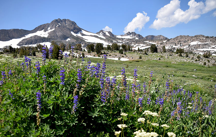
The hike to Winnemucca Lake is one of the quintessential hikes of South Tahoe, especially when it comes to searching for summer wildflowers. Not only is the hiking trail to Winnemucca Lake a favorite by long-time Tahoe locals, it’s a mecca for wildflower enthusiasts from Sacramento to the Bay Area.
Hiking to Winnemucca Lake is relatively short at 5 miles round-trip, but it’s a highly rewarding adventure. In addition to seeing numerous species of Sierra Nevada Wildflowers, you’ll see excellent views in all directions.
Support Tahoe Trail Guide with a financial contribution via PayPal (single contribution) or Patreon (reoccurring contributions). Your support of Tahoe Trail Guide is very much appreciated!

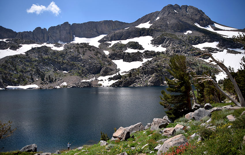
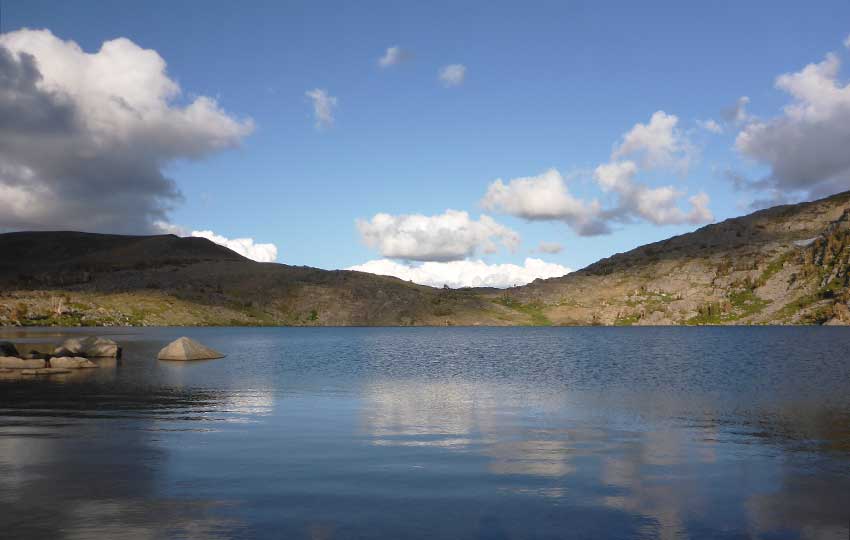
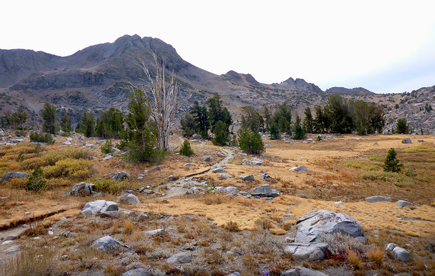
From various aspects of the Winnemucca hiking trail, you’ll be able to locate Elephants Back, Round Top, The Sisters, Caples Lake, Little Round Top, Red Lake Peak, and Freel Peak (in the distance). You’ll also travel past Frog Lake, which is a nice place to take a short break.
I believe the primary draw for hiking to Winnemucca Lake during summer months is the incredible display of wildflowers. This is not surprising to me as the area features so many species, and many can bloom well into the late summer (sometimes you just have to hike a little higher up and past the actual lake).
Scroll to the bottom of this article to see a photo gallery of Winnemucca Lake wildflowers. Also, there’s information about finding wildflowers at (and on the trail to) Winnemucca Lake.
There’s decent fishing at Winnemucca Lake in the summer, and you’ll be on the right track traveling along this trail if you’re hiking either the Pacific Crest Trail or Tahoe-Yosemite Trail (just know they diverge at mile 1.3).
If, for whatever reason, you don’t have the time or energy to make it all the way to Winnemucca Lake, hiking to Frog Lake and then just returning to the Carson Pass Information Center is an option. You may want to consider this idea if you’re hiking with really young children or elderly folks.
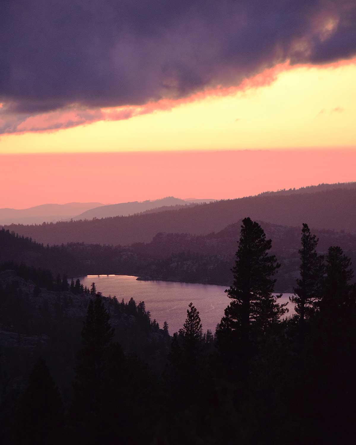
Another aspect to consider before heading to Winnemucca Lake is the previous winter’s snowpack. Carson Pass is famous as a backcountry ski destination. Not only does Carson Pass receive snow early in the season, it also holds it late into spring (and summer).
For example, my 136th and final day of cross-country skiing for the 2018/19 winter (which was epic!) was on June 13, 2019. I only skied to Elephants Back that day to make a bunch of fun downhill turns. However, I could’ve easily went all the way to Winnemucca Lake. Roughly 90% of the trail was covered in snow beginning at the Carson Pass Information Station.
So in the winter, this route provides access to great (but) technical cross-country skiing. The same goes for backcountry alpine skiing, namely at Elephants Back and Round Top.
Visit XC Skiing & Snowshoeing to Winnemucca Lake for specific details regarding winter travel to Winnemucca Lake.
Winnemucca Lake Hiking Trail Data (approximations):
- Location: South Tahoe – Carson Pass
- Category of Hike: Short Hike, Day Hike
- Total Mileage: 5.0 miles
- Total Elevation Gain: 600 feet
- Highest Point: 9,100 feet
- Trail Conditions: Hard-packed soil with exposed rocks and roots
For other shorter hiking options, visit Short and Easy Hikes in South Lake Tahoe.
Considerations for Hiking Winnemucca Lake Trail:
- Parking for the Winnemucca Lake hiking trail is at the Carson Pass Information Station, and is now a digital kiosk that only accepts credit/debit cards between May 31 – October 31 ($5 day use)
- Between November 1 – May 30 every year, the parking lots at Carson Pass officially become Sno-Parks and require a Sno-Park permit (purchase day or season permits in town before traveling to Carson Pass)
- Admire, study, and take photos of the wildflowers, but don’t pick them
- Keep in mind that at Carson Pass snow arrives early and stays late, so check the trail conditions prior to arriving
- Please note that snow arrives early Carson Pass and stays late, so check the trail conditions prior to arriving
- Adhere to all Leave No Trace principles
- There are few trail signs and markers on public lands in the Tahoe region, so unless there are tracks to follow, the correct route may be difficult to identify – when in doubt, turn back
- Be prepared for inclement weather by carrying warm clothes, food, and water
- Leave an itinerary of your plans with someone who’ll call emergency services if you don’t return by your prescribed time
Dogs are allowed, but keep them on leash and pick up after them
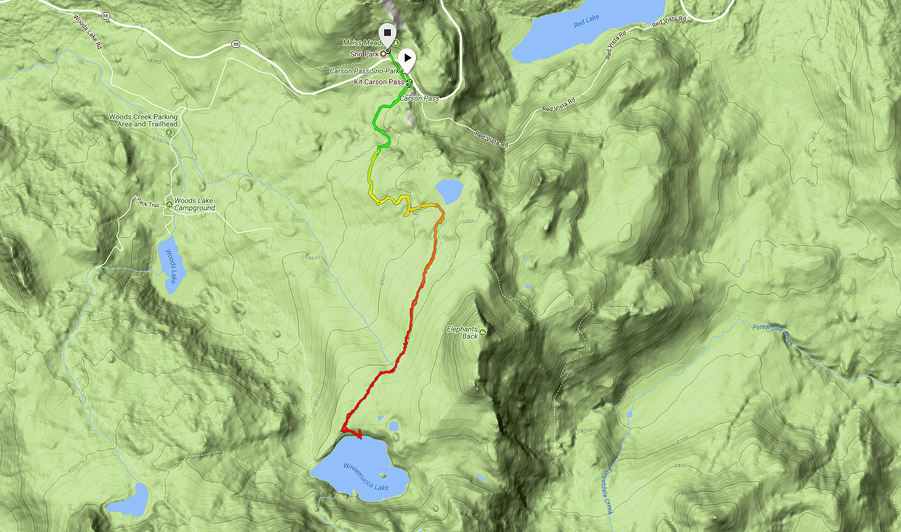
Parking Directions for the Winnemucca Lake Hiking Trail:
Park at the Visitor’s Center/Sno-Park at the top of Carson Pass in order to travel south.
There’s another parking lot just around the corner on the north side of State Route 88. However, only use it if the Visitor’s Center lot is full or if you plan to travel north from Carson Pass. Crossing the road can be dangerous due to the serpentine nature of State Route 88 and resultant blind corners.
In the summer (May 31 – October 31) you’ll need to pay a $5 day-use fee at the south parking lot, which is via a digital kiosk (credit/debit cards only).
You’ll need a Sno-Park permit ($5/day, $25/season) for travel between November 1 and May 30th every year (regardless of snow levels). You need to purchase the permits prior to your arrival (not at the actual Sno-Park).
You can buy them in Meyers or South Lake Tahoe. And, they’ll save you a $100 ticket (parking without a permit).
If the Carson Pass Information Station is open while you’re at Carson Pass, check out their selection of books and maps. The store sells lots of cool stuff to get you interested and informed about the region’s flora, fauna, and history.
The trailhead to Winnemucca Lake is located just behind the Carson Pass Information Station.
Here’s a map to assist you in finding the parking area for Carson Pass.
Travel along the Winnemucca Lake Hiking Trail:
Be prepared for elevation gain because the trail to Winnemucca Lake is mostly uphill. The trail is hard-packed and obvious during the summer.
It’s a favorite hiking trail for many people, so I recommend arriving early at the trailhead. You’ll have better luck securing a parking spot and avoiding the crowds by arriving early.
The trail travels through diverse terrain, including forests and exposed rocky and grassy fields.
The trail is lined with multiple varieties of Sierra Nevada wildflowers for much of the summer. Keep in mind that because this location sits above 8,000 feet, the snow tends to remain later into the summer. After big snow years, the wildflowers may not start blooming until July or August. On the other hand, at lower elevations they’ll start showing up in May and June.
You’ll be exposed to the elements once you hike past Frog Lake. The wind can be aggressive by the time you reach the Pacific Crest Trail at the Elephants Back junction. Bring extra layers and sun protection if you plan to spend the whole day out there.
The first 1.3 miles south from Carson Pass is the actual Pacific Crest Trail. Then it branches off from the route to Winnemucca Lake taking you west of Elephants Back.
This intersection is also where the Pacific Crest Trail and Tahoe-Yosemite Trail diverge. Continue straight along the trail to arrive at Winnemucca Lake.
Then, you could travel further along this trail to Round Top Lake, and Fourth of July Lake. Then, you could continue down into Summit City Canyon (which is the Tahoe-Yosemite Trail route).
For other shorter hiking options, visit Short and Easy Hikes in South Lake Tahoe.
The actual trail is less obvious during the winter. However, the trail is frequented enough that most likely there’ll be clearly laid tracks upon your arrival.
That said, there are some challenging sections early on with regard to cross-country skiing. So, I recommend reading Cross-Country Skiing and Snowshoeing to Winnemucca Lake for more specific information regarding this winter backcountry route.
Wildflowers at Winnemucca Lake
Please note that I’ve compiled the following gallery of Winnemucca Lake wildflowers over various years. And, the photos are from different times during the summer(s). Therefore, don’t expect to find all of the wildflowers presented here on one hike.
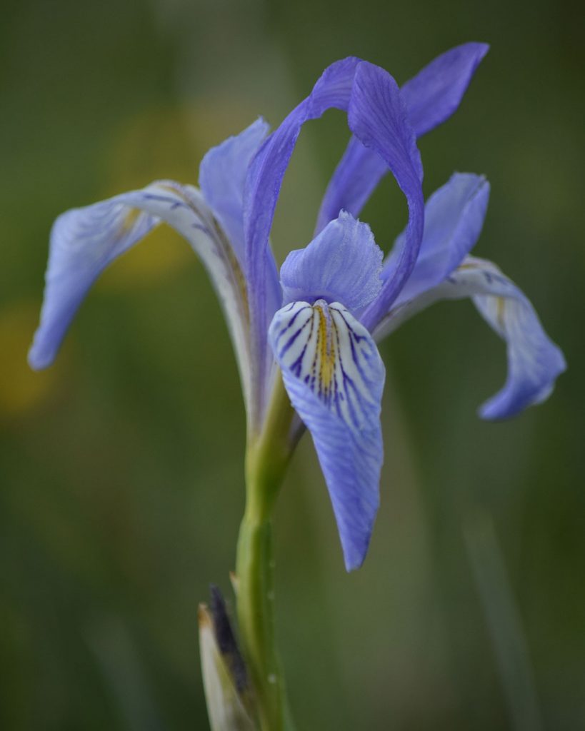
Also note that wildflower bloom times are often skewed at Carson Pass compared to other locations around Lake Tahoe. For example, Western Blue Flag will normally bloom closer to Lake Tahoe in the month of May. In 2019, however, I found many of those Wild Irises still in bloom at Winnemucca Lake on July 26th.
As I gather relevant photos of wildflowers found near Winnemucca Lake, I will update this gallery. In the meantime, post in the comment section the wildflower species that you believe are missing from the gallery.

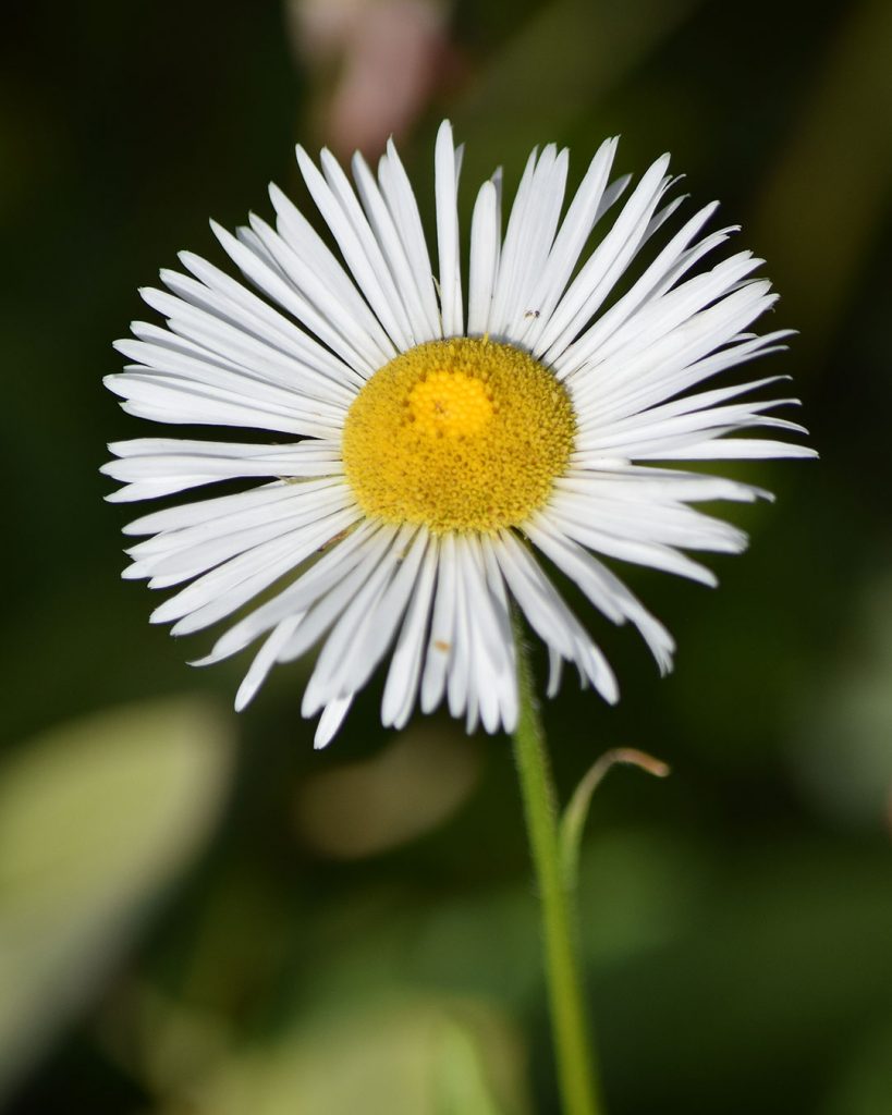
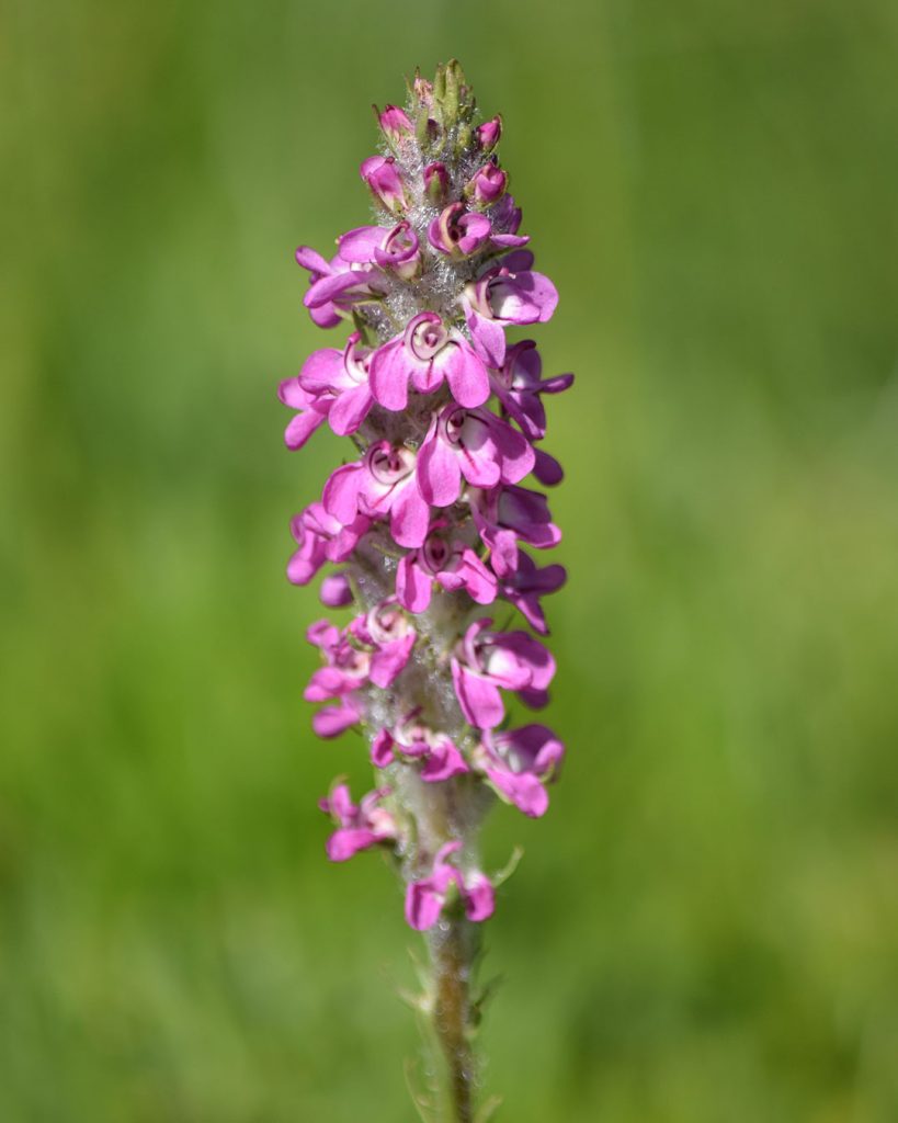
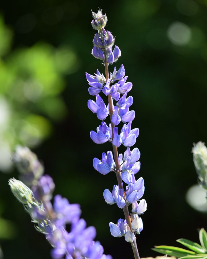
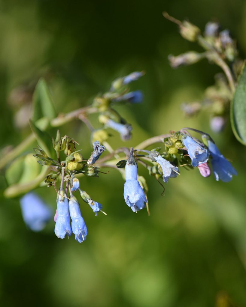
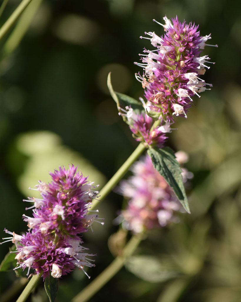
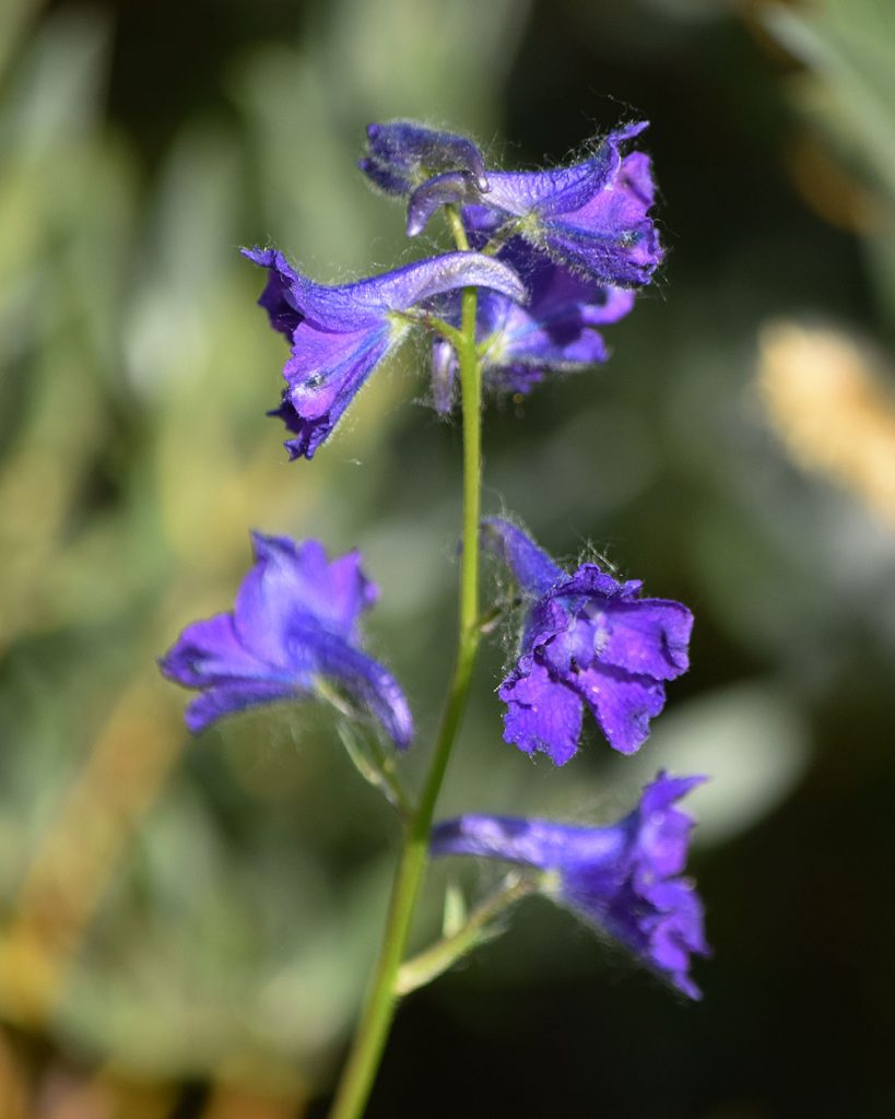
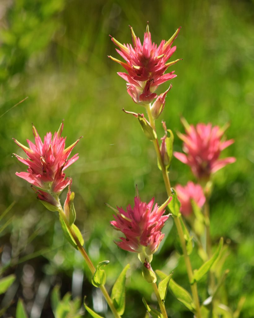
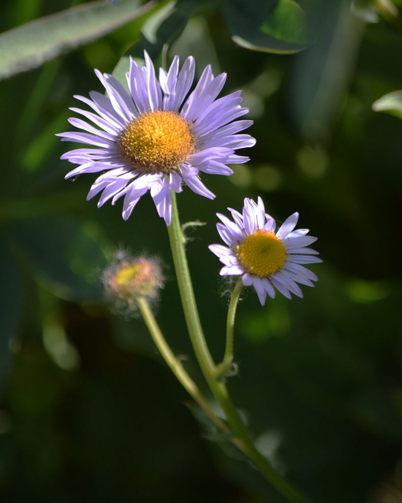
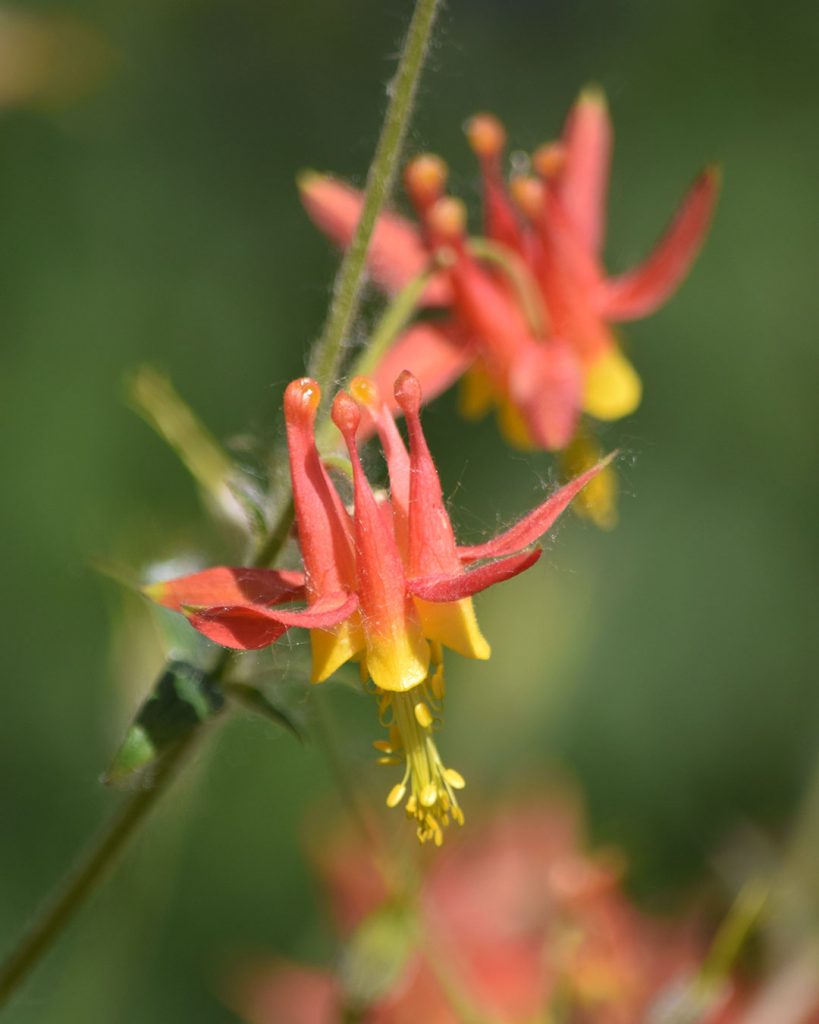
Western Blue Flag – Iris missouriensis (8/26/19) © Jared Manninen Coulter’s Fleabane: Erigeron coulteri (8/21/19) © Jared Manninen Little Elephant’s Head – Pedicularis attollens (8/21/19) © Jared Manninen Variety of Lupine (8/21/19) © Jared Manninen Mountain Bluebells – Mertensia ciliata (8/21/19) © Jared Manninen Nettle-leaf Giant Hyssop – Agastache urticifolia (8/21/19) © Jared Manninen Nuttall’s Larkspur – Delphinium nuttallianum (8/21/19) © Jared Manninen Giant Red Paintbrush: Castilleja miniata (8/21/19) © Jared Manninen Subalpine Fleabane: Erigeron glacialis (8/21/19) © Jared Manninen Western Columbine: Aquilegia formosa (8/21/19) © Jared Manninen
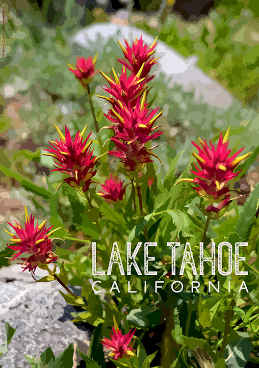
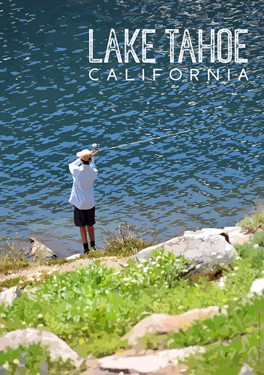
Winnemucca Lake Merchandise
I created the following posters based on my photographs of hiking the trail to Winnemucca Lake. I will continue to update and upload new designs, so check back often.
You can purchase them (and other Tahoe Swag) at my RedBubble account. There are many other products available, in addition to posters, so please check out my Lake Tahoe-related art & designs.
Do you have other insight, feedback, or trail updates about hiking Winnemucca Lake?
If so, please post it in the comment section below for the benefit of everybody 🙂
Hiked Carson Pass to Lake Winnemucca today, Aug 11, 2019. Beautiful clear day, Amazing wildflowers at their peak, but the spectacular show is mainly beyond Frog Lake, about half way between Frog Lake and Winnemucca Lake. Lower down the trail in the meadow areas are mostly Mule’s Ear’s (they were either waxing or waning, but didn’t seem quite at peak) and delicate sprinkling of color, but not the masses you get further up. There was still a nice show of iris scattered around Frog Lake but they looked like they were finishing up, along with petite yellow and white blooms mixed with the grasses on the East side of Frog Lake. But up around the PCT split, past Frog Lake, are the show-stoppers! Get your camera ready! Paintbrush, Pennroyal, Phlox, Columbine, Lupine, Iris, Buttercup, Astor, Cowparsnip, etc. displayed in thigh-high masses along the trail. Lots of butterflies and busy bees, too. But no mosquitoes at all. There was snow on the surrounding slopes, but no snow on the trail (though we didn’t go beyond Winnemucca), and only one small stream over the trail that we easily walked across. We saw someone catch a large trout in Frog Lake, and enjoyed seeing a Clark’s Nutcracker in a tree and several chipmunks. Keep in mind, it was very crowded in the two parking areas, and it costs $5.00 to park. The trail was pretty busy with a steady stream of hikers (this was on a Sunday afternoon), and LOTs of dogs, many off leash (I like dogs, but keep ’em restrained please, and carry out the poop. We saw a doggy-doo-doo bag left on the side of the trail). Absolutely beautiful up there right now!
Hey Barbara,
Thanks so much for the detailed trail report about the hike to Winnemucca and Frog Lake! Sounds incredible 🙂 Funny, because my roommate just drove up there yesterday with her mom, but said they couldn’t find a single spot to park at Carson Pass. So, they continued driving a little further west and wound up hiking to Lake Margaret.
I’ve hiked to Frog Lake a couple of times in the past few weeks to get some wildflower pictures. I was able to get some nice shots of those Western Blue Flags (irises) in bloom, as well as some photos of Prairie Smoke (after it had already been pollinated). Although, I may have to make another trip up there to see everything else in bloom now.
Again, I appreciate the update. The season has been wild!
The winter of 2018/19 was epic at Lake Tahoe. I continued to cross-country ski and snowshoe out of Carson Pass to Winnemucca Lake well into the month of May. On May 16, 2019, Carson Pass received a foot or more of snow. And then the following week, more snow fell. Wildflower bloom times for Carson Pass and Winnemucca Lake will most likely be closer to July (and later) for 2019.
I hiked this trail this last week and was very satisfied with the information provided by the website. That being said, I wanted to point out that the volunteers at the Visitor’s Center at Caron Pass were very helpful in providing additional information about the hike to Winnemucca Lake. For example, the suggested I also hike around Frog Lake on the way to Winnemucca Lake, which provided a wonderful view of Hope Valley, including Red Lake. Finally, I wanted to note there were two small patches of snow on the trail, which were easy to traverse. Overall, a great hike and a great day.
Thanks so much for the feeback and trail conditions, Jim! Yeah, I’ve met many of the Carson Pass Visitor’s Center volunteers over the years and they’re all super helpful and knowledgeable. Based on your feedback, I’ll include at least a little information on Frog Lake when I carve out some extra time.
Funny that you mentioned this particular hike because I was planning to head out that way today (7/26/19) to check out the wildflower status. Although, there are thunderstorms in the forecast for the second half of today, so we’ll see if I make the trip out there!
Take care, and thanks again 🙂
Although the Lake Tahoe region did not experience a lot of snowfall at the beginning of the Winter 2017/18 season, Carson Pass (as usual) had quite a bit. During the week of December 4th, I cross-country skied three times from Carson Pass to Winnemucca Lake. The snow was wind-scoured and crusty in places, but there was plenty of coverage everywhere.