During my first summer of living at Lake Tahoe I took a mountaineering course offered through Lake Tahoe Community College’s wilderness education program. The course was a fantastic way in which to learn more about the new outdoor playground that I found myself living in.
I moved to Lake Tahoe in the fall of 2005, so I took this backpacking trip in the summer of 2006. That said, Desolation Wilderness and the featured route hasn’t changed much since that time. But, then again, that’s the whole point of designating a geographic location as a wilderness area.
Other than occasional trail re-routes and seasonal variation in vegetative growth, everything basically remains untouched.
Support Tahoe Trail Guide with a financial contribution via PayPal (single contribution) or Patreon (reoccurring contributions). Your support of Tahoe Trail Guide is very much appreciated!

This 4-day backpacking adventure through Desolation Wilderness was the second half of the mountaineering course. A practical application of the lessons learned in the first class, so to speak.
In both classes, I learned new mountaineering skills, met good friends (one of which I still routinely maintain contact), and just developed a greater appreciation for my backyard.
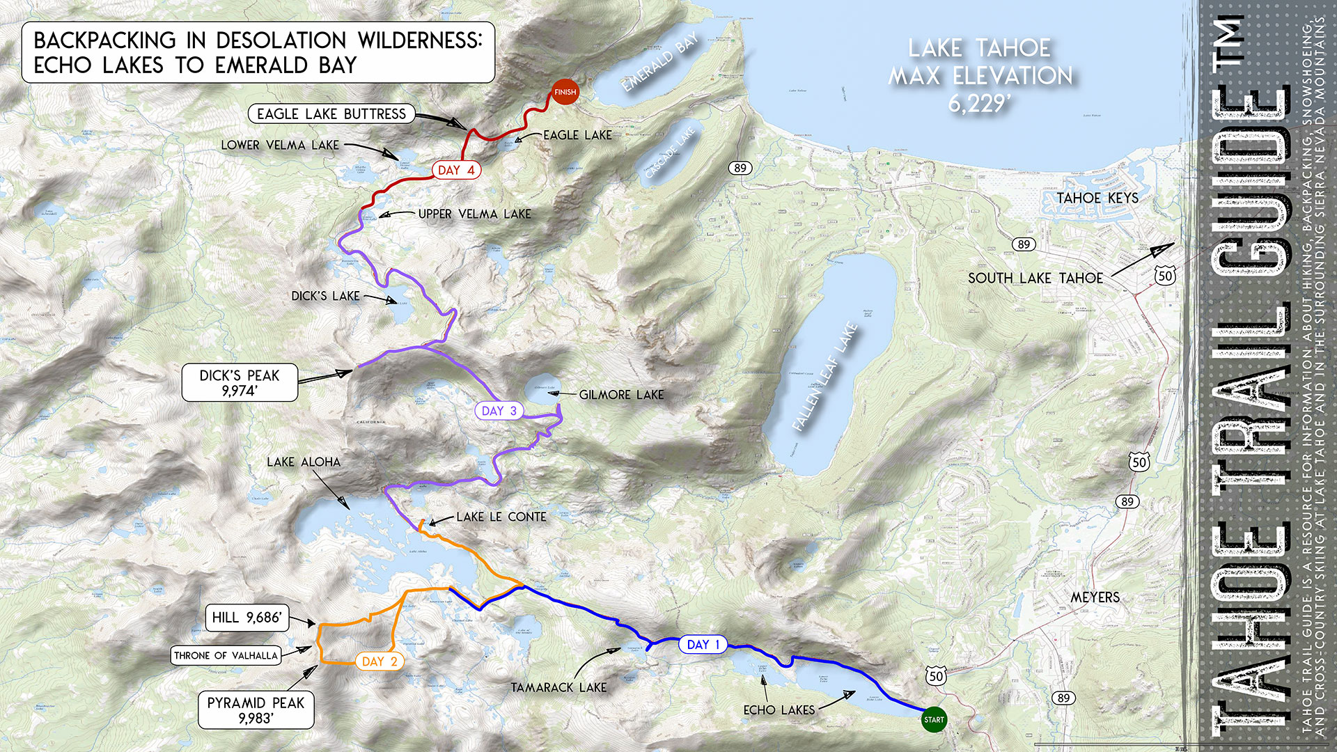
The following is the journal that I kept during the trip. I’ve posted at the end of the story a map of our route and basic trail data and considerations from the backcountry adventure.
Monday, July 24, 2006 (Lake Aloha)
We performed gear checks and shuttled our cars between the exit and entry points. Then, we made our way to the trailhead at Lower Echo Lake, which is on the southeast end of Desolation Wilderness. That was right around noon.
This backpacking trip was going taking us on a modified route from Echo Lakes to Emerald Bay. You could easily hike the Pacific Crest Trail/Tahoe Rim Trail north to an intersection just past Dick’s Lake.
Then, you could continue on down the trail to Emerald Bay. However, we plan to take a day to hike up Pyramid Peak, and also take a side trip to the summit Dicks Peak.
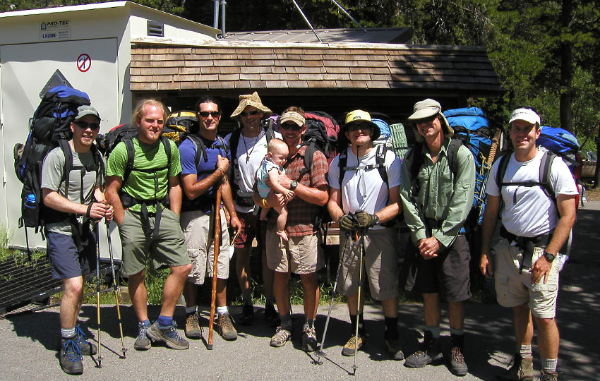
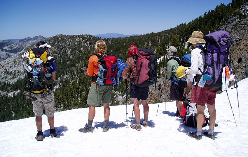
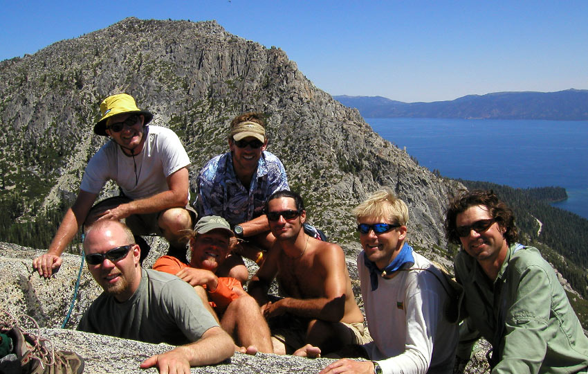
There are eight of us in the group, including our instructor Rick. Everyone except Mathew, who I befriended in the first half of the mountaineering course, is older than I. And, I believe most of the guys are married.
Once we started hiking, I was amazed by the stark contrasts. The bleached granite stood out from the deep blue sky and lakes. And, the rich green needles of Jeffery Pines and old, gnarled Junipers provided even more visual contrasts.
I knew the Sierra Nevada Mountains existed well beyond the ridge line surrounding Lake Tahoe. However, I never realized just how accessible everything was and how beautiful it all could be.
The Pacific Crest Trail and Tahoe Rim Trail use the same path through Desolation Wilderness. So, we basically tapped into a direct pipeline to miles of pristine wilderness..
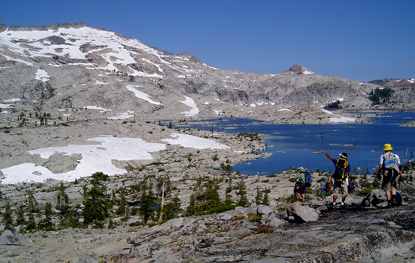
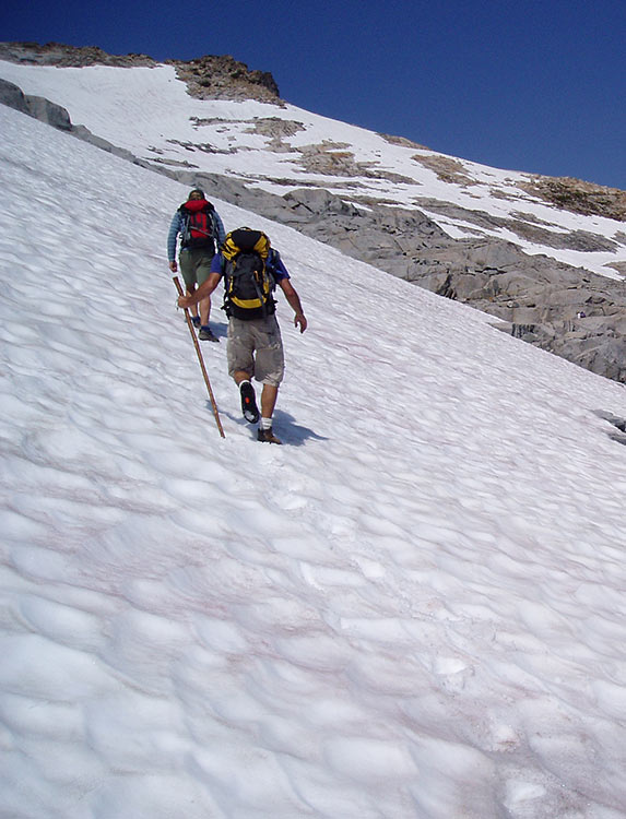
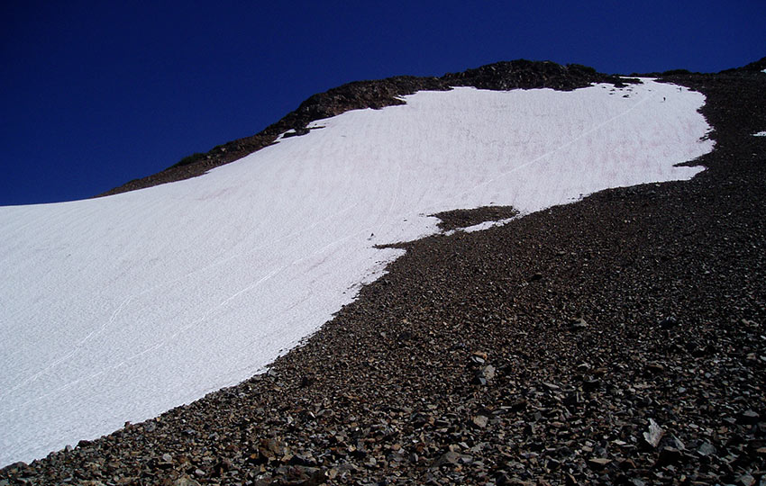
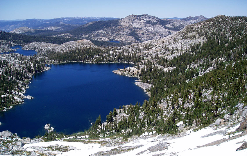
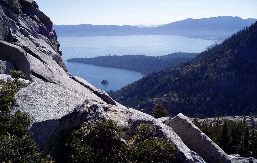
We traveled roughly seven miles in four and a half hours. At which point we reached our first campsite on the southern side of Lake Aloha.
The area where we camped reminded me of a day spa. The small peninsula in which we tented was surrounded by small pools and pockets of water. And, there were multiple granite ledges from which to swim and relax.
There were also man made retaining walls, allegedly constructed sometime during the 1920/30s. The walls allowed the lake to retain more water than it naturally would. One member of our group said that Lake Aloha acts as a reservoir and collects the surrounding snow melt.
Surprisingly, the water was cool rather than ice cold despite the lake being a drainage for snowmelt. Probably because we were there in late July.
Earlier on our hike we stopped to swim at Tamarack Lake. I wasn’t a huge fan of the experience, however. Unlike Aloha, which is filled with granite slabs from which to navigate without slipping, slimy rocks lined Tamarack Lake.
Tomorrow’s plan is to leave our gear at Lake Aloha and then hike to Pyramid Peak. When we return, we’ll collect our stuff and hike to our next “lodging.”
I’m glad that we’ll be slack-packing up Pyramid Peak. I feel strong, but there’s no reason to carry the extra weight if we don’t need to.
Lake Aloha seems appropriately situated for staging a base camp. From there, you could embark on any number of day hikes. My concern with that idea, however, is that you’d essentially have to leave your gear unattended. I never really worry about theft from humans. Rather, your gear becomes a prime target for critters, which can easily chew their way through your stuff.
It sounds like the others are beginning to prepare dinner. Time to eat!

I feel so much better now that I’ve eaten and had a chance to genuinely relax.
For dinner we ate beans, tortillas, salsa verde, and avocados. Mathew couldn’t find any bulk dehydrated refried beans before the trip. So, he bought dehydrated black bean soup and red beans and rice soup. Then he combined both in Ziplocs. He cooked the mixture with slightly less water so that the paste was thick enough to spread over the tortillas. Quite the chef.
Conversation was light and fun. And, many of the guys struck up conversation with me, inquiring about my work and from where I came.
I appreciated their interest and including me in their conversation. However, for the past couple of years I’ve grown bored of talking about myself. This is usually not the case!
I’m not sure what the deal is, but I feel like I haven’t much left to say. I’ve maintained a robust journal ever since thru-hiking the Appalachian Trail. But since I moved to Lake Tahoe last year (2005), I’ve been more interested in listening than speaking.
I considered cowboy camping tonight. However, the bugs came out in full force as soon as the sun set. So glad I set up the tent.
Tuesday, July 25, 2006 (Lake Le Conte)
Today’s hike was more strenuous than yesterday’s and my sleeping accommodations are better. I should sleep well tonight. And instead of tenting tonight, I’ll be sleeping under the stars. I’m using a ground cloth, closed cell foam mattress, bivy sack, and sleeping bag.
Prior to leaving our Lake Aloha campsite this morning, I swam for about 30 minutes. I woke up at 5AM thinking we were all going to rise at first light, but I was alone.
Before I realized how bad the mosquitoes were, I had already dismantled my tent. So I swam mostly to avoid getting eaten alive.
No matter. The early morning swim was a fantastic way to start the day.
We began our hike to hill 9,686 (simply referred to by its elevation) at 9AM. We reached its summit at about 12:30PM.
The hike took longer than I expected and there were a lot more benches and false summits than I anticipated. Fortunately the views were stunning.
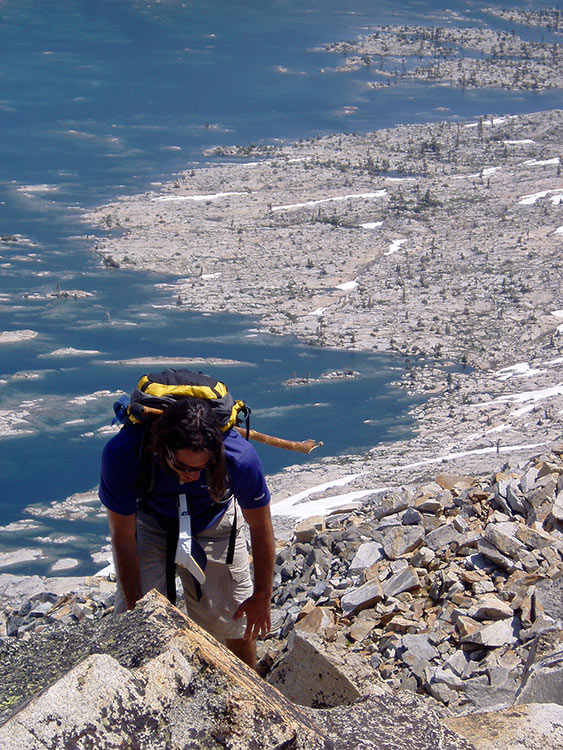
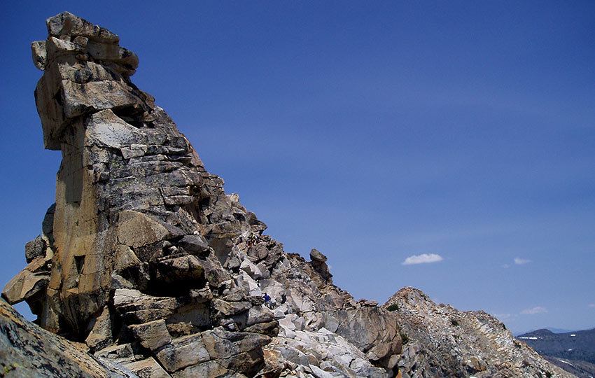
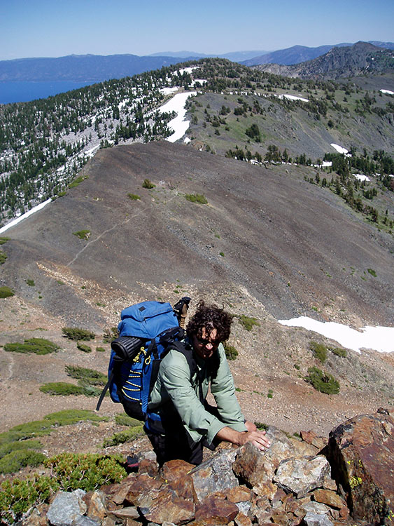
We took a short break on hill 9,686 and then proceeded to traverse the ridgeline leading to Pyramid Peak. That was slow going because there was a section near the “Throne of Valhalla” that required some actual climbing. Mathew and I, and one other hiker had negotiated the section by the time the rest of the crew reached the same spot.
Once Rick arrived, he placed a fixed line for people to rappel using the Dulfersitz method. It was fun to watch and caused me to reevaluate the route we three had taken. Mostly because we didn’t use ropes and hadn’t truly considered the consequences.
You tend to feel safer in a group, but that feeling also can cause you to take more risks. In this case, it wasn’t the most difficult of climbs and it was a relatively short distance. However, it still could’ve yielded catastrophic results had one of us slipped or tripped.
By the time the remaining group members negotiated the short climb, I finished my only quart of water. Fortunately, Mathew packed enough water to share until reaching the next water source. Total bush league on my part.
On Pyramid Peak, we snacked and took photos but didn’t linger very long. We still had miles to cover.
On our way down from Pyramid Peak there was a massive swath of snow that enabled us to glissade down. A total blast!
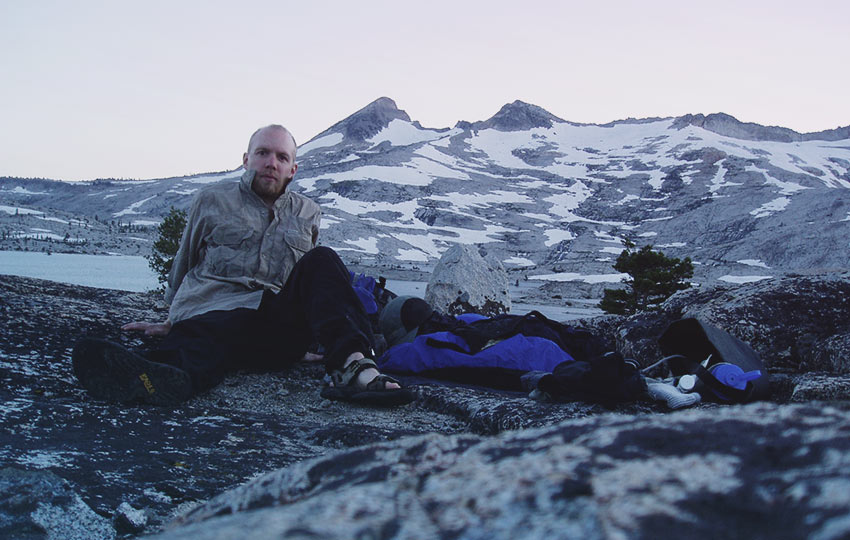
After returning to Lake Aloha , we grabbed our (undisturbed!) gear and hiked the short miles over to Lake Le Conte.
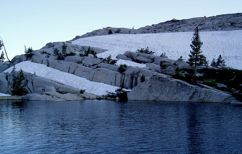
At Lake Le Conte, we’re totally exposed on a small prominence of granite opposite of Lake Aloha. But we have panoramic views of the Crystal Range and Mosquito Pass.
Directly behind us is the actual lake, which is small but deep and frigid. It’s no wonder, really, there are piles of snow melting directly into it!
After setting up camp, I dove into Lake Le Conte. Rinsing off before calling it a night always helps me relax and sleep more soundly.
Today I remembered how frustrated I usually am when traveling in a group!
While serving in the USMC, hiking in large groups was my biggest irritation. I was most annoyed on company or battalion level “forced marches.” Since everyone has their own rhythm and pace, it’s just so challenging to keep everyone organized.
On the Appalachian Trail, thru-hikers usually hike by themselves for this very reason. We meet up at rest stops and campsites, but we nearly always hike by ourselves and at our own pace.
Being in the group today was probably one of the contributing factors to my miscalculation of water needs. Not that I’m exceptionally fast when I hike, but I keep a quicker pace in order to minimize exposure. I also tend to push hard early on, and then taper off as the day or event progresses.
When working in groups, this isn’t always possible, so learning to adapt is what I contemplated during today’s hike.
The wind is blowing consistently and keeping the mosquitoes at bay. When I sit upright, the cool evening breeze soothes my skin. I wish I could fall asleep sitting here.
Wednesday, July 26, 2006 (Upper Velma Lake)
Today was another long one. So much so that we decided to stop short of our scheduled destination.
I wasn’t feeling exceptionally great. Last night’s sleep was less than ideal thanks to a small critter scurrying around me. It felt like I spent half the night shooing it away with my trekking poles.
I also found myself nursing a minor headache for most of the day. I don’t believe it was a symptom of altitude sickness, just general fatigue and dehydration. The pain eventually subsided thanks in part to being able to swim a couple of times.
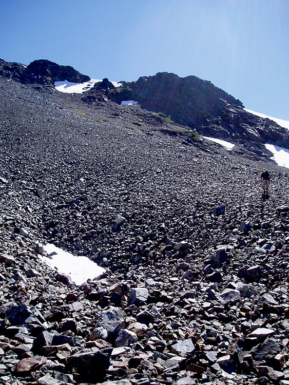
We summited Dick’s Peak early in the day. A stout climb to say the least! The trail leading up to the summit was difficult because the majority of it took us over busted rock
I remember climbing on similar rock when I was a child living in the Upper Peninsula of Michigan. But there the rubble was a result of years of extensive copper mining.
Aspects of the trail leading to the peak were steep, but nothing too technical. The primary challenge was dealing with the conditions while wearing our packs. We weren’t planning to backtrack any sections on this particular route so we had everything with us at all times.
Descending Dicks Peak was especially difficult due to the loose stuff. My ankles definitely got a workout.
As far as food goes, this trip has worked out perfectly. One of the guys scheduled to be in our cooking group was unable to attend. So, we were operating on the idea that we would be missing one dinner since that person was responsible for bringing one.
We’ve managed, however, to have enough food. At this point I only have a few snacks left for tomorrow. Usually I bring way too much food that I end up hiking excess food out of the field. There’s no question that it’s good to have extra supplies, but I prefer to keep them at a minimum.
Today it seemed like I didn’t (again!) drink nearly as much water as I should have.
I’ve noticed that during this trip my water and calorie consumption has increased way beyond my norms. I think this is a direct result of traveling in a group. There’s just so much more downtime. We rest twice as much (as I would if I were alone), so I eat and drink twice as much! Also, the frequent stops leave me exposed longer which seems to lead to a greater need to drink water.
A Forest Ranger stopped by after dinner. Rick knew her so she stuck around to chat. It sounds like she might be hiking with us tomorrow for part of the trip.
Currently I’m zipped up in my bivy sack and sweating like crazy! But the mosquitoes are so bad right now that I dare not open it up. With what little light there is outside I can see their silhouettes flying around me.
Thursday, July 27, 2006 (Emerald Bay)
Today was another challenging, but exceptional day backpacking through Desolation Wilderness. We bushwhacked our way to Lower Velma Lake early thanks to our alpine start of 6AM.
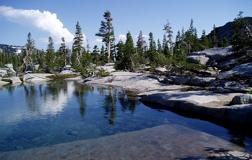
But Lower Velma Lake was stunning and offered cool, refreshing water. I located a steep slab at the edge of the lake and dove into the water a number of times.
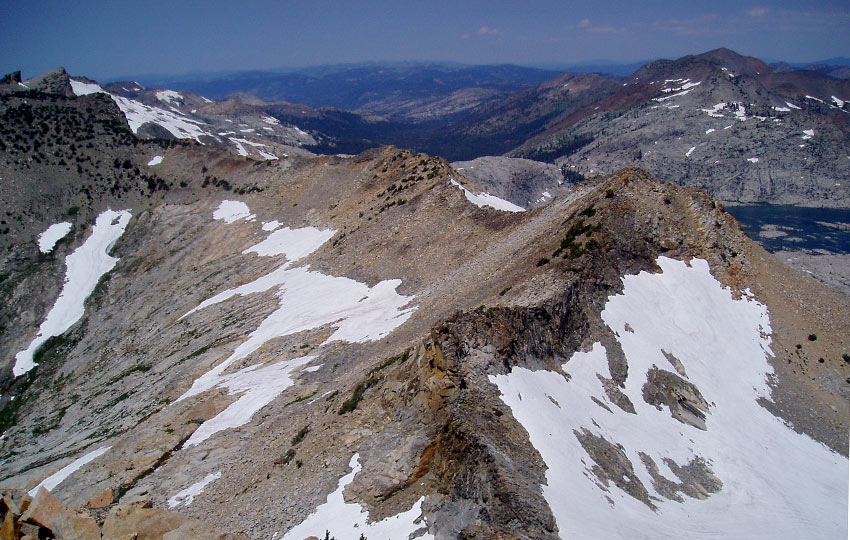
Afterwards, we continued to push to the base of Eagle Lake Buttress for the remainder of the afternoon.
We moved slowly toward our way to the base of the buttress. This was because the ascent was steep and the underbrush was thick.
Once we arrived, we staged our gear, took a quick break, and then planned a route up the buttress.
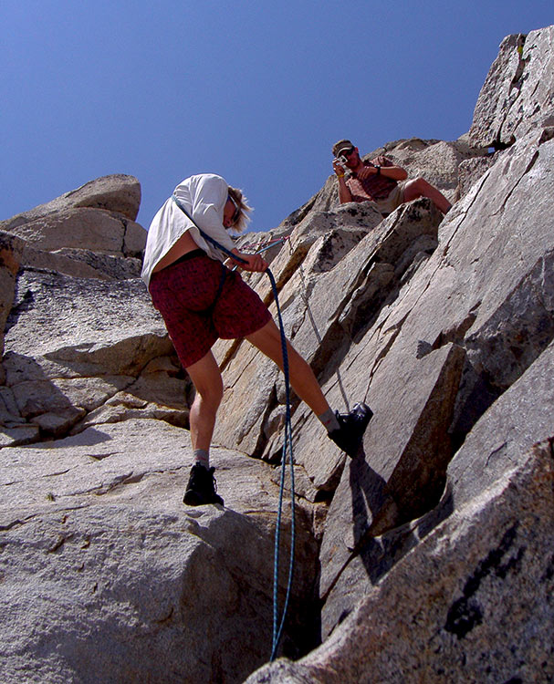
A handful of people free climbed the 5.7 pitch. However, this time I chose to be on belay (using a bowline on a coil) while I climbed. I knew I wouldn’t fall, but I still didn’t feel confident enough in my skills to do the ascent unaided. Besides, we had the rope so it really wasn’t a big deal to tie up.
An interesting aspect about the short climb was that I accomplished it wearing my bomb proof Montrail Moraine mountaineering boots. I was pleased with being able to adapt using them rather than having to rely on rock climbing shoes. It really is more about technique than gear.
The crux of today’s route was definitely Eagle Lake Buttress. But, we still had miles to cover before completing our journey.
The descent from the buttress was as difficult as anything we did during the past three days. Basically, we needed to scramble down steep angles of scree. This is always nerve-racking and difficult, especially when it’s the last major obstacle to overcome.
People tend to check out after they complete the hard parts. And, that’s when many backcountry accidents occur. Knowing this, we kept our wits about us and arrived at Eagle Lake safely.
From there it was a quick jaunt down to the parking lot.
My face took a beating from the sun since we spent much of the day on Eagle Lake Buttress. And by the time the trip was over, I was exhausted.
But even though the trip took its toll on me, it was a total success. It had been a long time since I had pushed myself that hard, and knowing that I could still hang was satisfying.
Each time I venture into the backcountry, I’m reminded that moving to Lake Tahoe in 2005 is one of the best decisions I’ve ever made.
For all of your Desolation Wilderness excursions, I highly recommend using Tom Harrison’s Map of Desolation Wilderness #ad. All of his maps are very clean and easy to read.
Backpacking in Desolation Wilderness: Echo Lakes to Emerald Bay (approximations)
- Location: South Tahoe – Desolation Wilderness
- Category of Hike: Multi-Day Hike
- Total Mileage: 27 miles
- Total Elevation Gain: 5,050 feet
- Highest Point: 9,983 feet (Pyramid Peak)
- Trail Conditions: Variable conditions ranging from hard-packed sand to boulder and scree fields
Considerations for Backpacking in Desolation Wilderness:
- You absolutely need to have a permit from the Forest Service for backpacking through Desolation Wilderness.
- You need a camp stove permit from the Forest Service for Desolation Wilderness acknowledging that you know how to safely operate a stove in the backcountry.
- Plan for the worst, hope for the best—this route features many miles of fully exposed, high elevation terrain. There is nowhere to run in the case of inclement weather so be prepared.
- There are multiple ways in which to summit Pyramid Peak. Don’t feel obligated to follow my same exact route since negotiating the Throne of Valhalla requires climbing skills.
- I don’t know that we truly summitted Eagle Lake Buttress. Although I have some climbing experience, I’m not very familiar with this specific location. We simply may have been in a different aspect compared to what more experienced and knowledgeable mountaineers would consider the top.
- I don’t recommend summitting Eagle Lake Buttress if you’re a traditional backpacker. There’s no need to add unnecessary risk to your trip. We climbed it because was under the guidance of a professional and we were technically enrolled in a mountaineering class. The alternative would be to hike directly to Eagle Lake and then just follow the trail to Emerald Bay.
- Begin your vehicle shuttling earlier than you expect because the drive to and from Echo Lakes and Emerald Bay can be a total time suck when there are lots of tourists in town, as well as active construction zones.
- Do yourself, and everyone else, a favor and plan to backpack this route (or some variation of it) during mid-week. Desolation Wilderness (aka Destination Wilderness) can be really busy on the weekends, so don’t become one of the crowds.
- Campfires are illegal in Desolation Wilderness. Period. Besides, campfires are part of an old and outdated model of backpacking. California, including Lake Tahoe and the Sierra Nevada Mountains, as well as neighboring geography during the summer is prone to wildfire. As I update this article (7/7/20) there’s a 5,000+ raging wildfire burning in the Carson Valley. And, on July 5th, Desolation Wilderness was besieged by an arsonist who lit at least three small wildfires. Both incidents occurred in less than a week. Never, ever start a campfire in Desolation Wilderness.
- Adhere to the Leave No Trace Seven Principles.
- There are few trail signs and markers on public lands in the Tahoe region, so unless there are tracks to follow, the correct route may be difficult to identify–when in doubt, turn back.
- Again, be prepared for inclement weather and carry plenty of warm clothes, food, and water.
- Leave an itinerary of your plans with someone who’ll call emergency services if you don’t return by your prescribed time.
- Dogs are allowed, but keep them on leash and pick up after them.
So blowing up spots. Your first summers here and your writing about local secrets and creating more traffic then the mountains can handle. STOP GEOTAGGING
I appreciate your concern for the increased tourism at Lake Tahoe, but you’re preaching to the choir. In my 15+ years of living in Tahoe (half of that time working in the outdoor recreation industry), I’ve seen a dramatic increase in all aspects of tourism at Lake Tahoe. Realistically, though, Tahoe is no different than any other location around the world whose economy is directly tied to tourism. So, this issue is far bigger than Lake Tahoe.
Essentially, there are two diametrically opposed schools of thought regarding over-tourism: 1) impose martial law and keep everyone out; 2) or, let everyone in but with the appropriate information and education.
Old time locals have been preaching abstinence for decades, similar to what you’re proposing (stay away, there’s nothing to see here). I totally agree that abstinence is 100% effective, but I also know that it’s 100% unrealistic. Keeping people out doesn’t work, and it’s totally egocentric … “go ahead and shut the door behind me because I made it in.”
Public land is for everyone. Period.
By preventing and restricting people from going into the backcountry, you discourage potential taxpayers and philanthropists from actually funding the programs, agencies, and dedicated stewards who are so vital to the preservation of public lands. The bottom line is that if people don’t believe they’re allowed to recreate on public land, they have no vested interest in preserving or conserving it.
The other option of saving public land is akin to contraception in that you promote education and mitigation of risk. Teach people how to recreate responsibly so that they don’t “love the place to death.” Show them where they should park and travel so that they don’t disrupt locals and their neighborhoods, for example. Provide appropriate information regarding their proposed endeavor so that they can plan and prepare accordingly (and not become a drain on local emergency services or destroy sensitive lands).
I embrace the latter approach, which is one of the main reasons I created Tahoe Trail Guide in the first place. People are eager to have outdoor adventures and I fully support that. I know the direct benefits of recreating on public land and encourage others to embrace it as well. So, I provide accurate information so that people can make appropriate decisions about recreating outdoors at Lake Tahoe.
Instead of wasting time, energy, and valuable resources on trying to keep people out, I’d much rather work toward encouraging people to develop a healthy love for the outdoors.
Realistically, tourists have been running roughshod across Lake Tahoe since the early to mid-1800s. This will never change.
Desolation Wilderness was nicknamed “Destination” Wilderness long before I ever moved here. Pyramid Peak is, literally, visible from most locations in South Lake Tahoe. Thousands of backpackers travel along the Pacific Crest Trail and Tahoe Rim Trail through Desolation Wilderness every year. The specific route from Echo Lakes to Emerald Bay is a standard and popular point-to-point backpacking route based on the convenient trailheads.
I do not reveal any “secrets” in this article. I simply documented a 2006 backpacking experience that I had with the intention of inspiring other people to embrace backpacking as a healthy activity. I also wanted to point out the fact that there are actual mountaineering classes (offered at Lake Tahoe Community College) that people can take in order to learn about backpacking and backcountry safety.
If you’ve looked at any of my other trail articles, you’d notice that I pretty much stick to writing about the main trails around Lake Tahoe (that have already been promoted in countless other guidebooks and websites). I choose to write about these locations because I find much of the available information about them (from those other sources) lack accurate detail. This means people driving and wandering all over the place in a potentially destructive manner. I do believe that many locations around the lake should be left out of guidebooks, but this isn’t because they’re my “secret.” Rather, it’s often because there are no established trailheads or trails for people to safely find and follow. And I encourage people to develop their own process of discovery when embarking on their outdoor adventure (adhering to the Leave No Trace Seven Principles).
If you take issue with one of my articles, then you take issue with all of my articles. And by that same rationale, you must take issue with every guidebook that’s ever been written about any tourist location around the world.
No matter how much I’d love to have the backcountry all to myself, I fully support the fact that public land is for everyone. Period.