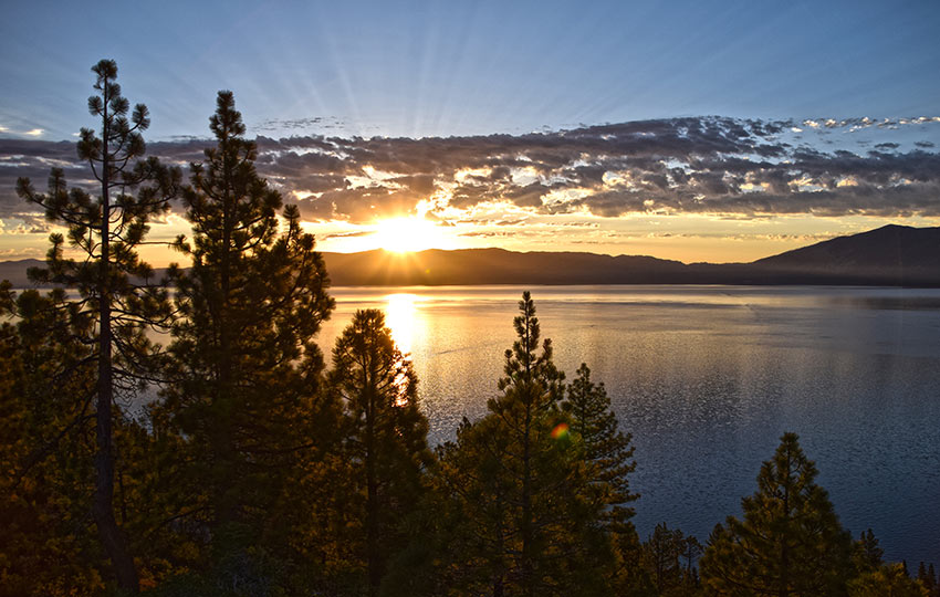
Hiking to the Eagle Point Campground Vista Point (wooden sitting bench) is more like an after-dinner walk you’d take with your child than an actual hike. However, that’s not to say this short trip isn’t worth your while.
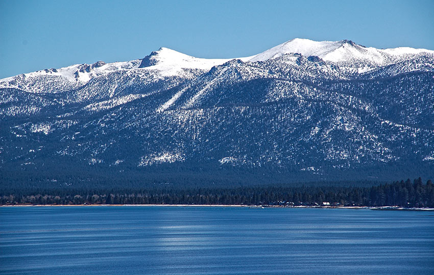
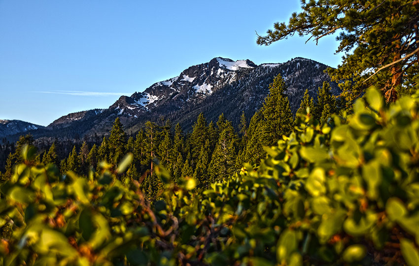
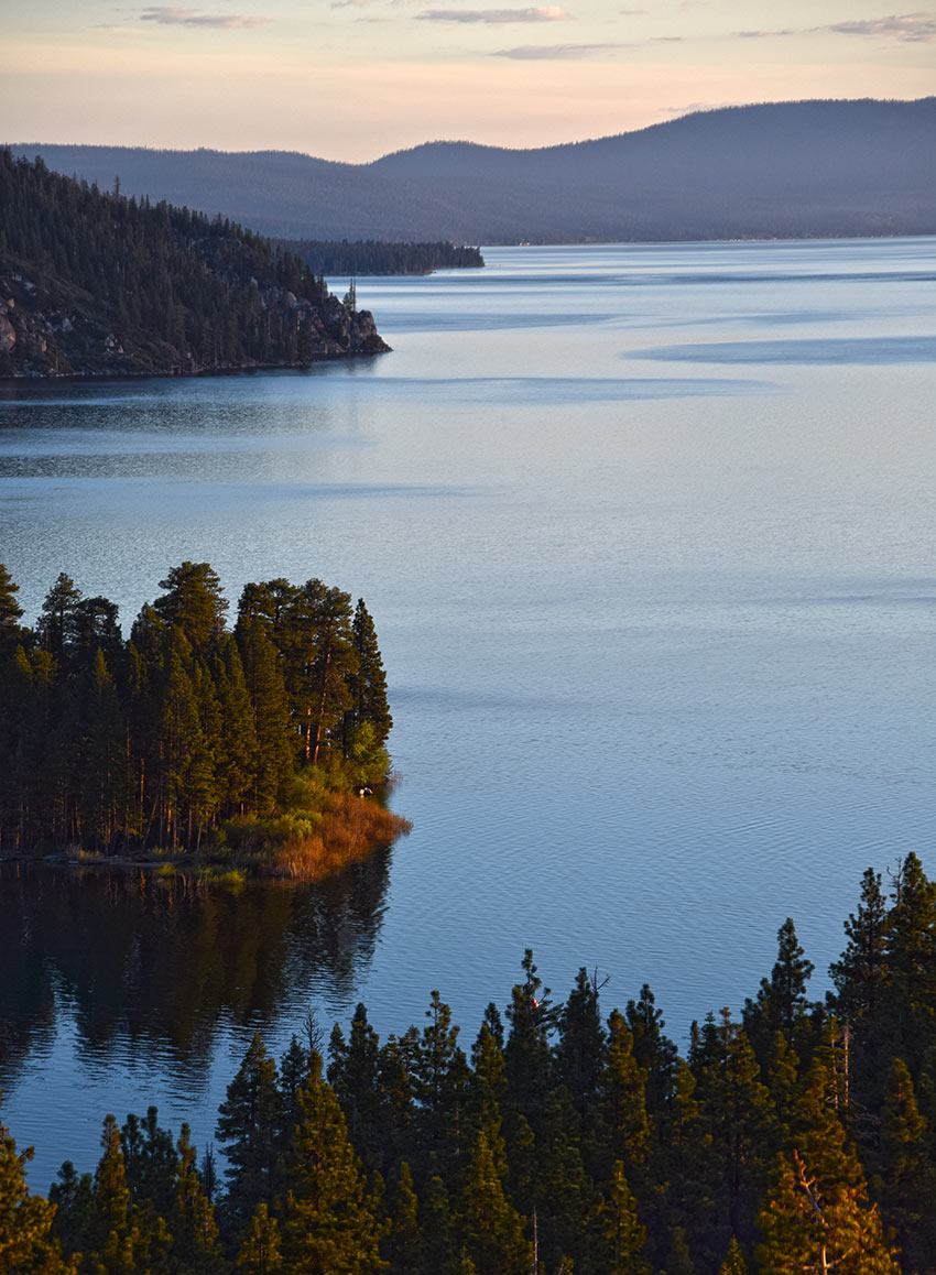
In fact, I would say the ends justify the means in this case. That’s because you’re rewarded with stunning views despite the easy 1.25 mile round-trip walk through Eagle Point Campground. The sights include Lake Tahoe, Freel Peak, Jobs Sister, Mount Tallac, Maggie’s Peaks, Emerald Bay, and glimpses into Desolation Wilderness.
*Please note that in 2025, there are major parking restrictions at Emerald Bay in an effort to mitigate the non-stop congestion, as well as address safety concerns. Here’s the article from the Tahoe Daily Tribune (June 19, 2025) discussing the details. There’s a shuttle service that’s running in conjunction with the parking restrictions.
Support Tahoe Trail Guide with a financial contribution via PayPal (single contribution) or Patreon (reoccurring contributions). Your support of Tahoe Trail Guide is very much appreciated!

Just know that this short trek is more about the views than the actual hiking. So look elsewhere if you seek an aerobic Tahoe hike featuring lots of miles and elevation gain. This hike has neither.
My recommendation for hiking to the Eagle Point Campground Vista Point is to go early to watch the sunrise.
Eagle Point Campground and Overlook Trail Data (approximations):
- Location: South Tahoe – Emerald Bay
- Category of Hike: Short Hike
- Total Mileage: 1.25 miles (out-and-back)
- Total Elevation Gain: 50 feet
- Highest Point: 6,600 feet
- Trail Conditions: Asphalt road and a couple hundred meters of hard-packed sand (you could roll a wheelchair to this location)
For other shorter hiking options, visit Short and Easy Hikes in South Lake Tahoe.
Considerations for Hiking the Eagle Point Campground and Overlook Trail:
- This is a campground, after all, so respect the campers’ privacy and property
- If you’re walking through the Eagle Point Campground during the off-season and/or the gate is locked, use of the on-site facilities is prohibited (i.e. restrooms will not be available)
- The parking area that I highlight in this article is limited, so if it’s full when you arrive go hike somewhere else rather than trying to squeeze your vehicle into too small of a space (i.e. you’re going to impede traffic and potentially cause an accident or receive a parking violation)
- Adhere to all Leave No Trace principles
- There are few trail signs and markers on public lands in the Tahoe region, so unless there are tracks to follow, the correct route may be difficult to identify–when in doubt, turn back
- Be prepared for inclement weather and carry plenty of warm clothes, food, and water
- Leave an itinerary of your plans with someone who’ll call emergency services if you don’t return by your prescribed time
- Dogs are not allowed on any of the trails or roads in Emerald Bay
- Drones are not allowed in Emerald Bay or any other State Parks in the Sierra District
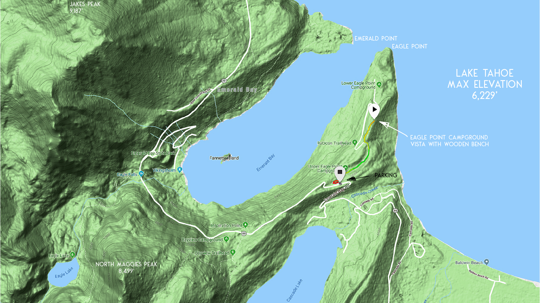
Parking for the Eagle Point Campground and Overlook Trail:
The geographical location of Eagle Point Campground limits the parking options. Essentially, you’ll park on the side of the road (SR 89) near the entrance gate to the Eagle Point Campground.
No matter the season, never block the entrance gate to Eagle Point Campground. For that matter, never block any other green gates around Lake Tahoe.
And be mindful of where you park along this moderately narrow strip of road. You don’t want to cause an accident or receive a parking violation.
The entrance gate and this section of road is located after the second hairpin turn traveling north on SR 89. Keep in mind that the first hairpin turn is near the private road to Cascade Lake.
The entrance gate is set back from the road so it’s easy to miss. Therefore, pull over immediately after making that slow and tight second turn.
The trailhead is the entrance gate to the campground.
Here’s a map to help you find the entrance gate to the Eagle Point Campground.
Travel through Eagle Point Campground and along the Overlook Trail:
Walk along the main road for a little over half a mile from the Eagle Point Campground gate.
At this point, the road will start to curve to the left and begin to descend.
There’s a path (approximately three feet wide) that shoots off to the right with a sign stating “Overlook Trail.” This is the trail you want to take and will lead you to the wooden bench at the overlook point.
Turn around if you’re still walking on the road and heading down a long straight stretch. You’ve probably missed the sign and passed the trail. So you just need to go back and look closer for the path.
Have a seat and take in the views after making your way to the wooden bench!
Return to your vehicle along the same route you took to reach the vista point.
Parting thoughts … The Eagle Point Campground closed down for numerous reasons during much of the 2010s. Fortunately, public access to the park was never denied. However, camping and use of the facilities within the park was prohibited.
Surprisingly, I discovered this park during its closure years while searching for a lakeside trail to Eagle Point. Unfortunately, there’s not an actual trail at lake level. But the views are still incredible!
For other shorter hiking options, visit Short and Easy Hikes in South Lake Tahoe.
Starting at Vikingsholm I hiked the south rim of Emerald Bay. However, instead of traveling closer to the water the trail climbed uphill until it spit me out on the Eagle Point Campground service road.
At this point, I realized where I was and began to connect the dots.
I drove past the campground a million times before. But I never gave it much thought because the gate always looked locked. And, really, how exciting is a derelict campground?
Fortunately, this campground features incredible panoramic views of Lake Tahoe that are easy to walk to.
Do you have other insight, feedback, or trail updates about hiking Eagle Point Campground and Overlook Trail?
If so, please post it in the comment section below for the benefit of everybody 🙂