Fallen Leaf Lake is one of the most popular summer play locations on the south shore of Lake Tahoe. And for good reason! There are tons of access points to the lake, and the water is always refreshing. But, because Fallen Leaf Lake is so popular, it can become crowded. I find this to be the case during the heart of summer and closer to the campground (located on the north side of the lake).
As a result of all this foot traffic, there are countless social trails on the north side of Fallen Leaf Lake. They’re mostly short, and they generally all lead to some aspect of the shoreline. Long story short, it would be a fool’s errand to map out each and every one of these little “wandering” trails.
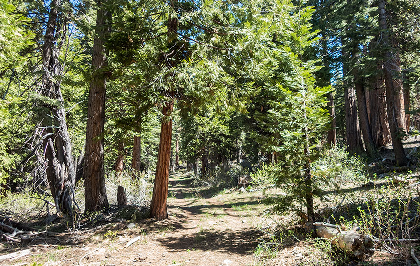
Rather, I’d like to offer one of my favorite hiking trails at Fallen Leaf Lake that’s slightly more structured than those social trails. This hiking trail is located on the east side of Fallen Leaf Lake and is secluded and generally untraveled. And, it hosts a surprisingly diverse amount of wildlife and plant life. Keep in mind, though, that this trail isn’t particularly flashy or stunning. It’s just a nice forested hiking trail that offers respite from the busy-ness that can be Lake Tahoe.
Support Tahoe Trail Guide with a financial contribution via PayPal (single contribution) or Patreon (reoccurring contributions). Your support of Tahoe Trail Guide is very much appreciated!


This hiking trail is barely 1.25 miles long (one-way) making it an ideal trail for young and old hikers, or athletically-inclined people looking for a quick “nature fix.” Just make sure you hike down to the lake and back a couple of times to get those extra tenths of a mile!
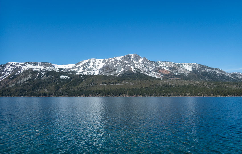
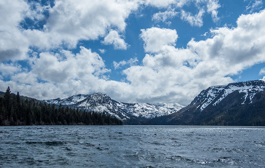
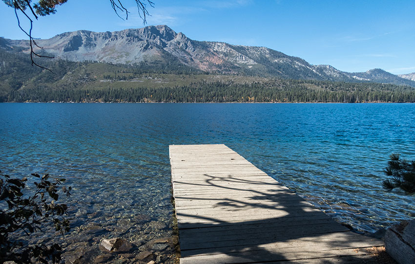
This hiking trail is located on the eastern side of Fallen Leaf Lake. It travels through a beautiful forest and provides a couple of different access points to the lake (including a public dock). None of these access points are beaches, in the traditional sense. However, you can totally swim from any of these locations. And, these shoreline locations provide stunning panoramic views of the lake itself, as well as Mount Tallac and Desolation Wilderness.
Keep in mind that this short and easy hike is not something that you’d necessarily want to plan your entire day around. For example, I prefer to hike this short trail when I just want to briefly immerse myself in nature. Or, if I’m just looking for a quick place to do some birding. So, I’ll often hike this Fallen Leaf Lake trail before or after work, or while out and about running errands.
Fallen Leaf Lake Trail Data (approximations):
- Location: South Tahoe – Fallen Leaf Lake
- Category of Hike: Short Hike
- Hike Time: 1 hour
- Total Mileage: 2.5 miles (out-and-back)
- Trailhead Elevation: 6,547 feet
- Highest Point: 6,547 feet
- Total Elevation Gain: 200 feet
- Trail Conditions: Hard-packed soil and dirt, with grassy sections that can be wet in spring
For other shorter hiking options, visit Short and Easy Hikes in South Lake Tahoe.
Considerations for Hiking Fallen Leaf Lake (East Side):
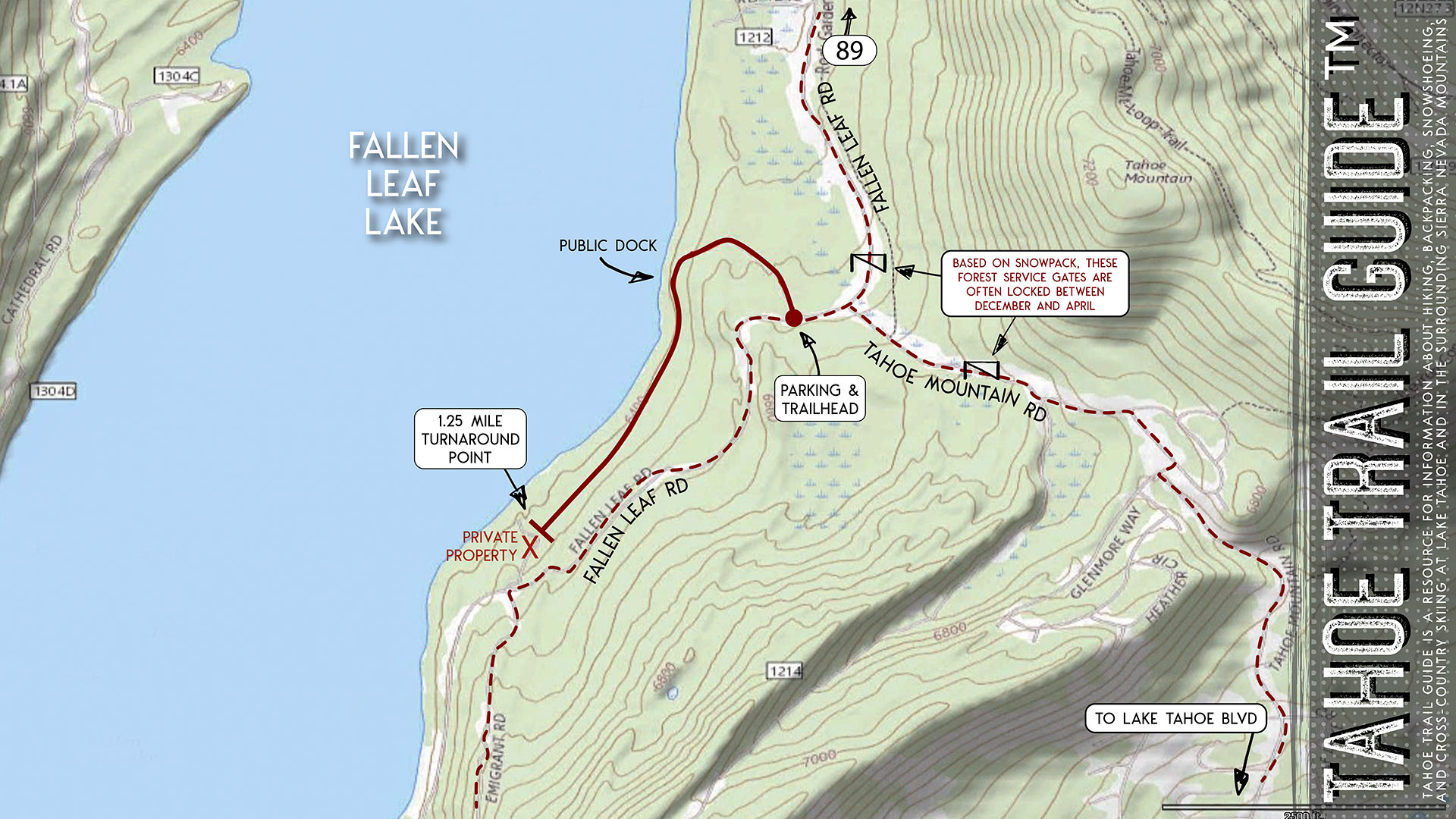
- The Forest Service gates on Fallen Leaf RD and Tahoe Mountain RD are generally locked from December through April (sometimes earlier or later depending on snowpack), but the trailhead is located close to the Fallen Leaf RD gate.
- Dogs are allowed, but keep them on leash and pick up after them
- Adhere to the Leave No Trace Seven Principles
- There are few trail signs and markers on public lands in the Tahoe region, so unless there are tracks to follow, the correct route may be difficult to identify — when in doubt, turn back
- Prepare for inclement weather by carrying warm clothes, food, and water
- Leave an itinerary of your plans with someone who’ll call emergency services if you don’t return by your prescribed time
Parking Directions for the Fallen Leaf Lake (east side) Hiking Trail:
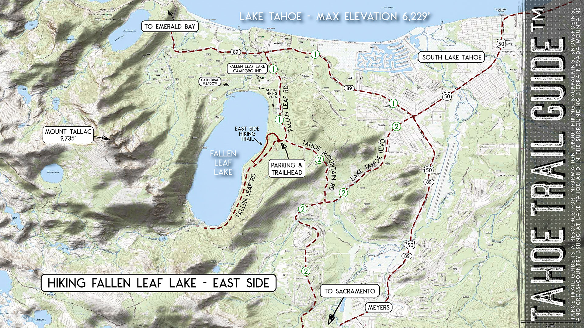
There are two different ways in which to find the parking area and trailhead for this Fallen Leaf Lake hiking trail. Both of these routes are indicated on the above map with the numbers 1 and 2. The first route is faster and more straightforward from most places in South Lake Tahoe. On the other hand, the second route is a bit more complex to navigate. However, I offer it for people coming from Meyers, CA.
***Please note that Fallen Leaf Road and Fallen Leaf Lake Road are two separate roads. You want to search for Fallen Leaf Road when using online navigation.
Driving Option 1
The first way to locate the Fallen Leaf Lake (east side) trailhead is the simplest and most direct.
- From SR 89, turn onto Fallen Leaf RD.
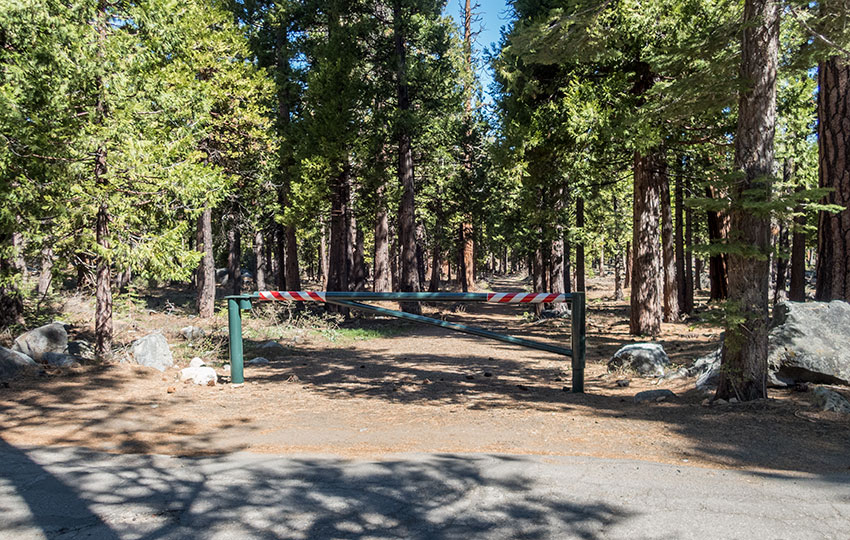
- Drive along Fallen Leaf RD for 2 miles to reach a green Forest Service gate, which is the trailhead. This gate is locked and positioned parallel to the road, and on the lake side of the road. And, it’s located just past the T-intersection between Fallen Leaf RD and Tahoe Mountain RD.
- Park in the dirt pullout located on the opposite side of the road (from the gate).
Never block or park in front of any Forest Service gates, regardless of season.
Driving Option 2
The second way in which to reach the Fallen Leaf Lake (east side) hiking trail is slightly more roundabout. Again, I offer it as an alternative because some people will be starting their journey from Meyers rather than South Tahoe. And, for them, this is slightly more direct.
- Drive up Tahoe Mountain RD from the intersection at Lake Tahoe BLVD.
- Turn right at the T-intersection (Glenmore Way).
- Take a left at the T-intersection (Dundee Cir).
- Turn left at the T-intersection (still Dundee Cir, but turns into Tahoe Mountain RD). At this point, you’ll again be driving down Tahoe Mountain RD. This is a single-lane forested road so be mindful of other motorists, bikers, and hikers. Continue to drive down this road until you reach the T-intersection with Fallen Leaf RD.
- Take a left on Fallen Leaf RD and drive a couple hundred meters to a Forest Service gate, which acts as the trailhead. This gate is locked and positioned parallel to the road, and on the lake side of the road. And, it’s located just past the T-intersection between Fallen Leaf RD and Tahoe Mountain RD.
Never block or park in front of any Forest Service gates, regardless of season.
Travel along the Fallen Leaf Lake (east side) Hiking Trail:
Begin your hike along the east side of Fallen Leaf Lake at the Forest Service gate on Fallen Leaf RD (2 miles from SR 89). Again, remember that this gate is oriented parallel to the road and on the lake side of the road. This gate prevents citizens from driving down the hiking trail. After all, the first section of the trail resembles an old dirt road.
Please note that the gate at the trailhead is not the same Forest Service gate located at 1.75 miles from SR 89. That gate is oriented perpendicular to the road and restricts access to Fallen Leaf RD during winter months. So for hiking along Fallen Leaf Lake’s east side trail during winter months, you’ll actually have to park near that road access gate.
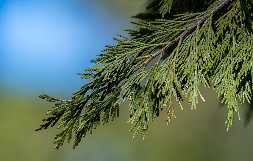
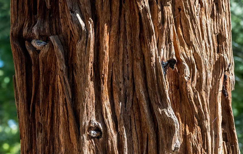
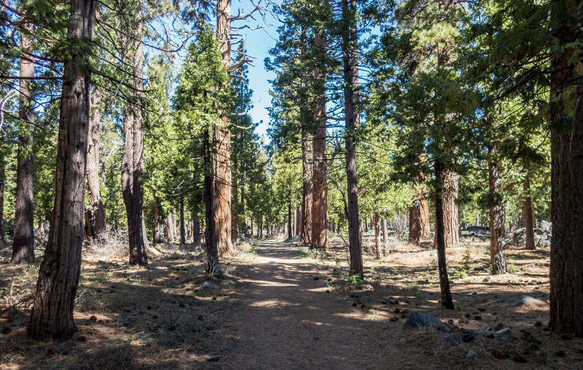
From the trailhead gate, hike west toward Fallen Leaf Lake. The trail is wide open and flanked by beautiful California Incense-Cedar trees.
The trail gradually leads downhill and to the left (south). Soon after heading downhill, you’ll reach a relatively open section of trail. In this open section, you’ll find an intersection.
Head all the way downhill to access Fallen Leaf Lake and the public dock. But be super careful when hiking down those last few steps. At one point in history, there were actual steps leading to the dock but they’re so deteriorated now that they’re more of a suggestion. Just mind where you step in this short section of trail.
After you’ve spent some time at the public dock, head back up the hill and take a right (south) to continue along your journey. Keep in mind that if don’t hike all the way down to the lake, you’ll just take a left (south) at that intersection.
Please note that from the intersection, you could also head north along Fallen Leaf Lake. In that case, the lake would be on your left when hiking. However, this isn’t the trail I’m taking you on today. Essentially, though, that trail leads in the direction of the Fallen Leaf Lake Campground. But it’s not necessarily a straight shot to the campground. There’s a lot of distance to cover, and you’ll have to navigate a bunch of meandering trails. So, I’ll leave that section for you to explore on your own.
Travel south for approximately one mile through the forest along the trail. This section of trail constitutes the majority of the hike. There are various access points to Fallen Leaf Lake along this stretch of trail. But, they’re not all obvious so keep an eye out for footpaths that lead to the lake. Otherwise, enjoy the secluded forest in which you’ll be hiking.
This trail dead-heads at a private road/driveway. As tempting as it may be to hike up that section of road to make a loop of this hike (by returning via Fallen Leaf RD), don’t do it! As good stewards of the land, we must avoid trespassing on private property.
From the private road, turn around and hike back along the same trail in which you came. As you hike back, remember to take a right and head uphill once you reach that relatively big intersection. Remember, that intersection is the one in which you could access the public dock.

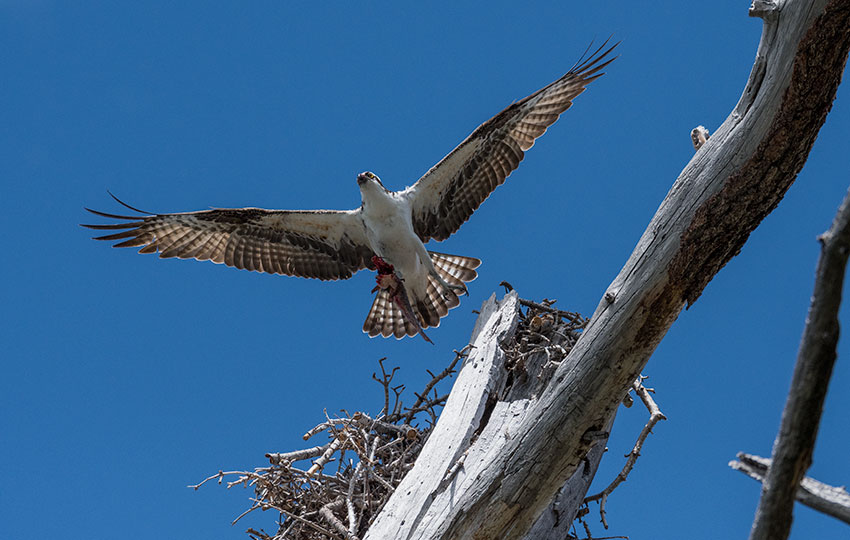
Brown Creepers (Certhia americana) are all around the Fallen Leaf Lake hiking trail, but good luck finding one! They’re only about the size of an egg and their feather patterning provides exceptional camouflage. © Jared Manninen If you’re lucky, you may spot one of these lovely North American Porcupines (Erethizon dorsatum) while hiking at Fallen Leaf Lake. In spite of their distinct appearance, they’re actually pretty hard to find in the forest, particularly in the shadows! © Jared Manninen An Osprey (Pandion haliaetus) carrying a fish in its talons and flying overhead out of its nest. There are various Osprey nests around the rim of Fallen Leaf Lake, so keep your eye overhead when hiking this trail. © Jared Manninen


Wandering Trails of Fallen Leaf Lake and Other Nearby Hiking Options
As I’ve previously mentioned, there are countless social trails around the north side of Fallen Leaf Lake. In many respects, I consider them “wandering” trails. They provide short and fun excursions into nature without a lot of commitment required. But because they’re numerous and they do meander, I don’t believe they’re worth writing about in great detail or actually mapping them out. Embrace the process of discovery by exploring them on your own time.
If you’re looking for another dedicated trail to hike near Fallen Leaf Lake, I recommend hiking Cathedral Meadow. This trail is located on the northeast side of Fallen Leaf Lake, so you’ll have to do some driving to reach its trailhead. But, that trail will take you from the Sno-Park on SR89 to the outflow of Fallen Leaf Lake (on the north side). This outflow is the beginning of Taylor Creek, which is famous for hosting the fall Kokanee Salmon spawning.
For other shorter hiking options, visit Short and Easy Hikes in South Lake Tahoe.
Do you have other insight, feedback, or trail updates about hiking Fallen Leaf Lake?
If so, please post it in the comment section below for the benefit of everybody 🙂
Greetings. I am a long-time visitor to Fallen Leaf, first coming in 1945; my family owns a cabin on Stanford Hill at the south end. In Oct 1983, I hiked around the western side of lake starting at the Stanford Alumni Camp, then past the ruins of the Baldwin estate, over the dam and up the eastern shore avoiding the road as much as I could. The trail you describe appears to be at least part of the dirt road leading to the Taggart cabin that was probably located close to what you term a public dock. I have not interacted with the Taggart’s for at least five decades so I don’t know if they sold their property, which I believe was owned fee simple. Nice photos. I have some prints photos from my hike so many years ago.
Hey David,
Thanks so much for the comment! You’ve definitely had a longer-term relationship with Tahoe (and Fallen Leaf Lake) than me 😉
There are all kinds of private properties around Fallen Leaf Lake, which I always encourage people to steer clear of. That’s also why I didn’t include any of the trail north of that dock. I just don’t know the property boundaries in that area well enough. It’s an interesting thing here in Tahoe where there is so much private property/structures adjacent to public lands (National Forest). Sometimes it can be hard to discern which is which due to a lack of signs and current activity (i.e. owners of the private property/structures not being around or maintaining their lots). Even a lot of the Forest Service signs, as well as other public agencies such as the California Tahoe Conservancy, neglect their signs and properties (not intentionally, but because there’s just so much to manage around the basin and they’re always short-staffed). All of that is kind of the reason I’ve been building Tahoe Trail Guide. In an effort to help people navigate the public lands effectively while avoiding private property. And, like I always say, “when in doubt, turn back.”
At some point down the road, I do hope to include more local history on my website because it is fun to discover the rich history of Tahoe.
Again, thanks for the comment and information!