People have been cross-country skiing at Lake Tahoe since the mid-1850s. The incredible Snowshoe Thompson is one of the most notable people to ever ski in the Lake Tahoe region. For 20 years, Snowshoe Thompson transported mail across the Sierra Nevada Mountains. His 180-mile, 5-day round trip journeys extended from Genoa, NV, to Placerville, CA.
Over 160 years later, cross-country skiing is still thriving at Lake Tahoe!
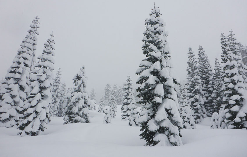
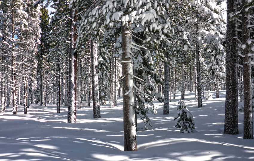
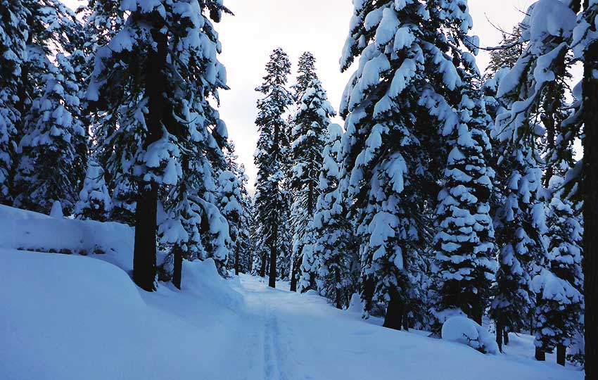
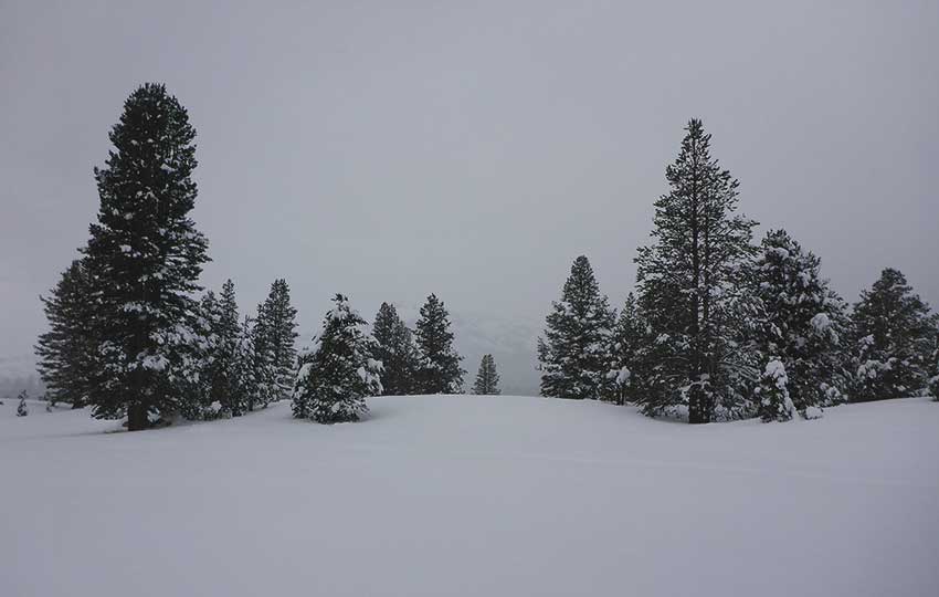
The cross-country ski terrain on the south shore of Lake Tahoe ranges from flat and easy to steep and strenuous. Keep in mind, however, that you’ll primarily find off-track and backcountry cross-country skiing areas around South Tahoe. There simply aren’t that many locations in South Lake Tahoe that feature groomed xc ski areas.
So if you’re specifically looking for groomed xc ski options, consider visiting North Lake Tahoe/Truckee where there are a handful of dedicated xc ski resorts.
Support Tahoe Trail Guide with a financial contribution via PayPal (single contribution) or Patreon (reoccurring contributions). Your support of Tahoe Trail Guide is very much appreciated!

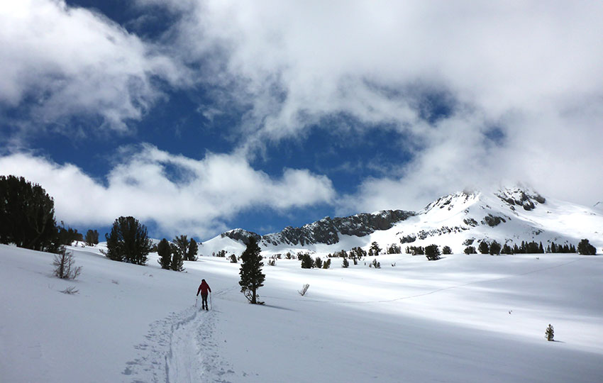
Assuming that you’re reading this article because you’ll be visiting South Tahoe, just be prepared to embrace your inner Snowshoe Thompson when cross-country skiing on this side of the lake!
What I’m really trying to say is that you’ll find plenty of winter adventure while cross-country skiing in South Tahoe. However, you’ll need to be aware of your surroundings and limitations. Snow travel can be strenuous and dangerous no matter how “easy” it looks.
Just an FYI … the only groomed areas in South Tahoe are:
- Kirkwood XC (high enough elevation so it’s groomed all winter)
- Camp Richardson (groomed only when there’s enough snow)
- Lake Tahoe Community College (groomed only when there’s enough snow)
Unless Lake Tahoe is experiencing a really big winter, Camp Richardson and the Lake Tahoe Community College won’t consistently be grooming xc ski trails. They’re both located at “lake level.” Therefore, snow may not accumulate enough to allow for grooming. So, before rushing out to cross-country ski at any of these locations, read their descriptions below.
Considerations for Your XC Skiing Adventure in South Lake Tahoe :
- Be avalanche aware when traveling through mountainous terrain, which you’ll find at Lake Tahoe.
- Assess the risks, weigh their consequences, know your limits, and be conscious of your decisions before taking action.
- Leave your winter adventure itinerary with a responsible person who’ll take appropriate action if you don’t return at your prescribed time.
- When in doubt, turn back.
- Dress in layers in order to shed or add on articles of clothing.
- Wear appropriate footwear and gloves for the winter conditions.
- Carry the necessary safety gear for your specific adventure and know how to use it.
- Stay adequately fueled and hydrated.
- When parking, don’t block traffic or Forest Service gates, and don’t impede snow removal vehicles while they’re operating.
- Always practice the Leave No Trace Seven Principles.
- Keep your dogs on a leash and pick up after them.
- Public lands are for everyone.
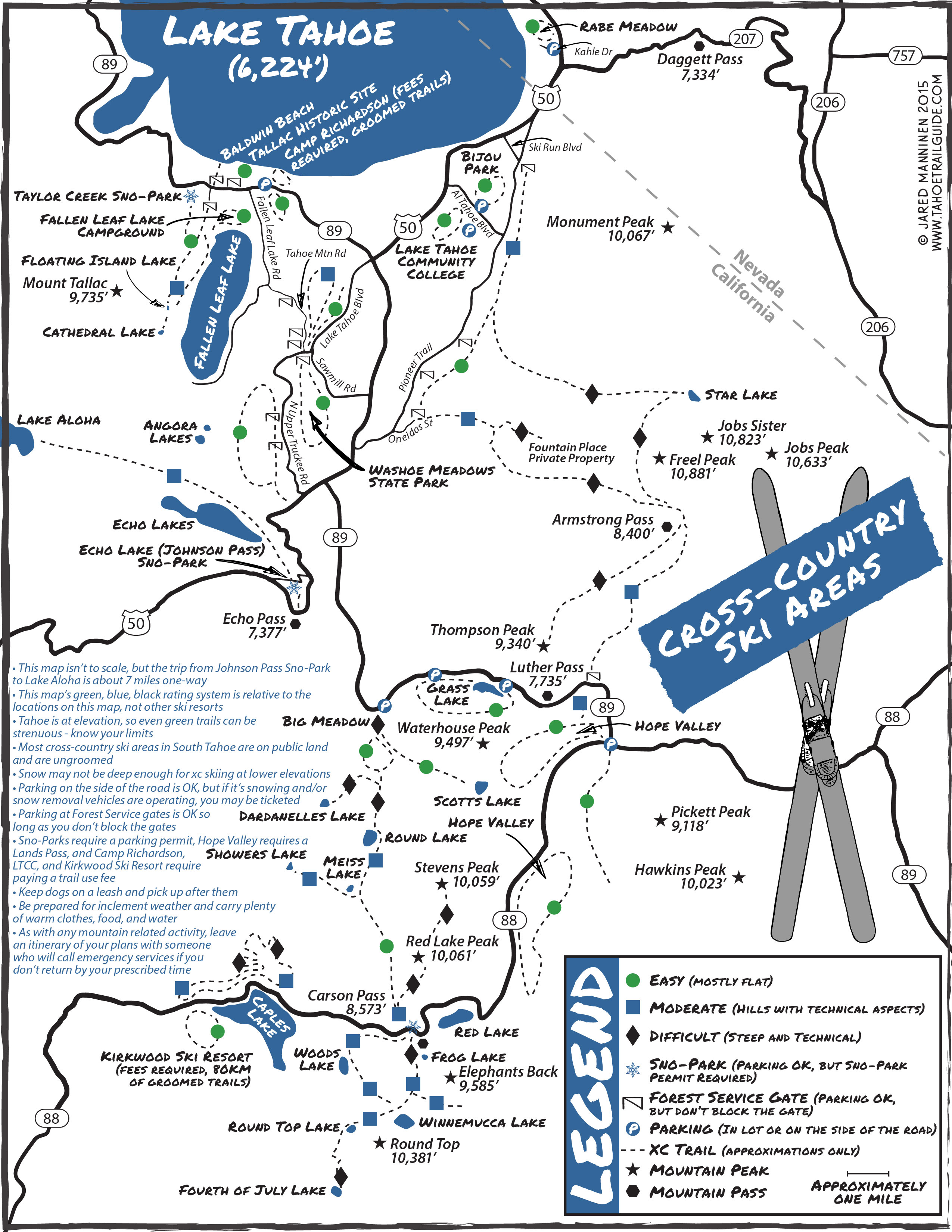
The rating system I’ve used on the map above is dynamic. Depending on snowpack, weather conditions, and your skill level, an easier location (i.e. green dot) may actually end up being challenging. Also, the map is of my own creation and not necessarily to scale.
- Green Dots = Easier terrain
- Blue Squares = Moderately strenuous terrain
- Black Diamonds = Steep and dangerous terrain
South Tahoe Cross-Country Ski Areas
Listed below are general areas in which to cross-country ski in and around South Lake Tahoe.
Again, there are very few locations that actually featured groomed terrain. So be prepared for off-trail and backcountry adventures when cross-country skiing in South Tahoe.
Fallen Leaf Lake Area
There are many locations to cross-country ski near Fallen Leaf Lake and along State Route 89 north of the “Y” (intersection of HWY 50/SR 89).
On the lake side of SR 89 you’ll find terrain that’s mostly flat and consists of shorter trails. These areas include Baldwin, Kiva, and Pope Beaches. Also, the Taylor Creek Visitor Area and the Tallac Historic Site feature beginner cross-country skiing terrain.
Camp Richardson (no pets, trail pass required) has groomed trails once the snowpack reaches two feet.
On the mountain side of SR 89, you’ll find Mount Tallac Road, leading to Floating Island and Cathedral Lakes. And, the Taylor Creek Snow Play Area (Sno-Park permit required) provides access to Cathedral Meadow and Fallen Leaf Campground.
Keep in mind that all of the places along SR 89 north of the “Y” often don’t receive a lot of snow. They’re at lake level, which means that they usually don’t have enough snow early or late in the winter on which to cross-country ski. And, what snow they do receive during winter can melt out fast.
In a lot of respects, I treat this zone as a quick, in-and-out type of a xc ski location. And, by that, I mean it’s worth it to xc ski right after a snowfall here, but then leave before it begins to melt. Again, unless it’s a massive winter, locations at “lake level” often won’t hold snow for very long.
Fortunately, all of these areas are easily accessible from SR 89 so you can assess them quickly for snow levels.
Meyers
West of the HWY 50/SR 89 intersection (the “Y”), you’ll find many easy to moderate areas in which to cross-country ski. Locations to cross-country ski in this area include Washoe Meadows State Park, Tahoe Mountain, and the Angora burn area.
Drive along Lake Tahoe Boulevard west of the “Y.” Then scout around Tahoe Mountain Road and North Upper Truckee Road (and adjacent streets) to find a Forest Service gate at which to park. Don’t block the gates, and avoid parking in a manner that’ll block traffic or impede snow removal operations.
The Lake Tahoe Golf Course is located adjacent to Washoe Meadows State Park on its east side (separated by the Upper Truckee River). Access the golf course via HWY 50. Keep in mind that Tahoe Snowmobiles operates a snowmobiling operation (basically a loop at the golf course) during the winter (snow permitting). So, it can be a bit noisy if they’re busy. However, they need a lot more snow on which to operate than cross-country skis so xc skiing at the golf course early and late in the season is a good option.
When there’s enough snow, you can also link routes between Washoe Meadows State Park and the Lake Tahoe Golf Course to create a longer adventure. Access between the two locations can be tricky to find, but the main link is on the southern side of Washoe Meadows State Park along the Upper Truckee River.
To access the Angora burn area, travel along North Upper Truckee Road and drive in and around the side streets on the west side. There are Forest Service gates and other access points at the end of Shoshone Drive, Cayuga Circle, Seneca Drive, Wintoon Drive, and Nez Perce Drive.
Please note that many of the Forest Service gates and spots in which to park for accessing cross-country ski terrain in Meyers are located within residential areas. So be courteous to locals and avoid trespassing on private property.
Also note that all of these areas in Meyers are still considered to be at a lower elevation. So, again, these locations may not have enough snow to cross-country ski on until later in the winter.
Echo Summit
On Highway 50, drive through Meyers and head just west of Echo Summit (as if you were going to Placerville). Then, turn right onto Johnson Pass Road (west side of summit). Drive up this road and park at the Echo Lakes Pass Sno-Park (Sno-Park permit required).
From the Echo Lakes Sno-Park, you can cross-country ski to Echo Lakes and further into Desolation Wilderness (i.e. Lake Aloha and beyond).
For travel from the Sno-Park to Desolation Wilderness, I recommend simply sticking to the main road that leads to Echo Lakes. Trying to actually follow the PCT/TRT, for example, may be more hassle than it’s worth. And, you risk trespassing on private property.
The road to Echo Lakes isn’t plowed in the winter. So, be sure to factor the extra time it takes you to cover that distance into your plans.
Another option for cross-country skiing out of the Echo Lakes Sno-Park is to travel south along the Forest Service Road that bisects Echo Summit. The route I’ve outlined is relatively short, but it’s satisfying when you don’t have much time or a storm is quickly approaching.
Please note that the Caldor Fire of 2021 swept across Echo Summit, so there are a lot of dead trees around the Echo Lakes Sno-Park area. Therefore, all of the dead trees present a major safety concern, and even more so when high winds are present on Echo Summit.
South Lake Tahoe (City Limits)
Lake Tahoe Community College (LTCC) grooms about 5km of trails when snow permits.
Neighboring Bijou Community Park is ungroomed, but the park’s terrain is flat.
Both locations are located centrally in South Lake Tahoe, which means they’re also at lake level. So, the big challenge for cross-country skiing at either of these locations is whether or not enough snow has accumulated to warrant the use of skis. You may need to wait until winter is well underway to cross-country ski at either of these locations.
You may find more cross-country skiing options nearby along Pioneer Trail or at the end of Oneidas Street. Park at one of the Forest Service gates on either road and cross-country ski off-trail and toward the mountains.
Again, don’t block the gates. And be courteous to locals as many of the locations at which to park along Pioneer Trail and on Oneidas Street are located within residential areas.
Stateline
Rabe Meadow, which is located at Kahle Drive, is convenient because of its proximity to town. However, the meadow is so close to the lake and located on the east side of the Tahoe Basin. So, usually Rabe Meadow is only good for cross-country skiing when winter is in full swing. Or, you may be able to log a quick xc ski session right after a decent snowfall (and before it all melts).
A note about snow in the Tahoe Basin … snow travels across the Tahoe Region from the west. And it tends to dissipate quickly once it passes Echo Summit and the north/south ridge. This generally leaves the eastern side of the Tahoe Basin with far less snow than the western side.
Spooner Summit
Years ago, the area around Spooner Lake was a dedicated groomed cross-country ski area. However, the the couple in charge of managing the area closed up shop during the drought winters between 2011-2015. For a season or two, the non-profit organization, Nevada Nordic, took over grooming operations at Spooner Lake. However, it appears that Nevada Nordic is now exclusively focused on grooming xc ski trails along Mount Rose Highway out of Incline Village (North Tahoe).
So, as far as I know, there is currently no grooming operations at the Spooner Summit area. That said, other than snow levels and a parking fee there’s nothing preventing you from cross-country skiing around Spooner Lake.
Luther Pass
Luther Pass (Grass Lake) is one of the more popular locations for cross-country skiing in South Lake Tahoe.
Parking is free and abundant along State Route 89 on Luther Pass. Grass Lake (on Luther Pass) is flat, making it a perfect location for beginner cross-country skiers. And, Luther Pass is located at a higher elevation than other places around South Lake Tahoe so it accumulates snow earlier and holds it longer during the winter.
The times I find Grass Lake to be most beneficial for cross-country skiing is at the beginning and ending of the winter, as well as during storms. Or, if I just want to hammer out a quick evening workout (two miles from end-to-end), I’ll head up to Luther Pass.
Due to its close proximity to SR 89, you can get in and out of the “backcountry” at Luther Pass easily. This is why I like cross-country skiing here during storms and in the evening.
Parking and access can be problematic at the Big Meadow trailhead due to high snowbanks. There are also only a small handful of pullouts at which to park. Occasionally someone will take it upon themselves to carve out snow steps when the banks are high.
I prefer to cross-country ski at Big Meadow closer to spring, when the snow has receded back from the roads and parking/access to the trailhead is more dependable.
In the meantime, I recommend heading to Grass Lake.
Hope Valley
Hope Valley is arguably the most popular location at which to cross-country ski in South Lake Tahoe. The terrain is primarily flat, there’s plenty of places to explore, parking is fairly easy, and it’s an ideal location for beginner and recreational cross-country skiers.
However, Hope Valley sits at a lower in elevation than nearby Luther Pass and Carson Pass. So, it can take some time for enough snow to accumulate for cross-country skiing in Hope Valley.
There are multiple locations at which to park in order to cross-country ski in Hope Valley. This is great for the sake of being able to find a spot at which to park. However, you need to know where you’re planning to park beforehand.
There are two different and distinct paying options for parking in Hope Valley during the winter. And, they both require you to pay in advance.
To reiterate … there are no options for paying for parking anywhere in Hope Valley. Come prepared with either (or both) a Sno-Park permit or a Lands Pass.
For parking and cross-country skiing out of the Hope Valley Sno-Park on Blue Lakes Road, you’ll need a Sno-Park permit. You need to purchase it in town or online.
For parking near Pickett’s Junction (intersection of State Routes 88/89), you’ll need to have a Lands Pass only available for purchase online from the California Department of Fish & Wildlife. Valid CA hunting and/or fishing licenses also are acceptable. It’s a confusing situation because there are only a few, very specific aspects as to where the Lands Pass is technically required. Where are they? I honestly don’t know. I just always carry my fishing license. I’ve never actually heard of anyone being ticketed for not having a Lands Pass. However, I’d be remiss if I didn’t provide this information.
Please note that the Lands Pass needs to be carried on your person, while the Sno-Park permit needs to be displayed in your vehicle.
Carson Pass
Carson Pass (Snow-Park permit required) is an extremely popular location for cross-country skiing, snowshoeing, and alpine touring. Specifically, people love to venture to Winnemucca Lake on xc skis, which is on the south side of Carson Pass. On the other hand, I love traveling to the Red Lake Peak area which is on the north side.
Whether you adventure on the south or north side of SR 88, Carson Pass features challenging uphill climbs and diverse terrain. However, if you’re not savvy cross-country skiing in diverse (and somewhat technical) terrain or relatively physically fit, save this area for when you gain more experience.
That said, once you negotiate the first mile or so (traveling either south or north of the Carson Pass parking area), the trails will only be as technical as you want them to be. After those initial climbs, the terrain opens up and you can pick whatever line you want to cross-country ski.
Kirkwood XC
Kirkwood Ski Resort, further west on SR 88, has a cross-country ski area (trail pass required, dogs allowed on designated trails), and rental/retail shop. The cross-country ski area boasts approximately 50km of groomed trails (in optimal winter conditions) and features easy to advanced routes along their trail system.
My recommendation is to call ahead for grooming and accessibility. Kirkwood has a tendency to receive a lot more snow that other areas around South Tahoe. So, the roads may temporarily be closed or the xc area may not have been recently groomed. Also keep in mind that the Schneider Camp trail system requires a lot of snow before they can safely run the groomer over it. So, it often won’t be fully opened until later in the season.
All of that said, even in a generally low snow year thanks to its higher elevation Kirkwood XC will most likely have between 10-20km of groomed terrain. And that usually consists of the flatter loops out in the main meadow, as well as some of the intermediate Caples Creek trail system. So there should be something for everyone. Again, though, just call ahead to inquire about the trail conditions.
Cross-Country Skiing Explained Articles and Videos
Please note that I wrote and produced the Cross-Country Skiing Explained series of articles and videos with the beginner and intermediate cross-country skier in mind. This is the demographic for whom I most often serve(d) while working in the outdoor recreation industry at Lake Tahoe. I basically treat these articles and videos as extensions of the conversations that I have (had) with those customers.
That said, expert skiers probably could take away something of value from these resources. Just know that I don’t address race-oriented philosophy, technique, or gear selection.
Considerations for buying cross-country ski gear (new and beginner xc skiers)
- Intention, Types of XC Skis, and Whether to Buy New or Used (Part 1)
- How Much Gear to Acquire, Evaluate Your Commitment, Value of Taking XC Ski Lessons (Part 2)
- Can One Set of Classic Cross-Country Skis Work for Groomed and Off-Track XC Skiing? (Part 3)
- Can I Use One Set of XC Ski Boots for All of My Cross-Country Skiing Needs? (Part 4)
- Overview of Off-Track and Backcountry Cross-Country Ski Gear
- Invest in Technique More than Gear
Classic Cross-Country Ski Components
- Introduction to Classic Cross-Country Skis (Part 1)
- Geometry of Classic Cross-Country Skis (Part 2)
- The Grip Zone of Classic Cross-Country Skis (Part 3)
- Types of Bindings for Classic Cross-Country Skiing (Part 4)
- Ski Boots for Classic Cross-Country Skiing (Part 5)
- Classic Cross-Country Ski Poles (Part 6)
- FAQs about Classic Cross-Country Skiing
Waxing Your “Waxless” Cross-Country Skis (for beginner and intermediate xc skiers)
- Introduction to Waxing Your Waxless XC Skis
- Step-by-Step Waxing Tutorial
- FAQs About Waxing Your Waxless XC Skis
Cross-Country Skiing Techniques, Demonstrations, and Related Concepts
- Outdoor VLOG (emphasis on the cross-country skiing experience)
- Cross-Country Skiing in Challenging Conditions
- Considerations for Winter Adventure in Lake Tahoe’s Backcountry
- Using the Side-Step and Herringbone Techniques in the Backcountry
- 10 Tips for Spring Cross-Country Skiing in the Backcountry
- 5 Reasons to Love Spring Cross-Country Skiing
- Considerations for Cross-Country Skiing During the Fall and Early Winter
- Discussing the Goal of Becoming a Better Cross-Country Skier and Embracing Backcountry and Groomed Terrain in Pursuit of that Goal
- The Cross-Country Skiing Experience: Immersing Yourself in Winter
Jared: There is someone who has cross country ski grooming equipment available and is talking about grooming trails at Tahoe Paradise Park. I thought you might be interested and could help out.
Hey Tom,
I appreciate the heads-up! I would be interested in chatting with the person with the grooming equipment. Not sure how much I’ll be able to help out on usual basis as I work 5-days/week at Kirkwood XC during the winter. But it would be great to meet that person. Feel free to pass along my name.
Thanks again for reaching out 🙂
What are current trail conditions?
Tahoe just received another 5-8 inches (depending on elevation) of fresh snow on December 17, 2020. And the temperatures have remained cold enough that there’s still dry and powdery snow on north aspects and in the forests at elevations above 7,000 feet. So in the backcountry, the snow is still really variable but there’s plenty of it on which to cross-country ski. In fact, it’s kind of deep in many protected (non-sunny) locations. I’ve xc skied the past couple of days at elevations of over 7,000 feet, and the snow is definitely deeper and less stable the higher up the mountains you go. Also keep in mind that there’s not a very good base on which the most recent snow has fallen. So I recommend staying off steeper angled terrain as avalanche risk is considerable right now. And you may want to consider using rock skis because there’s still so much natural debris (rocks, roots, bushes) just below the surface of the snow.
Hope that helps. Let me know if you were wondering about any specific locations.
Thank you Jared!
You’re welcome, Dmitriy L. Sorry about the confusion 🙂
Hi Dmitry
I’d also suggest to check sierraavalanchecenter.org for the observations section. The avalanche forecast is regional average, while you are perhaps more interested in the conditions in specific places, and, as Jared says, they may substantially vary over the aspect, elevation, exposure to sunlight and wind, etc. Observations often convey specific details about the specific place and there are a lot of people who take trouble to observe and post.
Also, be aware about the persistent weak layer from November’s snowfall and subsequent dry period that was reported pretty much all over Californian side of Tahoe shore
Best,
Dmitry M.
Hey Dmitry!
Sorry, I didn’t realize it was you (in your comment earlier). I’ve been doing a ton of YouTube videos this season (http://www.youtube.com/jaredmanninen) and, as a result, have been fielding a bunch of questions and comments across platforms (here on Tahoe Trail Guide, via email, YouTube, Instagram, and Facebook) each day. So, it’s been a bit overwhelming and I sometimes don’t always realize who I’m talking to 🙂
Yes, the Sierra Avalanche Center (http://www.sierraavalanchecenter.org/) is the go-to website for overall snowpack conditions at Lake Tahoe. I pretty much check it everyday.
And you’re right in that there’s a totally persistent weak layer throughout the Lake Tahoe region right now. I get the impression that the cold temps at night (20s) with daytime highs of not much more than the 40s (for a number of weeks between storms) has contributed to that layer being so sugary (and resistant to consolidation).
Last night when I was practicing some downhill turns on a low angle of terrain near Grass Lake/Luther Pass, I was experiencing a bunch of snow collapsing/whumpfing. Only a few inches over a few foot radius, but enough to give me pause. I wasn’t too worried about it for myself, though, since I was on such a small hill. But at one point I weighted one of my skis a little too much while turning and he tip easily torpedoed under the snow causing me to pitch forward. Again, not a big deal on the specific aspect on which I was playing but I’d definitely be cautious doing any steep angled terrain right now.
Good to hear from you, Dmitry!
Hi Jared,
It looks like there are two different Dmitrys in the thread, that’s why I put my last name initial. Dmitry M is me (and the one who was actively commenting your blog last year). Anyway, your firsthand observations are very helpful, thanks for your effort in keeping the sport alive.
Best,
Dmitry M.
Now I think I’m sorted out. haha. I appreciate you clarifying that. And it’s great to hear from you again, Dmitry M.!
This is so useful, thanks for all the info, Jared! Just starting to get into XC skiing so really appreciate the tips about where to go.
Thanks so much for the feedback, Connor. Glad I can be of service 🙂 If you ever have any questions about a specific location, let me know!
Hi Jared,
Are all the trails on the map accessible with cross-country skis (most importantly, are these slopes difficult to ski down in XC/BC setup where you cannot lock the heel), or some require alpine touring setup, especially trails towards Star Lake and Armstrong pass? is the terrain avalanche prone? Thanks.
Hey Dmitry,
Good to hear from you again! Yes, everything on the map is technically accessible for an off-track/backcountry cross-country ski (free heel). Between my Fischer Spider 62s, Excursion 88s, or S-Bound 112s, I travel everywhere around the south shore. That said, climbing is never a problem for me. By using the herringbone and side-step techniques I could pretty much ski up a wall. The descent, which you alluded to in your comment, is obviously the bigger challenge.
Accessibility in steep terrain is totally dependent on your skill level and the snow conditions. I’ve labeled the areas I believe to be very steep with black diamonds, and those areas require superior skills to negotiate safely. Downhill skills on cross-country skis, no matter the width or style is always challenging. So, I pretty much plan accordingly which usually entails locating the most favorable terrain for my descent or exit from the backcountry. For me, that’s about finding lower angle terrain or, when the snowpack is stable, I’ll make long, lazy zig-zag turns to get down the steeper stuff. When options are limited and I’m on steep slopes, I will often take my time by side-stepping down the problematic section. If the terrain is really sketchy and dangerous for me, I’ll just pull off my skis and walk down the problematic zone (you may want to have a set of micro-spikes in your pack for icy conditions). Lastly, if I find myself traveling through terrain that seems beyond my skill level, I’ll turn back well before I get myself into real trouble. Then, I’ll explore the lower angle terrain.
The snow conditions always dictate where I ski and how far I push my limits. When the snowpack is stable and forgiving (a few inches of soft stuff on a firm base), I’m a bit more daring. But if it’s either really thin with lots of obstacles beneath the snow surface (early and late season) or the snow is deep powder, I’ll find flatter terrain to play in and save that steeper stuff for later in the season (once it sets and stabilizes).
Again, all of the terrain is accessible but it’s up to you to plan your routes so that your skills are commensurate with the terrain through which you’ll be traveling. Definitely consult a real topographic map (versus my simplified version).
In and around Armstrong Pass is relatively favorable terrain for more advanced skiers assuming snow conditions are good because the TRT, for example, is mostly a traverse around the peaks in that area. There are a number of wide open slopes there. Traveling up to Star Lake from Pioneer Trail, on the other hand, is pretty steep. If I was planning a route through that area, I might ski up to Star Lake, through Armstrong Pass, then exiting the backcountry via Forest Service RD 051/Willow Creek Road (backside of Luther Pass). Or, I’d travel around Armstrong Pass, making my way down through Fountain Place and out through Oneidas Street. Both of these options, however, would definitely be challenging. And, I’d probably save them for later in the season when the snowpack becomes more stable.
As far as avalanche concerns go, always assume you’re traveling through avalanche terrain when your skiing at and around Lake Tahoe. Plan for the worst, and hope for the best.
I realize my answers are a bit broad, but there’s just no definite black and white answers to traveling through snow country. Everything is dynamic, and it’s up to you to make appropriate choices for yourself that will result in your safe return home. Always remember that the summit is optional, but the descent is mandatory. Good luck!
Thanks Jared! The information that you provide is really precious because details like these are crucial for planning of the trip in the unfamiliar terrain and at the same time nearly impossible to find in the internet resources, as pretty much anything related to any non-mainstream activities (e.g., non-resort skiing, be it XC or Randonnee).
Glad I can be of service, Dmitry 🙂
I agree that there’s not a lot of information online regarding backcountry cross-country skiing techniques, route planning, etc… In spite of the increased exposure of skate skiing and xc ski racing (i.e. Jessie Diggins and Kikkan Randall capturing the gold in the 2018 Winter Olympics), I think most people still view xc skiing as a declining art. Or, something that their grandparents did. haha It’s unfortunate because there really is an active group of people worldwide participating and studying the sport intensely. But most of that attention is focused on track skiing at groomed resorts/areas (skating and classic). This isn’t bad because a person needs to know proper technique (which is best achieved by learning it in an ideal environment), but there’s a disconnect between xc skiing on groomers and then applying those same skills to traveling through the backcountry.
As much as I’d love to have a thousand pairs of skis and the ability to handle steep terrain (i.e. alpine touring/randonee), I would ultimately prefer to travel light and fast through lower angle terrain on cross-country skis. So, I’m taking it upon myself to start building a library of articles and videos about backcountry cross-country skiing. It’s where all skiing began, after all.
If you have any questions, ideas, or recommendations for future articles/videos, feel free to let me know. I work seasonal jobs to pay the bills, but I’m always trying to update and create new content for this site. Basically, Tahoe Trail Guide is my long-term investment/employment 🙂
Lastly, if you haven’t checked out any of my other videos, I post them on YouTube (http://www.youtube.com/user/mxbrite/). Check ’em out when you get the time.
Hey Dmitry. I just wanted to let you know I recently updated this article thanks to your interest 🙂
Hi Jared,
Thanks a lot, this is helpful.
One thing that I wanted to mention regarding the safety.
There is a good book “Snow Sense” by Jill Fredston and Doug Fresler. It is relatively short and perhaps not overly detailed, but gives a good overall picture on the safety while travelling in backcountry in winter. Since many trails involve avalanche terrain or pass in the vicinity of such this book might serve as a heads-up and a good starting point for those that want to take the most from cross-country skiing. I am not sure if the reference to this book belongs here, in this particular post.
Thanks for the book recommendation, Dmitry 🙂 I’ll definitely pick up a copy. I believe I have heard of this book, and it may even be required reading for many of the winter/avalanche-related courses over at Lake Tahoe Community College (Wilderness Education & Outdoor Leadership program). At some point this season I’ll write a backcountry travel/cross-country ski tour related article and list some more winter considerations. Thanks again!
What would you recommend for this upcoming weekend for a snowshoe hike for a few hours on Sunday morning (12/3). I have Asthma so I need an easy hike but still want to enjoy South Shore. New to snowshoeing as well.
Hey Martha, thanks for getting in touch!
We did get a few inches of snow the other day and where I live (on the west end of the south shore at approximately 6,500′) we still have a blanket of snow on the ground. That said, probably around Grass Lake on Luther Pass would be a decent option. The issue is that it’s still only around 7,715′ and we haven’t had any real hard freezes (although last night was around 22 degrees). So, I wouldn’t attempt walking directly across Grass Lake, but rather stick to the edges. Also, I don’t know how much snow will ultimately remain by the time you arrive. Carson Pass is always another (probably better) option because it’s at about 8,500′ and will retain its snow more than at lower elevations. If you choose to hike near Carson Pass, pace yourself because there is some elevation gain associated with the trip. Read the Winnemucca Lake post for a snowshoe trip out of Carson Pass. You’ll travel over Luther Pass (along HWY 89) en route to Carson Pass, so check out Grass Lake (on the west side of the highway) first. I wish I could recommend something closer to actual Lake Tahoe, but I just don’t know that there will be any snow by next weekend in the lower elevations. Lastly, check the forecast before you go because there looks to be a little precipitation on its way for next weekend.
Thank you so much for your insightful response. It was very helpful!
No problem, Martha. I do hope the snow sticks around 🙂 Be safe out there!