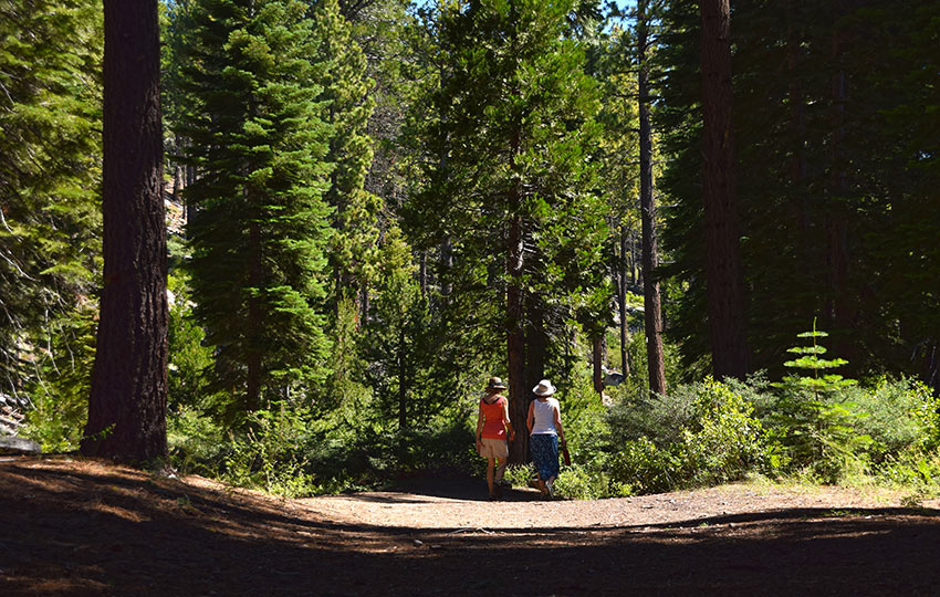
The hike to Meeks Creek Falls and around Meeks Creek is easy and provides plenty of solitude. There’s no elevation gain, so it’s perfect for the young and old. Hiking the Meeks Creek Trail as a loop takes you through a couple of micro-ecosystems. You’ll travel along a dirt road, in and out of the forest, and finally through a meadow.
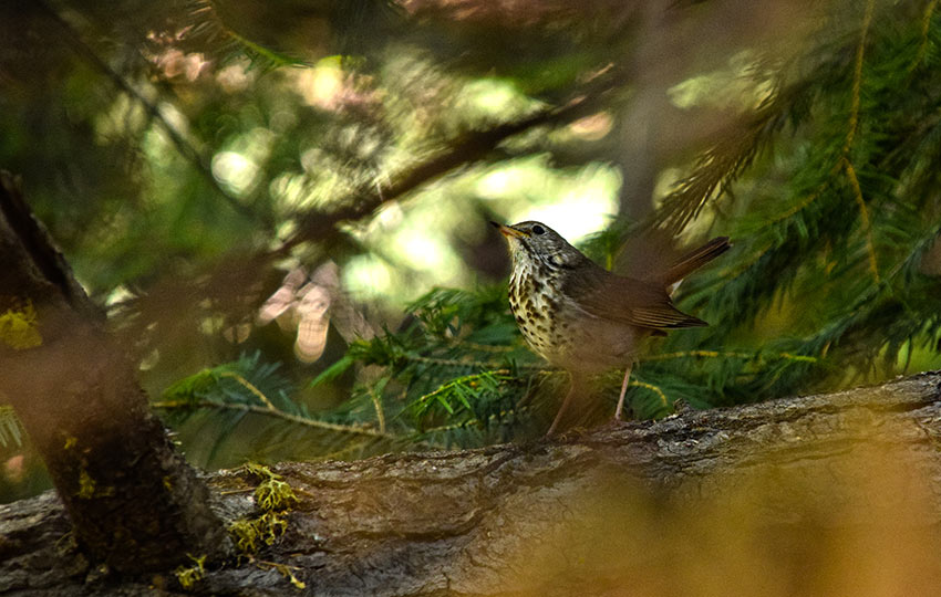
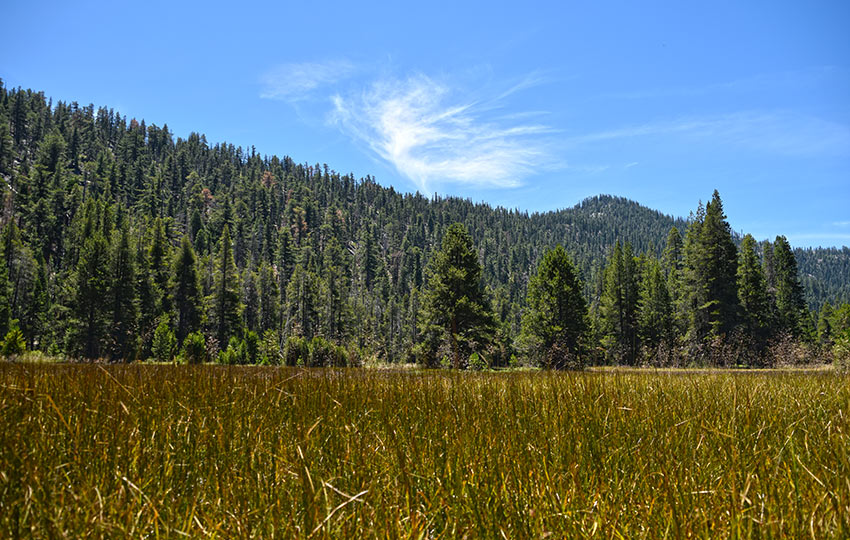
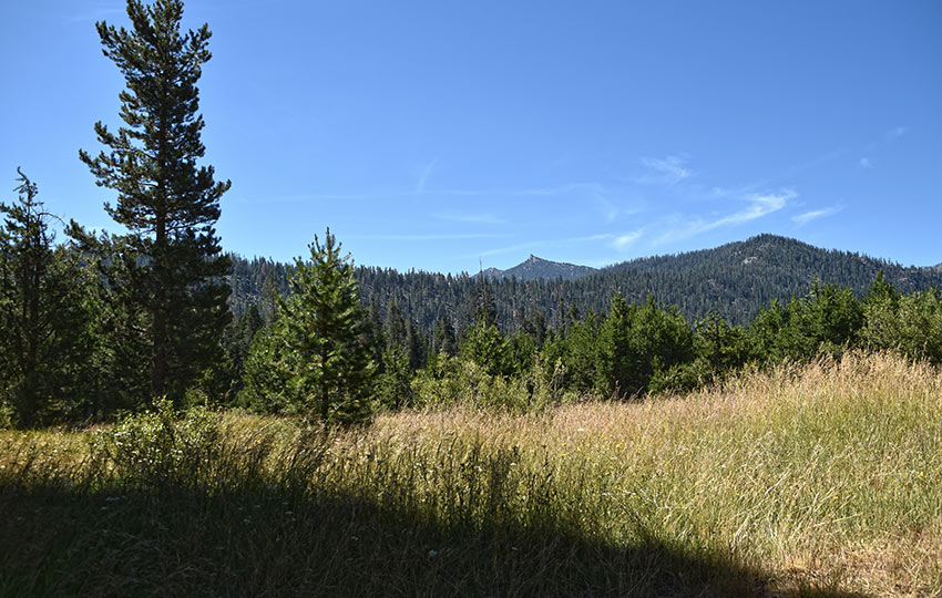
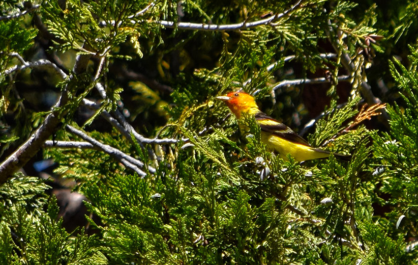
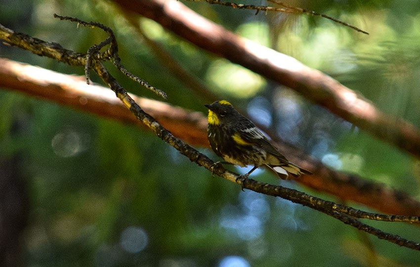
There aren’t many long views along the Meeks Creek Trail since it’s essentially flat and through forested land. However, you’ll be traveling by the creek and its adjacent meadow. This means there’ll be opportunities to see wildlife and Sierra Nevada wildflowers.
Support Tahoe Trail Guide with a financial contribution via PayPal (single contribution) or Patreon (reoccurring contributions). Your support of Tahoe Trail Guide is very much appreciated!

Keep in mind that the best time to see the Meeks Creek Falls running is earlier in the summer. The same goes for observing Sierra Nevada Wildflowers in full bloom. In both situations, this is based on the previous winter featuring a relatively normal snowpack.
I don’t recommend, however, hiking the loop around Meeks Creek early in the season because the meadow will be wet. Hiking through meadows while they’re wet is contrary to the Leave No Trace principle of traveling on durable surfaces. A wet meadow is a sensitive one, and is not considered durable. Dry grasses are considered durable. So, for hiking the full loop wait until later in the season. This will allow the soils to drain and the grasses to go to seed.
All of that said, there’s no bad time to hike to Meeks Creek Falls. There is easy access to the trail, it’s flat terrain, and the parking is free.
Meeks Creek Falls Trail Data (approximations):
- Location: West Tahoe – Meeks Bay
- Category of Hike: Short Hike, Day Hike
- Category of XC Ski/Snowshoe Route: Beginner
- Total Mileage: 4 miles (out-and-back) or 4.5 miles (loop)
- Total Elevation Gain: 50 feet
- Highest Point: 6,300 feet
- Trail Conditions: Packed dirt and grassy meadow
For other shorter hiking options, visit Short and Easy Hikes in South Lake Tahoe.
Considerations for Hiking Meeks Creek and Meeks Creek Falls:
- Meeks Creek Falls are most active following big snow years and earlier in the spring and summer. So, hiking the out-and-back option to Meeks Creek Falls is most appropriate under these conditions.
- Meeks Creek Falls are least active following low snow years and later in the summer. So, hiking the full loop around Meeks Creek is most feasible under these conditions.
- Adhere to all Leave No Trace principles
- Just to clarify … Don’t walk through the meadow on the south side when it’s wet as you’ll do damage to the sensitive terrain.
- There are few trail signs and markers on public lands in the Tahoe region. So, unless there are tracks to follow, the correct route may be difficult to identify – when in doubt, turn back.
- Be prepared for inclement weather and carry plenty of warm clothes, food, and water.
- Leave an itinerary of your plans with someone who’ll call emergency services if you don’t return by your prescribed time.
- Dogs are allowed, but keep them on leash and pick up after them.
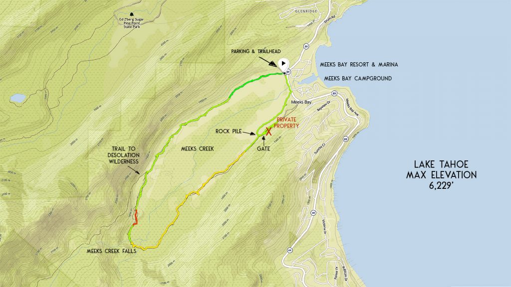
Parking Directions for Meeks Creek Falls Trail:
Parking is located on the west side of Lake Tahoe on SR 89. This area is just south of Tahoma and Sugar Pine Point State Park on SR 89. You’ll find the specific parking area opposite of Meeks Bay Campground and Meeks Bay Resort and Marina.
At the parking area, you’ll find the official trailhead with a message board. There are also Desolation Wilderness day-use passes at this kiosk for use if you were to hike to Lake Genevieve.
There are private structures near the trailhead. So, read all signs and adhere to all parking directions at this trailhead.
If the parking spots nearest the trailhead are occupied, park directly off of SR 89. Obviously, read and follow all signs posted relating to parking along SR 89.
Vehicle turnover is generally high at this trailhead. This is due to the fact that the Meeks Creek Trail is a flat and easy hike. So, don’t sweat if the parking area looks full. There’s a good chance that many of those vehicles belong to locals taking their dogs for a quick walk down the dirt road.
Please note that the trailhead to the Meeks Creek Trail is also an access point for Desolation Wilderness.
In fact, the Meeks Creek trailhead is the starting point for the lesser known Tahoe-Yosemite-Trail. But for now, just know that you don’t need to fill out a Desolation Wilderness day-use pass when hiking around the Meeks Creek area.
I only mention this because those passes are costly to print. And, it would be wasteful to fill one out since the Meeks Creek Trail doesn’t actually travel into Desolation Wilderness.
The trailhead to Meeks Creek Falls and Meeks Creek Trail is at the message board and gate.
Here’s a map to help you find the trailhead and parking to the Meeks Creek Trail.
Travel along the Meeks Creek Falls Hiking Trail:
Hike along the dirt road beginning at the message board and gate located just off of SR 89. This trailhead is across SR 89, opposite the Meeks Bay Campground and Meeks Bay Resort and Marina.
At about 1.5 miles, you’ll reach a fork in the trail.
The trail that leads off to the right will take you into Desolation Wilderness. Stay to the left and continue hiking around Meeks Creek in a counter-clockwise direction.
You’ll begin to notice evidence of man-made structures and debris once you get closer to Meeks Creek Falls. For example, at mile 1.75 there’s a small trail that’ll take you to a concrete foundation of an old building.
That short trail to the foundation links back to the main Meeks Creek Trail. Hike it if you want to satisfy your curiosity and check out the foundation.
Otherwise, keep hiking the more well-worn path for a few hundred more meters. At that point you’ll see the comical looking site of a long-abandoned three-stall outhouse.
This outhouse, along with the other structures you see while hiking the Meeks Creek Trail are remnants of Camp Wasiu. This was a Girl Scout camp that was active from 1950-1965.
As odd and humorous as the outhouses look in their state of deterioration and juxtaposed next to beautiful wilderness … consider the impact they had on this specific location.
Clearly, human shit collecting in pit toilets so close to a water source (Meeks Creek) and basically in the middle of sensitive wetlands wouldn’t fly by today’s land management standards (and common sense!).
But, hey, it was the 1950s! Humans couldn’t actually contaminate the earth back then, right?
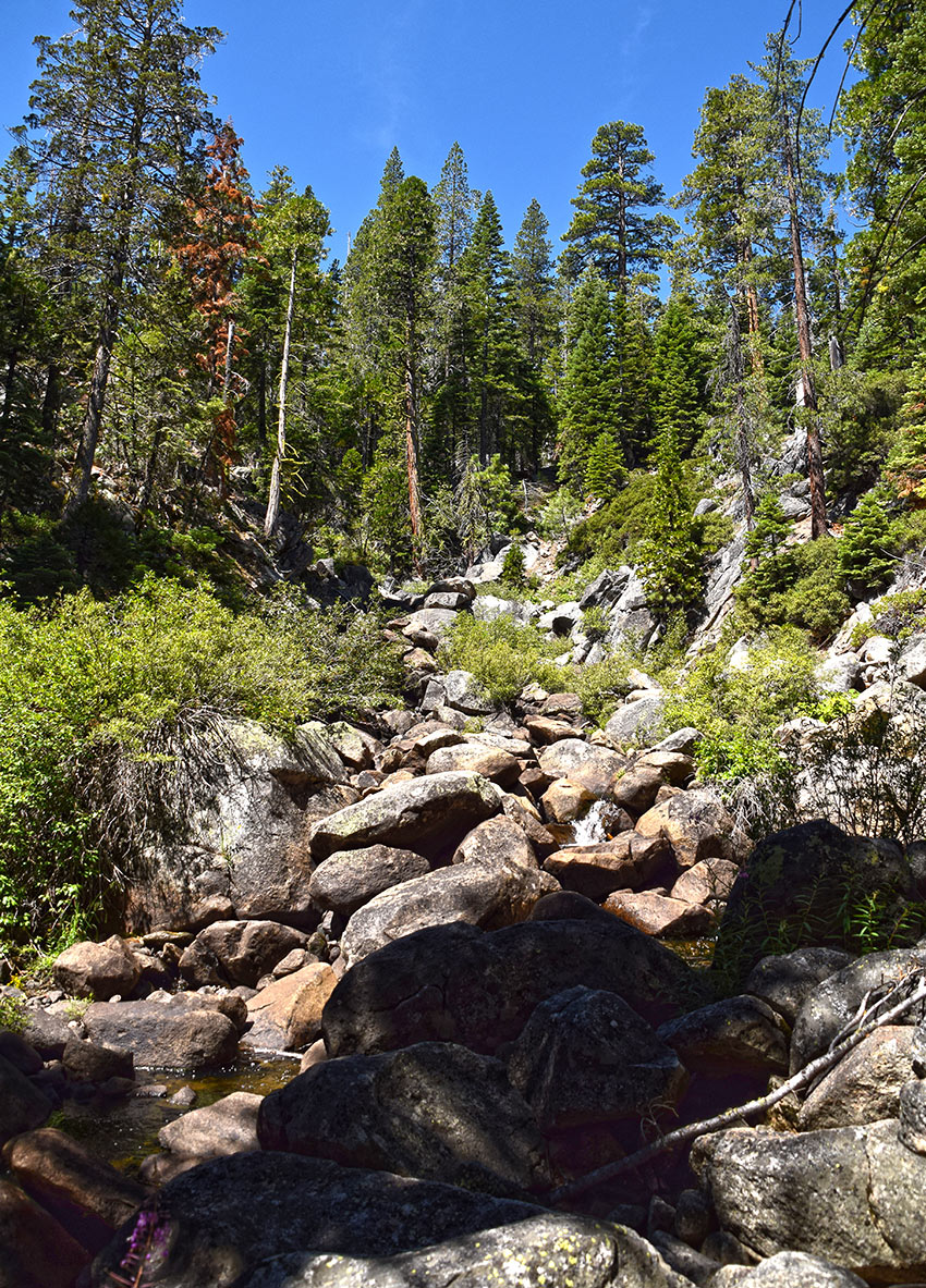
Soon after passing the outhouse, you’ll find a small trail that leads off to the right (west). This will take you through some trees and you up to Meeks Creek Falls.
Keep in mind that the amount of water running down the falls is dependent upon the previous winter’s snowpack levels.
If it was a low-snow season, those falls will dry up early in the summer.
I recommend that you visit Meeks Creek Falls in the spring and early summer in order to see them gushing. That’s not to say you can’t hike this trail all summer. It’s just that the falls won’t be very impressive in late July and August.
That said, crossing Meeks Creek in order to hike the full loop will be less wet and hazardous if the water running from the falls is low.
If you’re hiking the out-and-back option to Meeks Creek Falls you’ve reached your turnaround point. This route will yield approximately 4 total miles. So, hike back to your vehicle the way in which you came.
To continue hiking the loop around Meeks Creek (approximately 4.5 total miles), keep hiking the trail in a counter-clockwise direction.
So long as the trail is dry and qualifies as a durable surface continue hiking. You’ll see a couple more structures and piles debris along the way, and then you’ll reach a meadow.
This is where things get tricky depending on the time of year in which you’re hiking. How much snow Lake Tahoe received the previous winter will determine whether or not you should proceed.
Again, I must emphasize the importance of avoiding trampling over wet and sensitive meadow and wetlands. If it’s early in the season or the soil is obviously wet (due to a huge previous winter), turn back. Avoid hiking the full loop in this situation.
If it was a low-snow winter and you’re hiking during the second half of summer, you’ll probably be fine.
The path through the meadow won’t be nearly as defined as the one leading from the trailhead to the falls. However, you should still be able to navigate with ease thanks to previous foot traffic.
If you’re attempting to hike the loop in early summer and/or after a big-snow winter, the trail won’t be obvious. And, you’ll most find yourself walking through wet and marsh-like conditions.
I don’t recommend hiking the loop in this situation because you risk doing irreparable damage to the meadow.
Turn around and hike back the way you originally came.
Assuming the conditions are appropriate and hiking the full loop around Meeks Creek is feasible, you’ll find yourself traveling in a northeast direction back to SR 89.
At approximately 3.5 miles, you’ll see a gate. Do not walk past the gate and down the road (see the red X on the map). This is a private road that leads to and through private property.
I know it looks tempting to keep hiking down that road, but don’t do it. The locals who live there are tired and frustrated. Countless people trample across their property for many reasons including guidance, water, food… But your problems are not theirs, so stay off of that road at all costs. They will call local law enforcement for the trespassing violation.
Instead, just before reaching the gate look to your left (north) to find the correct footpath. It will curve slightly around and take you through a tree-lined area. Continue hiking along this footpath to reach the end of the Meeks Creek Trail loop. You’ll come out at SR 89 in front of the Meeks Bay Campground entrance.
When I hiked this trail in 2018, there was a large pile of rocks at this particular transition. Note that this photo was taken while looking back at the rock pile. How long that rock pile will remain is undetermined.
So, use the gate as a landmark to start looking for the correct trail. Find that trail because it’ll lead you through National Forest to your vehicle and away from private property.
For other shorter hiking options, visit Short and Easy Hikes in South Lake Tahoe.
The Meeks Creek area is also a wonderful location in which to cross-country ski and snowshoe during the winter. This is because it’s so easily accessible and provides a diversity of terrain in which to explore. But the same rules apply to staying off of private property in the winter.
Pay close attention to where you’re going when traveling around Meeks Creek in the winter. The area is forested and generally flat, so it may be challenging to orient yourself.
And as always in Tahoe, be mindful of where you park in the winter. If snow removal operations are in effect, parking becomes extremely limited. This, and it’s generally prohibited along roads such as SR 89.
Do you have other insight, feedback, or trail updates about hiking Meeks Creek Falls?
If so, please post it in the comment section below for the benefit of everybody 🙂
Jared,
Here Here!
it sounds like we are on the same page as Tahoe residents.
Your comments in the PS Section are spot on!
Thanks again and hopefully we have some renewed peace soon…let’s hope for some major back to back snowy winters. 🙂
Take care, stay sane.
Brittany
You’re welcome, Brittany. And thanks for all of the feedback. And I agree — bring on a big winter 🙂
Please be aware there are private properties that back up to the US Forestry property. You cannot park or walk through these properties. Parking is only located in the dirt area as located on the map on the north side across from Meeks Bay Marina. The trail is only a loopable trail if the creek is not flowing. So best to turn around and follow the way you went in. The second part of the trail has a lot of mosquitoes and natural wet meadows that should not be walked through. They should be protected. Pay attention to signage and do not go through private property! Private property is enforced by the owners and local Sheriff.
Hey Brittany,
Sorry for the delay in response. I’ve been super busy with work. Holy cats, there are so many people here right now! Normally during the weekdays at my summer job we’re busy between 10am-2pm. Now, since there’s a pandemic, we’re busy from 8:30am-6pm seven days a week! It’s non-stop. So bizarre.
Anyway, thanks for the feedback and reinforcement of what I’ve written about hiking at Meek’s Creek. That south side of the creek is definitely a sensitive area when the soil is wet. Every time I’ve hiked there, however, it’s been bone dry. I guess I tend to hike at Meek’s Creek after drought winters. And, I’ve actually seen vehicle tracks that have driven right down the middle of that meadow (via the FS gate?). So, yes, it’s definitely important to keep off of the terrain when it’s sensitive. But, dry grasses are considered a durable surface. That said, I’ll take some time in the next few days to edit the article to clearly emphasize this.
I have neighbor friends who live adjacent to Washoe Meadows State Park here in Meyers and have had to deal with people walking through their yard because they didn’t know where the park ended and the friend’s yard began. Those hikers simply wanted to exit the park, but didn’t know which way to hike due to a lack of signs. So to deal with that, those neighbor friends posted a simple sign this spring at the edge of their property that read “trail” with an arrow pointing in the correct direction in which to hike. Problem solved.
In my 15 years of living at Lake Tahoe I’ve always found it funny that there’s such a lack of signs on Tahoe trails. I totally understand the concept of keeping things “pristine” by not posting signs everywhere. However, it’s counterproductive not to point people in the direction of the correct route. “No trespassing,” “private property,” and “keep out” signs are fine for illustrating where people shouldn’t go. But people aren’t looking for places where they’re not supposed to be. They’re actually looking for places where they should be hiking (i.e. the trail). And, over the years, I’ve seen so many “no trespassing” signs pointed in so many conflicting directions in various locations around the lake that it becomes nearly impossible to tell where the borders between public and private land begins and ends. I know homeowners do this on purpose to confuse and frighten people but, again, it’s absolutely counterproductive. In fact, a person is more likely to linger longer around a property (or even walk across it) when there’s no clear direction in which to go compared to if there was a simple sign directing them to the trail (coupled with that “private property” sign). Nobody actually wants to trespass. They just want to hike. So show them where to go, and they’ll happily comply.
Anyway, I appreciate your feedback. Stay sane out there!
Hi Jared,
No problem at all, in fact I didn’t expect a response given my track record with inquires to articles sharing their thoughts on the ‘loop trail’ near/bordering our private property.
I had read your response, which I appreciate by the way, then drove home the other day and counted seven, yes seven signs from the HWY to our front door on just our private road alone. When we are home and have someone walk by WE DO confront them every time and help guide them the best we can. These signs are in both directions on the private road so either way you come down the road you know you are on private property, so signage is there and has been there on our private property. As for directional guidance, we have tried on numerous occasions to work with the US Forestry as we will not be posting directional signage on property that does not belong to us. We had actually enjoyed the quieter times when there were only a few locals at a time passing by along the correct pole line trail and not the dozens and dozens that we hear through the trees this year likely as a result of ‘COVID times’ and easily accessible apps and numerous articles/articles/forums/blogs telling people where to go hike etc, etc.
As an explanation for the vehicle tracks you mentioned, the Forestry did a defensible space burning about five years ago and at that time they brought their equipment and water trucks back there one fall for prescribed burning. No other vehicles are permitted otherwise, no ATV’s nothing. The US Forestry signs say this as well. They used our private road which they are allowed for “maintenance and emergency purposes only.”
There are two green and white signs at the last meadow prior to where our private property property starts. Just where the boulders you mention in the article are located, those boulders are part of the creek restoration project that will happen one day. They were just brought in 2 years ago July 11-13th. One sign points left and says something along the lines of loop trail to HWY while the other sign says private residences only to the right. You can easily see the foot trail that goes to the left and carries along the pole line and out to the highway, but for some reason walkers/hikers say they didn’t see this sign nor the large one at the entry gate saying into private property that reads, “Please be respectful, take the pole line trail so many feet to your left’, yet some still carry on through our property. We have no choice now but to install a fence. We were hoping not to have to go this route.
So yes there are signs, yes we have tried to make it clear, but we are running thin on patience and I am hoping you can see where we are coming from. I don’t like to have to redirect people, I don’t like being asked for water or directions from my front deck for passerby and I especially don’t like having to say hey you are on private property!!!
The only thing I wish is that people do find the respect for private property and are courteous about it, we are when we are visiting places out of town! We also don’t leave our garbage or dog poo bags around like people tend to do in our experience.
Happy trails and thanks again for listening.
Hey Brittany,
Yeah, I’d be just as frustrated as you having to deal with so many wanderers. Interesting about the sign directing people to the pole line trail. I honestly don’t remember seeing that when I hiked there last (which was a couple of years ago now), but it seems like that should help. But “should” and “does” are two different things.
I imagine that a big part of the overall problem in your specific situation is that the trail as it loops counter clockwise, dumps everyone out right in front of that gate/private road. And, the hiker has to reconcile the hard left turn (past the boulders) onto the actual pole line trail. I image many people become target-fixated and just see that road as a natural continuation of the trail they had been walking on and, as a result, the path of least resistance. Very unfortunate.
At my summer job, which is a resort and day-use area on the south shore, we’ve seen an exponential increase this year in illegal campers along the FS road that leads to the resort, countless people parking in fire lane/restricted areas along that same FS road, and everything in-between. There was even a rando arsonist who had spent all day (a few weeks ago) trying to set fire to Desolation Wilderness (on the other side of the mountain from us).
There’s definitely been an increased use of Tahoe trails in recent years, but this year definitely takes the cake on insanity. I think people have simply lost their minds having been in isolation for so long. Hopefully, this will all pass in the next month because it has definitely been a stressful summer.
I, too, wish the FS would do more as far as enforcement goes but they’re completely maxxed out on every aspect of their operation this year.
Anyway, take care and good luck surviving the summer!
p.s. I imagine a lot of the lesser than desirable responses you’ve received in the past from other sites/apps is a direct result of the authors not actually living at Lake Tahoe (and not understanding what it’s like to deal with countless visitors). That’s one of the things that annoys me about most “competitor” blogs — they’re usually written/published by random people passing through on their “van life” social media tour and get paid a few bucks from some decentralized/broad-reaching website that features trails from all over the country, if not the world. There’s no accountability because they’ve already “been there/done that” and don’t have to deal with the consequences.