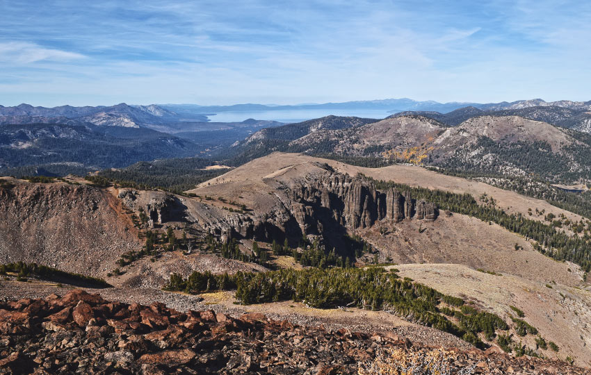
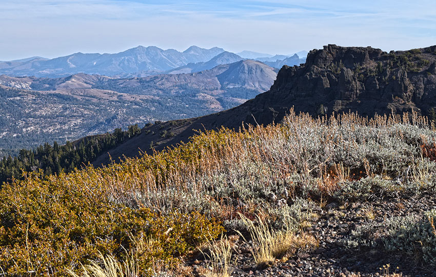
Steven’s Peak is an exceptional hike for adventurous people. Particularly those who are looking to challenge their physical stamina, weather forecasting, and land navigation skills. And throughout the journey you’ll be treated to stunning views in all directions. Most of which will be major landmarks of the southern end of the Lake Tahoe Basin.
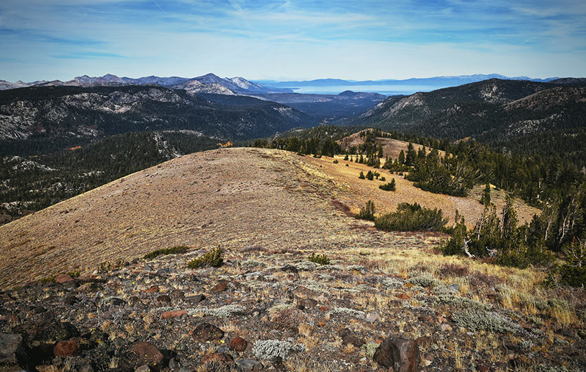
Since you’ll be trekking through Meiss Country, you’ll bear witness to panoramic views of:
- Round Lake
- Little Round Top and its ridge
- Red Lake Peak
- The Sisters
- Round Top
- Elephants Back
- Hope Valley
- Hawkins Peak
- Further south into Alpine County
You’ll also catch some glimpses of Freel Peak and Jobs Sister, Lake Tahoe, and Desolation Wilderness.
Support Tahoe Trail Guide with a financial contribution via PayPal (single contribution) or Patreon (reoccurring contributions). Your support of Tahoe Trail Guide is very much appreciated!

The trek to Steven’s Peak is not for the faint of heart, however. This route features approximately seven miles of off-trail hiking and navigating across (mostly) open terrain. This means that you’ll be fully exposed if you get caught in inclement weather or injure yourself. Or, if things go sideways in any one of a dozen different ways.
For hiking the Steven’s Peak Loop you need to be able to orient yourself when reading a topographical map. That said, if you’re new to hiking off-trail I would save this one for when you have more backcountry experience.
Steven’s Peak Loop Hiking Trail Data (approximations):
- Location: South Tahoe – Christmas Valley – Big Meadow Trailhead
- Category of Hike: Day Hike – Multi-Day Hike
- Category of XC Ski/Snowshoe Route: Advanced, Ski Tour
- Total Mileage: 12 miles
- Total Elevation Gain: 3,100 feet
- Highest Point: 10,059 feet
- Trail Conditions: Alternating between packed and sandy soil, with 7 miles of off-trail hiking
Considerations for Hiking the Loop Trail to Steven’s Peak:
- Don’t attempt this hike if you don’t know how to read a topographical map and orient yourself.
- The Steven’s Peak Loop is only 12 miles. However, plan to take much longer than you would if you were hiking along an established trail. Off-trail hiking always takes longer. Period. This is due to having to frequently refer to the map and orienting yourself. And it you spend time making decisions about routes to travel.
- Whenever traveling off-trail, do everything possible to minimize your impact. For example, avoid stepping on delicate vegetation and toppling rocks.
- Adhere to all Leave No Trace principles.
- There are few trail signs and markers on public lands in the Tahoe region. So, unless there are tracks to follow, the correct route may be difficult to identify. When in doubt, turn back.
- Be prepared for inclement weather and carry plenty of warm clothes, food, and water.
- Leave an itinerary of your plans with someone who’ll call emergency services if you don’t return by your prescribed time.
- Dogs are allowed, but keep them on leash and pick up after them.
Parking Directions for Hiking to Steven’s Peak via Big Meadow Trailhead:
Parking for the Steven’s Peak Loop is located at the Big Meadow Trailhead and campground. This trailhead is 5 miles south of the HWY 50/SR 89 intersection in Meyers, CA.
Drive south of Meyers along SR 89 through Christmas Valley until you reach the pronounced bend in the road.
In less than a half mile from this bend, you’ll find the entrance to the Big Meadow Campground and parking area.
The entrance is on the north side of SR 89, so keep your eyes open because it’s easy to miss.
Be cautious when proceeding around the bend because the trail from the Big Meadow Campground area crosses SR 89. There are many trail users that begin their adventure here. So, there’s a good chance you’ll encounter hikers and mountain bikers trying to cross the road at this location.
The parking is free and plentiful, and near the entrance you’ll find pit toilets.
The Big Meadow parking area serves many different people, however. It’s a trailhead to multiple other hiking trails, an official Tahoe Rim Trail trailhead, and is multi-use (i.e. hikers, mountain bikers, and horseback riders). So, you’ll be contending with many other people when looking for a parking spot.
As always, your best bet to avoid the crowds is to hike this trail during the week and/or early in the morning.
The trailhead for hiking the loop around Steven’s Peak starts at the Big Meadow Trailhead.
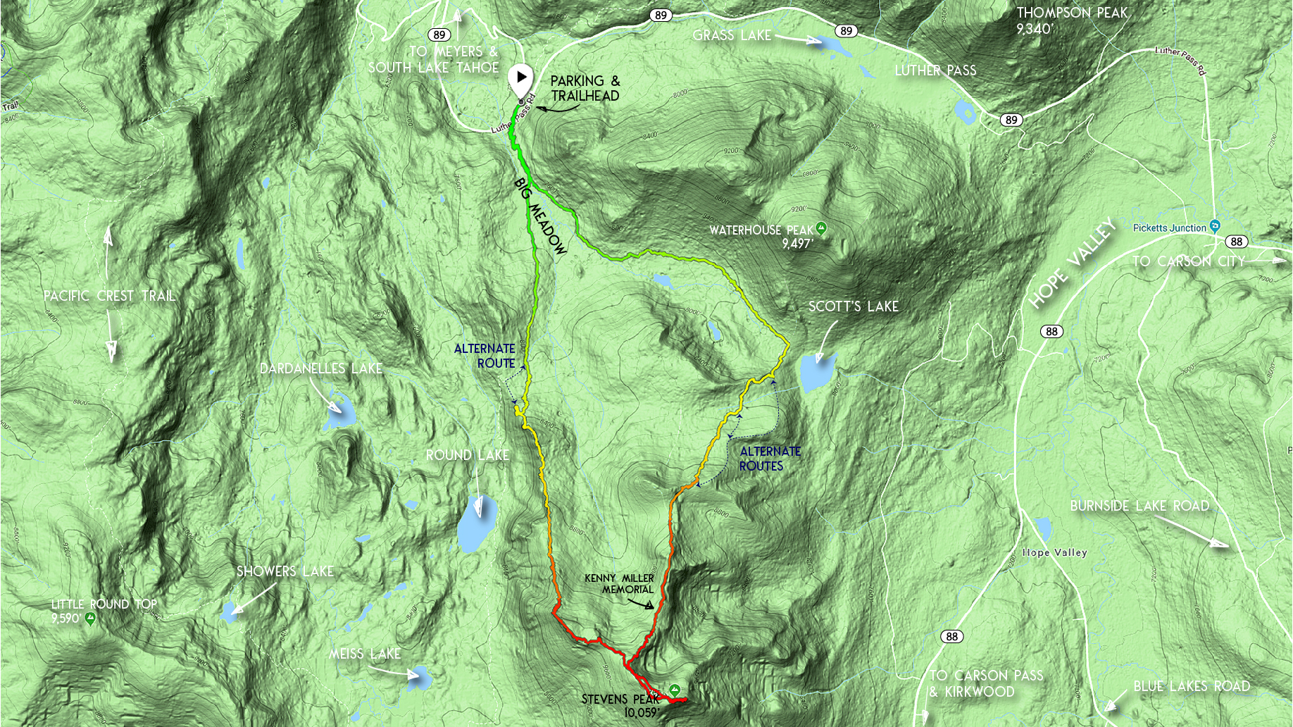
Here’s a map to help you find the entrance to the Big Meadow Trailhead and parking area.
Travel Directions for Hiking the Loop Trail to Steven’s Peak:
The loop hike to Steven’s Peak begins at the Big Meadow Trailhead.
Hike from the parking lot across SR 89. Use caution, obviously, when crossing this road. And then proceed up the trail for approximately .6 miles to a signpost that indicates Big Meadow or Scott’s Lake. This signpost is the beginning/ending of the Steven’s Peak Loop.
From this point, you need to decide whether you’re going to hike in a clockwise or counterclockwise direction. Neither direction is right or wrong or better or worse. However, hiking in a clockwise direction seems more logical so I’ll provide those directions first.
Clockwise via the trail to Scott’s Lake:
Hike the established trail to Scott’s Lake for about 2.5 miles. But don’t actually hike all the way to Scott’s Lake.
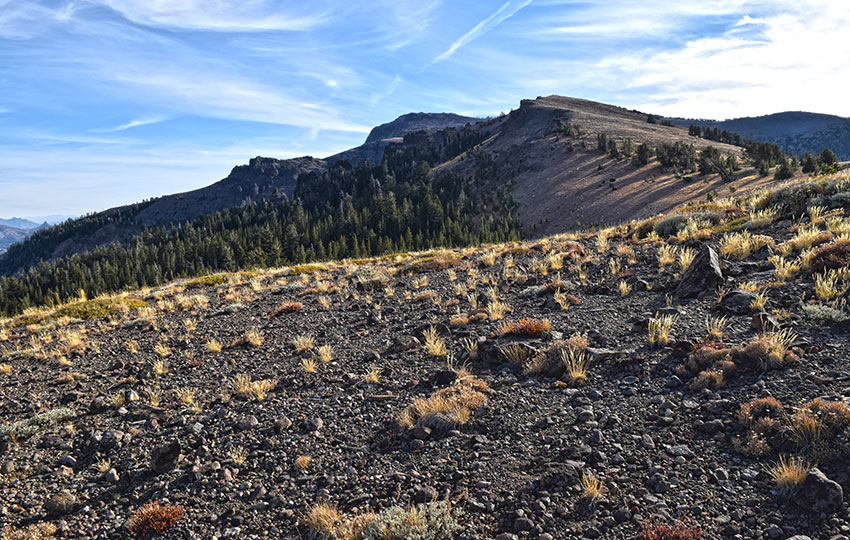
You want to be at a location somewhere beneath Waterhouse Peak. Once you’re there, head off-trail in a south-southwest direction (away from Waterhouse Peak).
While traveling through the forest, weave your way between the isolated ridge that parallels the Scott’s Lake Trail and the zig-zag ridge that’s located southwest of Scott’s Lake.
You’ll know you’re traveling in the right direction if, at around .5 miles, you cross the small creek that flows into Scott’s Lake.
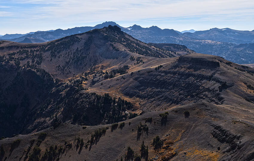
Continue hiking uphill and in a south-southwest direction until you reach a pronounced “T” intersection along the zig-zag ridge. Once you gain the ridge at this intersection, you should see Steven’s Peak due south.
Navigating to Steven’s Peak should be pretty obvious at this point if you’re hiking on a clear day. Nevertheless, hike south along the ridge for approximately 1.25 miles. And then veer southeast along the even higher ridge (connected with the one you’ve just hiked).
Steven’s Peak is the highest point along the rocky ridge top above you. There should be an ammo can at the top with trail registers contained within.
Please note that on the map I’ve indicated a relatively direct line between the Scott’s Lake Trail and the “T” intersection on the ridge. However, you could choose to hike more directly up to the zig-zag ridge and follow it until you reach the “T” intersection. See the Alternate Routes labeled on the map.
Either way is fine. On the day I recorded this hike, it was late in October. The sun was already beginning to set, so I simply wanted to travel more directly to the Scott’s Lake Trail. And, for the record, I was traveling counterclockwise.
The return hike to the Big Meadow trail (to complete the Steven’s Peak Loop) requires you to backtrack along the higher ridge until you reach the north/south running ridge which you originally hiked.
At this junction, however, hike northwest for about .75 miles. Toward the end of this short section, you’ll note a steep drop-off to the west. Contour the ridge until you begin to veer north.
Then, you’ll essentially continue traveling north for the remainder of the off-trail portion of the Steven’s Peak Loop. That is, until you reach the Big Meadow Trail.
I highly discourage you from stepping too close to the edge along this northward section. That’s because it’s comprised mostly of decomposing granite and volcanic rock (which can be crumbly). There’s plenty of flat terrain along this section. So as long as you don’t creep too close to the edge, you don’t need to be concerned about falling.
Be conservative when traveling here so that you can live to tell about your adventure.
Again, when I recorded the route featured on the above map I was hiking in a counterclockwise direction. So, I had elected to hike up a draw just off of the Big Meadow Trail to gain the ridge.
I wouldn’t concern yourself too much with following this exact route back to the trail. It would be simpler to just keep following the edge of the ridge downhill in order to link up with the Big Meadow Trail. See the Alternate Route labeled on the map.
Upon reaching the Big Meadow Trail, follow it back down to the Big Meadow Trailhead and parking area.
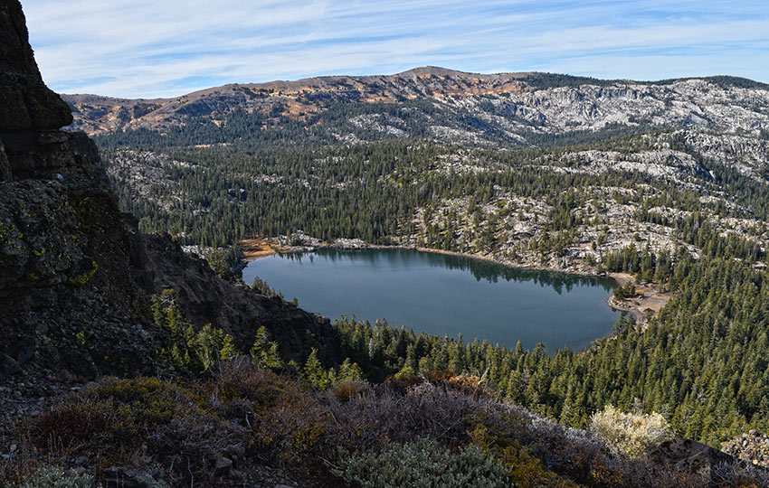
Counterclockwise via the Big Meadow Trail (in the direction of Round Lake):
From the Big Meadow/Scott’s Lake signpost, travel approximately 1.5 miles along the Big Meadow Trail.
At around 2 total miles, you’ll see a creek surrounded by grasses and willow. At any point in this area you can begin to hike off-trail in a southward and uphill direction.
I recommend hiking a little further, however, along the Big Meadow Trail. This trail eventually leads to Round Lake, but before doing so it travels downhill along an obvious switchback.
Stay on the trail until it takes a definitive turn to the northwest and begins to descend.
From this “corner” head primarily south, contouring the edge of the terrain (see the Alternate Route labeled on the map).
Obviously, take care while tracing a line along this edge. Much of the terrain is composed of crumbly volcanic rock and decomposing granite. However, there’s plenty of flat terrain to walk along this route. And it’s very easy to follow because of its defined boundary.
While following the western edge of the Steven’s Peak Loop, you’ll travel in and out of some wooded areas. But those sections are brief.
Stay as safely far west as you can, and you won’t have any problems navigating through these areas.
At around the 4-mile mark, you’ll need to veer in a southeast direction. For all intents and purposes, you’ll run out of ridge to the south. So just keep tracing the line along the ridge and in the (southeast) direction of Steven’s Peak.
You’ll reach the peak in about 1.25 more miles. Steven’s Peak is the highest point along a brief rocky ridge. And there should be an ammo can containing trail registers at the top.
To complete the loop, backtrack about .5 miles down the ridge until you reach another ridge that runs north/south.
Head north along this ridge for about 1.25 miles. You’ll reach a “T” intersection on this ridge, at which point you can start heading in a north-northeast direction.
You’ll begin to descend the ridge and into the forest. But as long as you continue traveling in that north-northeast direction, you’ll eventually connect with the Scott’s Lake Trail.
Use Waterhouse Peak as a landmark in which to guide you. Or, at the “T” intersection, you could elect to continue hiking along the zig-zag ridge that leads in the direction of Scott’s Lake.
Either way is fine. Just know that there’s no reason to hike up and over the isolated ridge that parallels the Scott’s Lake Trail (north of the zig-zag ridge).
Once you reach the Scott’s Lake Trail, continue hiking along it down to the Big Meadow Trailhead and parking area.
Additional Notes about Hiking the Steven’s Peak Loop:
Be mindful of your steps when hiking along any of the cliffs. There are numerous tripping and slipping hazards along the edge. Also, the terrain in this area is primarily composed of unpredictable volcanic rock and decomposing granite.
Whenever you hike off-trail, do everything possible to minimize your impact on the land.
Leave all natural features alone. Don’t roll, topple, or throw rocks and other naturally occurring structural features.
Hike on durable surfaces, such as rock, gravel, or hard-packed dirt. Avoid trampling over delicate vegetation.
Don’t harass or otherwise tempt (by feeding) wildlife.
Without question you could hike a dozen and one different routes directly to Steven’s Peak from the Big Meadow Trailhead. However, “the longest way round is the shortest way home.” The loop route I feature in this article affords the best views and the easiest terrain of which to navigate.
This is a relatively remote and slower hike due to the fact that more than half is off-trail. So, you could turn it into a fantastic overnight backpacking trip. If you do, however, be sure to check the forecast. That’s because there’s nowhere to hide once you’re above the trees!
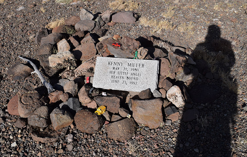
Kenny Miller Memorial Site:
On the ridge that runs north and south (just north of Steven’s Peak) you’ll find a memorial site. This features a granite plaque with the name of a 12-year old boy named Kenny Miller etched into it.
This child suffered at the age of two from a near-death case of meningitis. As a result, he didn’t develop mentally beyond that of a 4-year old.
He was reportedly very active to the point where he found it challenging to physically stop moving. So his parents, instead of trying to keep him isolated within a building (home or school), provided him with as much natural stimulus as possible (i.e. going outside to play).
They purchased a condo at Lake Tahoe and often went hiking and backpacking.
The day that Kenny Miller went missing he and his family were hiking along the Pacific Crest Trail. While his parents were looking at the Meiss Family Cabin and Barn, near the PCT/TRT intersection in Meiss Meadow, Kenny wandered off.
Although they hadn’t left him alone for more than a couple of minutes, Kenny had disappeared. That was June 23, 1992.
In spite of extensive search and rescue efforts, his body wasn’t recovered until July 4, 1992. And this was on a ridge 2.5 miles away.
I cannot confirm whether or not the ridge on which his memorial now rests is the same ridge on which he was found.
Steven’s Peak is a favorite among backcountry skiers and riders, but they primarily access it via Carson Pass. This is because the Big Meadow Trailhead is closed during the winter (i.e. very limited parking on the road) and the approach from it would take forever. So if you’re a backcountry alpine skier or snowboarder, look elsewhere for information about skiing Steven’s Peak. This is not my area of expertise. And there are plenty of other websites that can provide this type of information.
Do you have other insight, feedback, or trail updates about hiking Steven’s Peak?
If so, please post it in the comment section below for the benefit of everybody 🙂