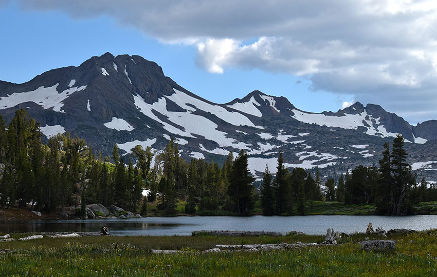
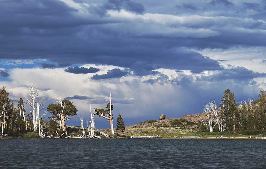
Hiking to Frog Lake is an ideal adventure for all ages and fitness levels because the trail to Frog Lake is relatively short and easy. In addition, once you reach Frog Lake you’ll be treated to exceptional views around the Carson Pass area.
From Frog Lake, you can see:
- Freel Peak
- Hope Valley
- Markleeville Peak
Then, as you continue to look around in a clockwise direction, you’ll see:
- Elephant’s Back
- Round Top
- The Sisters
- Caples Lake
- Little Round Top
- Red Lake Peak
Just as compelling as the landscape views, is the abundance of beautiful Sierra Nevada wildflowers that grow near and around Frog Lake during warmer months.
Support Tahoe Trail Guide with a financial contribution via PayPal (single contribution) or Patreon (reoccurring contributions). Your support of Tahoe Trail Guide is very much appreciated!

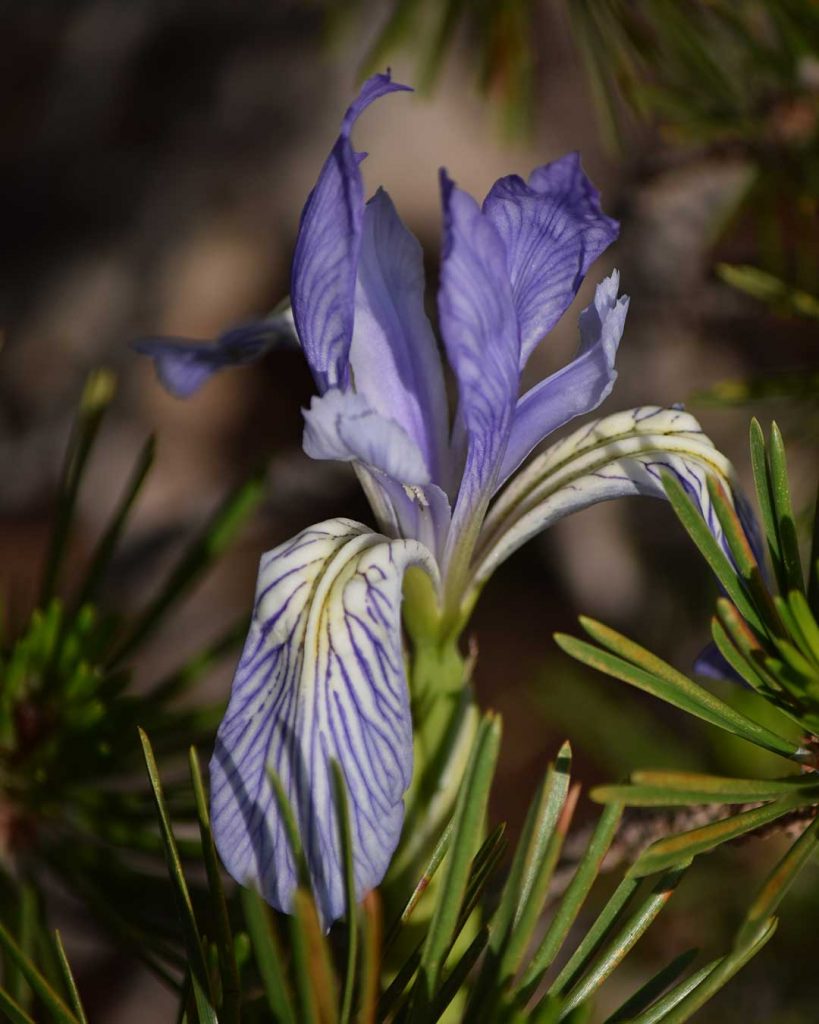
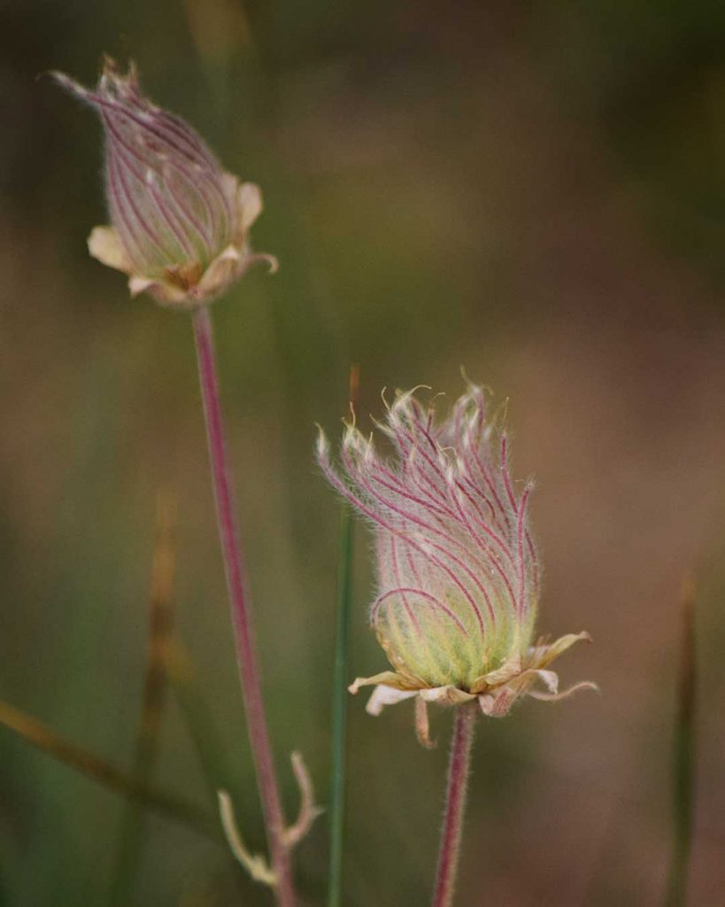
You can find two of my personal favorite wildflowers on the east side of Frog Lake. They are the Western Blue Flag (aka Wild Irises) and Prairie Smoke (aka Old Man’s Whiskers).
Scroll to the bottom of this article to see a photo gallery of Frog Lake wildflowers, as well as information about finding wildflowers at (and on the trail to) Frog Lake.
Know that Carson Pass always receives and holds snow early and late in the season due to its location and higher elevation.
Whether you’re looking for a short invigorating workout with some views, or you’re on the hunt for wildflowers at Carson Pass, check the trail conditions before arriving.
To put things into perspective … my last day of cross-country skiing for the 2018/19 season was June 13, 2019, on Elephants Back at Carson Pass. On that day, the trail from the Carson Pass Visitor’s Center to Frog Lake (and further on to Winnemucca Lake) was still 90% covered in snow.
Again, if you’re planning to hike to Frog Lake earlier in the summer just do your homework before setting out (to determine whether or not you’ll need to bring snowshoes!).
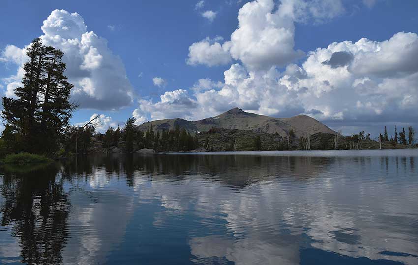
Also note that I’ve never considered Frog Lake to be a swimming lake.
Instead, continue on to Winnemucca Lake in order to jump in a cold and refreshing alpine lake.
Although I always recommend continuing on to Winnemucca Lake, if your time and energy only affords you the trip to Frog Lake you won’t be disappointed.
Lastly, there are a million-and-one different “Frog Lakes” in the U.S. For example, there’s a popular Frog Lake trail in Oregon, and there’s even a Frog Lake in North Tahoe near Truckee, CA. Frog Lake is often just a generic name used to denote a much smaller lake. Just know that this article only deals with the Frog Lake located between Carson Pass and Winnemucca Lake in Mokelumne Wilderness (CA).
Frog Lake Trail Data (approximations):
- Location: South Tahoe – Carson Pass
- Category of Hike: Short Hike, Day Hike
- Hike Time: 1-2 hours
- Total Mileage: 3 miles (out-and-back with a loop around Frog Lake)
- Trailhead Elevation: 8,570 feet
- Highest Point: 8,870 feet
- Total Elevation Gain: 350 feet
- Trail Condition: Hard-packed sand and rocky terrain
For other shorter hiking options, visit Short and Easy Hikes in South Lake Tahoe.
Considerations for Hiking Frog Lake:
- The day-use fee during the warmer months (May 31 – Nov 1) is $5, and you can pay that via a digital kiosk at the south lot (near the Visitor Center) with credit/debit cards
- Between November 1 – May 30 every year, the parking lots at Carson Pass officially become Sno-Parks and require a Sno-Park permit (purchase day or season permits in town before traveling to Carson Pass)
- Although the hike to Frog Lake is one of the more “easy” hikes in the area, still be aware that the approximate 1-mile journey to the lake is all gradually uphill
- Keep in mind that at Carson Pass snow arrives early and stays late, so check the trail conditions prior to arriving
- Admire, study, and take photos of the wildflowers, but don’t pick them
- Adhere to all Leave No Trace principles
- There are few trail signs and markers on public lands in the Tahoe region, so unless there are tracks to follow, the correct route may be difficult to identify – when in doubt, turn back
- Be prepared for inclement weather and carry plenty of warm clothes, food, and water
- Leave an itinerary of your plans with someone who’ll call emergency services if you don’t return by your prescribed time
- Dogs are allowed, but keep them on leash and pick up after them – this is especially important around Frog Lake as the immediate area is sensitive land
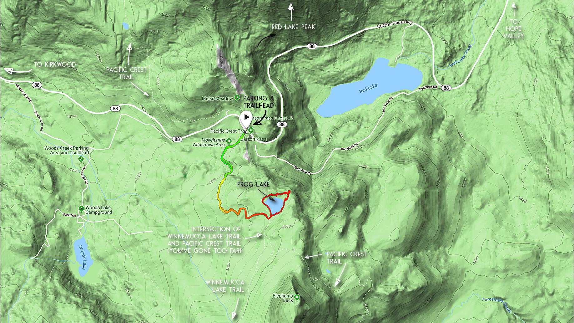
Parking for the Frog Lake Hiking Trail:
For the hike to Frog Lake, park at the Carson Pass Information Station on State Route 88 at the top of Carson Pass. This parking lot is on the south side of Carson Pass.
If the parking lot is full, there’s another area in which to park located on the small road (Red Vista Road) a hundred meters east on SR 88.
Lastly, there’s a full parking lot on the north side of SR 88 just west of the visitor center. If you use the north lot, however, be extremely careful crossing SR 88 because there are a couple blind corners on the road.
Parking at any one of these three locations requires a $5 day-use permit (digital self-pay station is in the south lot).
Please note that if you’re traveling to Frog Lake between November 1 and May 30, you’ll need a Sno-Park permit ($5/day, $25/season). The permits can be purchased in Meyers or online (not at the actual Sno-Park). Without a permit you run the risk of receiving a $100 ticket.
Here’s a map to help you find the Carson Pass Information Station and parking lot for the trail to Frog Lake.
Frog Lake Hiking Trail Directions:
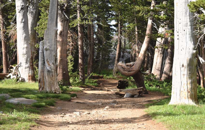
Start your hike to Frog Lake at the Carson Pass Information Center.
Hike south (and gradually uphill) along the Pacific Crest Trail for approximately 1 mile.
At this 1-mile point, you’ll reach an intersection with a small sign pointing to Frog Lake.
Take this small trail that branches off to the east a few hundred meters to reach Frog Lake.
Please note that if you reach the intersection where the Pacific Crest Trail branches off from the trail to Winnemucca Lake, you’ve gone too far. Turn back around and find the other junction that will lead you to Frog Lake.
There’s a small footpath around Frog Lake. This is a fun loop to add to your hike. And, it provides some great views looking across the lake south to Round Top.
Hiking this loop will also give you a total mileage for your hike closer to 3 miles.
If you choose to add this loop to your hike, be mindful of your steps. Don’t stray from the path as the terrain is sensitive immediately around the lake.
On the east side of Frog Lake is a marshy area where you can find Western Blue Flag and the Prairie Smoke I mentioned earlier. Additionally, you’ll find a bunch of other wildflowers.
The area in which those two varieties of wildflowers grow is sensitive so, again, tread lightly.
I recommend sticking to the footpath and using a telephoto lens to capture wildflowers in this specific spot.
Slightly further east of Frog Lake you’ll find a rocky overlook from which to see panoramic views (looking east) of Hope Valley.
For other shorter hiking options, visit Short and Easy Hikes in South Lake Tahoe.
Whether or not you hiked the loop around Frog Lake, in order to return to the Carson Pass Information Station you’re going to simply hike back in the same direction whence you came. For example, along the Pacific Trail heading north.

Wildflowers of Frog Lake
Please note that I’ve compiled the following gallery of Frog Lake wildflowers over various years and times during the summer(s). So, don’t expect to find all of the wildflowers presented here on one hike.
Also note that wildflower bloom times are often skewed at Carson Pass compared to other locations around Lake Tahoe. For example, Western Blue Flag will normally bloom closer to Lake Tahoe in the month of May. In 2019, however, I found many of those Wild Irises still blooming at Frog Lake on July 26th.

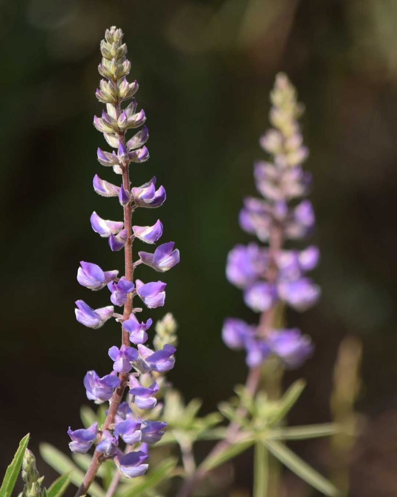
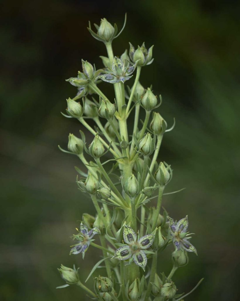
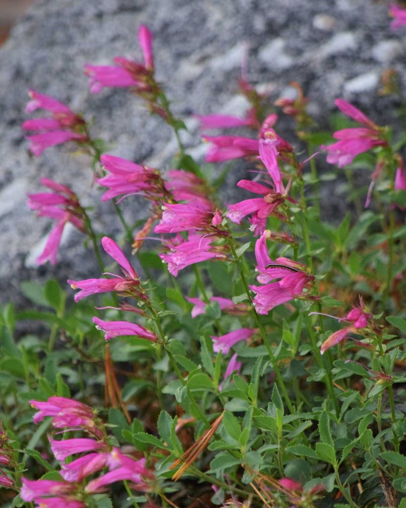
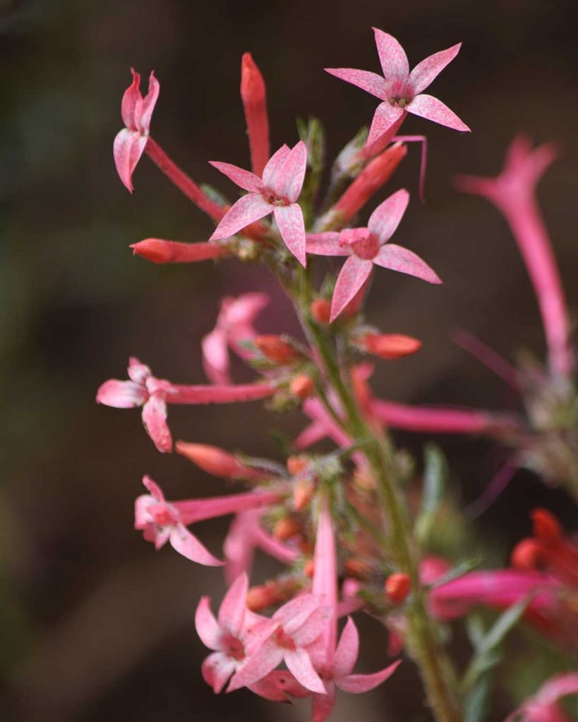
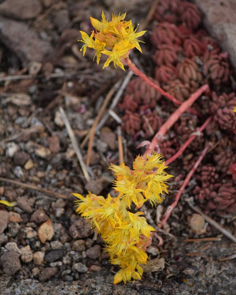
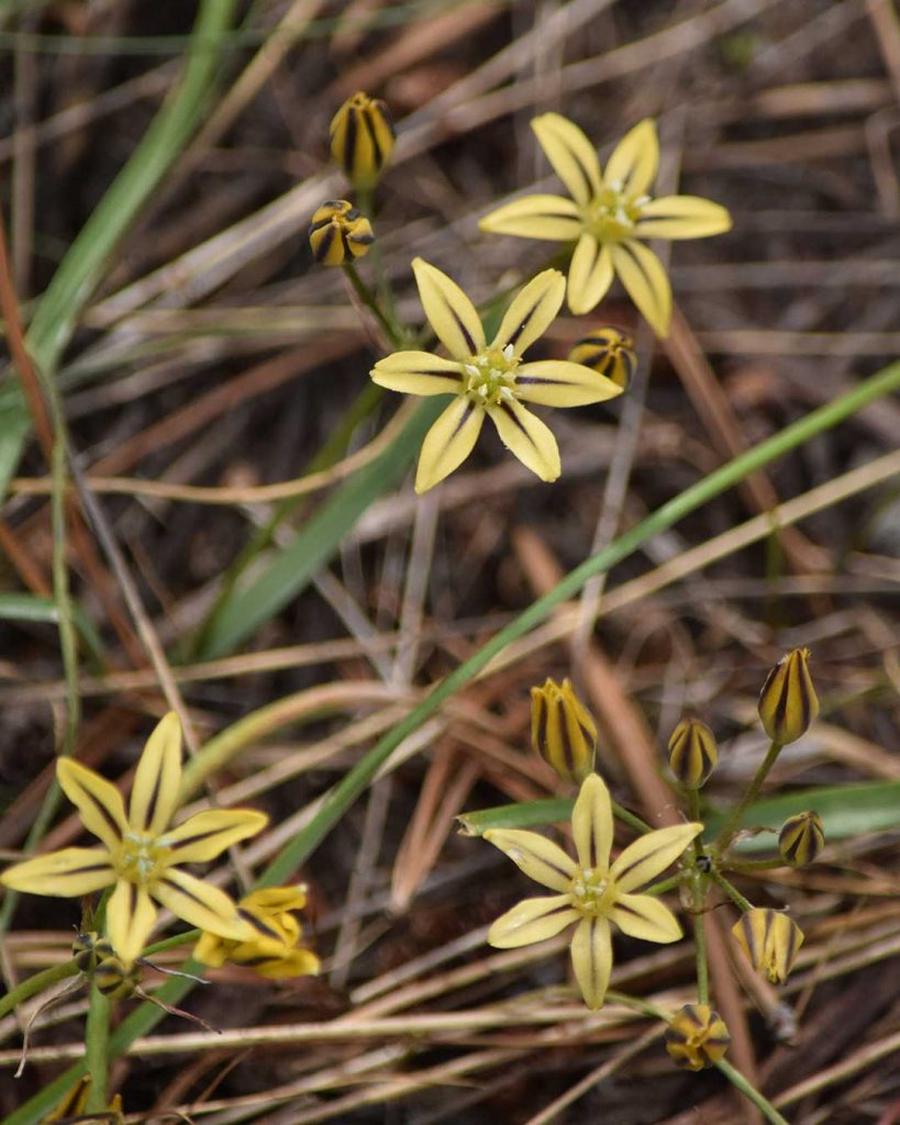
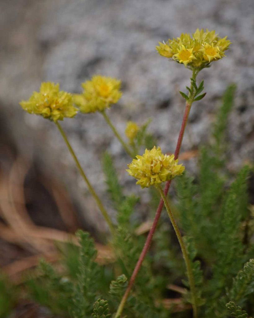
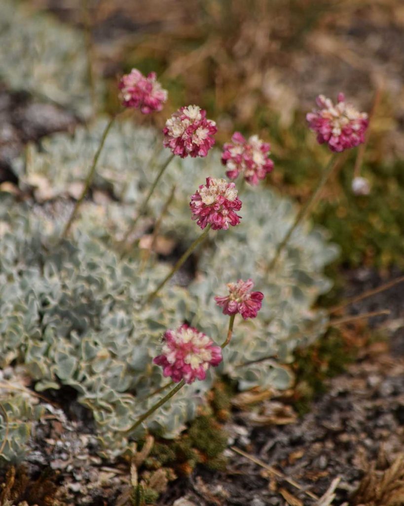
Variety of Lupine (7/26/19) © Jared Manninen Monument Plant – Frasera speciosa (7/26/19) © Jared Manninen Mountain Pride – Penstemon newberryi (7/26/19) © Jared Manninen Slendertube Skyrocket – Ipomopsis tenuituba (7/26/19) © Jared Manninen Spearleaf Stonecrop – Sedum lanceolatum (7/26/19) © Jared Manninen Western Blue Flag – Iris missouriensis (7/26/19) © Jared Manninen Mountain Pretty Face – Triteleia ixioides ssp. anilina (8/6/19) © Jared Manninen Gordon’s Mousetails – Ivesia gordonii (8/6/19) © Jared Manninen Prairie Smoke – Geum triflorum (8/6/19) © Jared Manninen Sierran Cushion Wild Buckwheat – Eriogonum ovalifolium var. nivale (8/6/19) © Jared Manninen
As I gather relevant photos of wildflowers found near Frog Lake, I will update this gallery.
In the meantime, feel free to post in the comment section below the names of wildflower species that you believe are missing from the gallery.
Do you have other insight, feedback, or trail updates about hiking Frog Lake?
If so, please post it in the comment section below for the benefit of everybody 🙂
what is the hike like from the Red Vista Road parking lot directly to Frog Lake? Is there a trail? cross country? steep climb? Thanks!
Hey Joe!,
Thanks for reaching out! I’m not super familiar with the history of Red Vista Road, but I believe it was the original Carson Pass route (up from Red Lake) made by western emigrants as there are some historical indications/markers along that route. But you were asking about the trail up to Frog Lake, not Red Lake!
The section of paved Red Vista Road nearest the Carson Pass information station is basically an overflow parking area for the south trailhead at Carson Pass nowadays. That’s what most people use it for, anyway. But you can totally hike up to Frog Lake from this road. The trail, however, is mostly unmaintained and a bit of a scramble in places. And it’s steep here and there. I honestly use this route a lot, though, to avoid the crowds of the main trailhead and because it’s slightly shorter than the main Winnemucca Trail. However, it’s not necessarily for everyone. I considered including that route in this article as an alternate way in which to reach Frog Lake, but ultimately decided against it because it can be challenging for some people. Again, it’s more of a route than an actual trail.
All of that said, the route/trail I use from Red Vista Road begins closer to SR88. If you were standing at 88 and walked down Red Vista Road roughly 10 car lengths, you’d want to start to veer right into the forest. The trail starts in a flat-ish area in the forest not far from the road. Again, it’s not maintained and there aren’t any signs but there is a footpath. No matter what, though, from this general location if you travel south and uphill you’ll eventually reach Frog Lake or somewhere very close to it. The elevation gain is about 400-500 feet in a shorter distance (less than a mile) so, again, just keep traveling up and to the south. There are cliff-like aspects off to the left of this area as you’re traveling uphill, so just choose a route to your comfort level that avoids steep sections.
Sorry for the vague description, but the route is essentially a cross-country/off-trail that most experienced hikers should be able to negotiate without too much trouble. It really is as straightforward as traveling uphill and to the south.
Let me know if you decide to try this out, and what your experience is!
Good luck, and thanks again for reaching out 🙂
Nice terrain. Great information. Amazing photos!
Thanks, Joan. I appreciate the kind words 🙂