
The Warr Trail is short and stout, featuring over 1,800 feet of elevation gain in just under three miles of hiking. Keep in mind that those are the stats for a one-way journey, and you still have to come down 🙂
The Warr Trail is shown on three of the more popular Lake Tahoe recreation maps. However, not many people (Tahoe locals included) actually know it exists. This is interesting because the trailhead is easily accessible and the trail provides a heart-pounding workout. Most importantly, the views at the top are stunning!
*** Please note that the Warr Trail was directly affected by the Caldor Fire (2021). Therefore, the landscape will look different than the photos I’ve presented in this article.
Support Tahoe Trail Guide with a financial contribution via PayPal (single contribution) or Patreon (reoccurring contributions). Your support of Tahoe Trail Guide is very much appreciated!

Warr Hiking Trail Data (approximations):
- Location: South Tahoe – Christmas Valley
- Category of Hike: Day Hike
- Category of XC Ski/Snowshoe Route: Advanced
- Total Mileage: 6
- Total Elevation Gain: 1,800 feet
- Highest Point: 8,300 feet
- Trail Conditions: Hard-packed sand with some roots and rocks
Considerations for Hiking Warr Trail:
- Be prepared for a significant climb in a relatively short distance.
- Bring foot traction devices when hiking the Warr Trail in late fall, early winter, and spring. This is because aspects of the trail may be icy.
- Adhere to all Leave No Trace principles.
- There are few trail signs and markers on public lands in the Tahoe region. So, unless there are tracks to follow, the correct route may be difficult to identify. When in doubt, turn back.
- Be prepared for inclement weather and carry plenty of warm clothes, food, and water.
- Leave an itinerary of your plans with someone who’ll call emergency services if you don’t return by your prescribed time.
- Dogs are allowed, but keep them on leash and pick up after them.
Parking Directions for the Warr Hiking Trail:
The parking “lot” to the Warr Trail is essentially hiding in plain sight.
At the junction of HWY 50 and SR 89, in Meyers, travel south on SR 89 into Christmas Valley. Do so for approximately 0.9 miles (a few hundred meters south of Shakori Drive).
The parking area is located on the east side of SR 89. It’s nothing more than a dirt turnout with some large rocks delineating the edge. And this is adjacent to an open field.
Parking perpendicular to SR 89 in this area would be ideal. Then there would be enough space to fit at least a dozen vehicles. Although, you’d never see that many people there at one time as it’s a lesser traveled hiking trail.

Finding the trailhead of the Warr Trail is slightly challenging for the first time. However, once you’ve found it you’ll never again have difficulty locating it.
When you’ve parked your vehicle and are ready to go, hike away from the road and directly toward the mountain.
There are at least two well beaten paths that run parallel to SR 89. One is near the highway and the other is a little further from it. However, these are not the trails you want to choose. They just take you between Shakori Drive and Santa Claus Drive. You’ll know that these are the wrong trails because they never really travel uphill.
The Warr Hiking Trail, on the other hand, immediately heads uphill. As it gains in elevation, it contours the mountain face in a southerly direction.
So, hike past those two foot paths toward the mountain.
Once you reach the base of the mountain, you’ll find a relatively wide and obvious trail.
As of November 2017, you could see from the parking area a huge tree that had been cut down. It’s laying parallel to the trail.
The trailhead for the Warr Hiking Trail is just beyond the fallen tree.
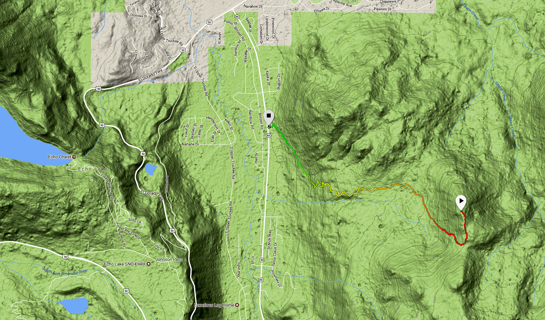
Here’s a map to assist you in finding the parking area for accessing the Warr Trail.
Travel along the Warr Hiking Trail:
The Warr Trail is on Tom Harrison’s Lake Tahoe & Tahoe Rim Trail Map #ad and National Geographic’s Lake Tahoe Basin Map (#803) #ad. You can also find it on the Lake Tahoe Basin Trail Map by Adventure Maps, Inc #ad.
However, those three maps cannot agree on the distance of the Warr Trail or where it starts. My GPS watch clocked the trail at 2.75 miles one-way.
All the maps do agree upon where it ends, however. And this location is at the intersection of the Saxon Creek Trail (aka Mr. Toad’s Wild Ride mountain bike trail).
Unless you’re planning to hike further to link up with the Tahoe Rim Trail via Tucker Flat, for example, I wouldn’t bother going to the Saxon Creek Trail junction.
Instead, I would recommend hiking further uphill to the unnamed peak closest (just north) to the Warr Hiking Trail. This route is shown on my map in the form of the hooked shape trail highlighted in red.
This brief deviation with the actual trail provides a much more gratifying turnaround point. You’ll be rewarded with exceptional views looking west. These views include Echo Summit, Echo Lake, the southern half of the Crystal Range in Desolation Wilderness, and Mount Tallac.
There’s some off-trail hiking involved in this choice, but nothing too dangerous. Just be conscious of your steps and don’t try to climb up and over the large granite boulders.
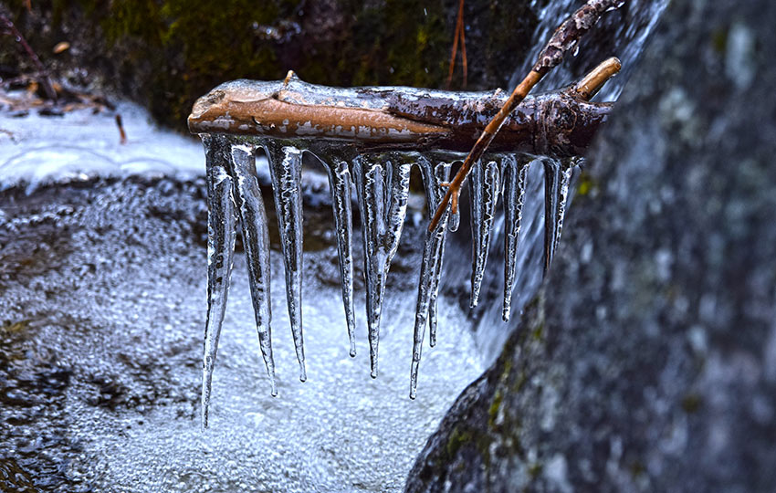
Many parts of the Warr Trail can be slick and icy in late fall, early winter, and spring. That’s because there are a handful of small streams that cross the trail. And they can quickly turn to ice under the right circumstances.
Also, the first major aspect of the trail is on a west facing slope. So a lot of the snow melt will also go through a freeze/thaw cycle which can create hazardous walking conditions.
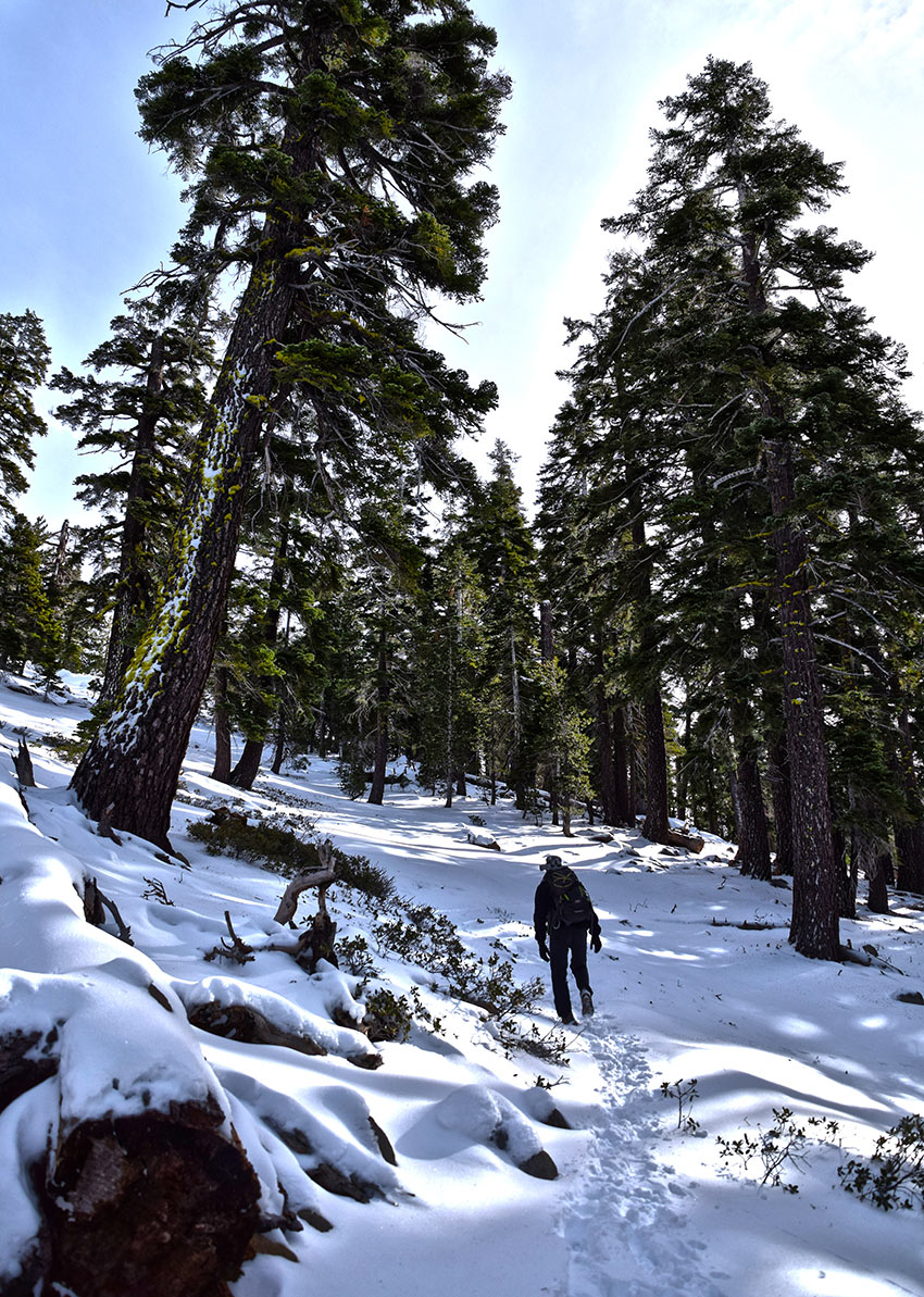
If in doubt, bring micro-spikes or foot traction devices to negotiate the icier parts. When the snow is deep enough, you’ll definitely want to bring with you some snowshoes.
If this trail has enough snow that you need snowshoes, exercise caution when traveling it.
The trail mostly faces west and south as opposed to more avalanche prone aspects of north/northeast/east. But, there are still a few parts of this trail where there is nowhere to go but down.
Do you have other insight, feedback, or trail updates about hiking Warr Trail?
If so, please post it in the comment section below for the benefit of everybody 🙂
Great article, Jared!
Thanks, Joe 🙂