The trail to South Camp Peak probably isn’t in the top five hiking trails at Lake Tahoe. And, it may not even be in the top ten. However, I would argue that it’s still as exceptional a hike as any at Lake Tahoe.
Parking is abundant (free!), the trail is easy to navigate, and there’s enough elevation gain to get your heart pumping. All of that, and the 10-mile (out-and-back) distance is perfect for a quality day hike.
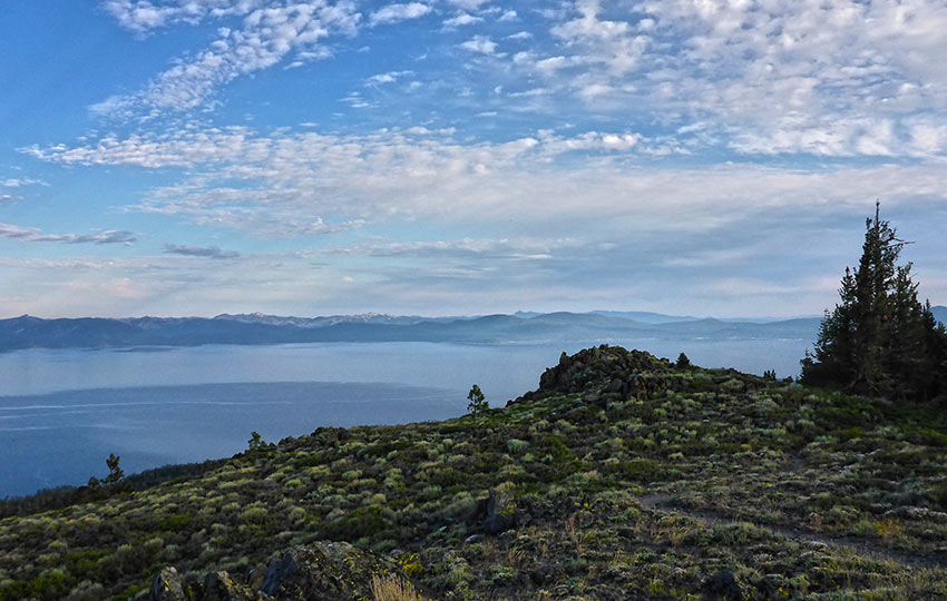
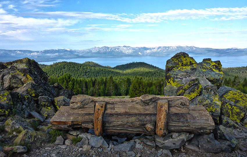
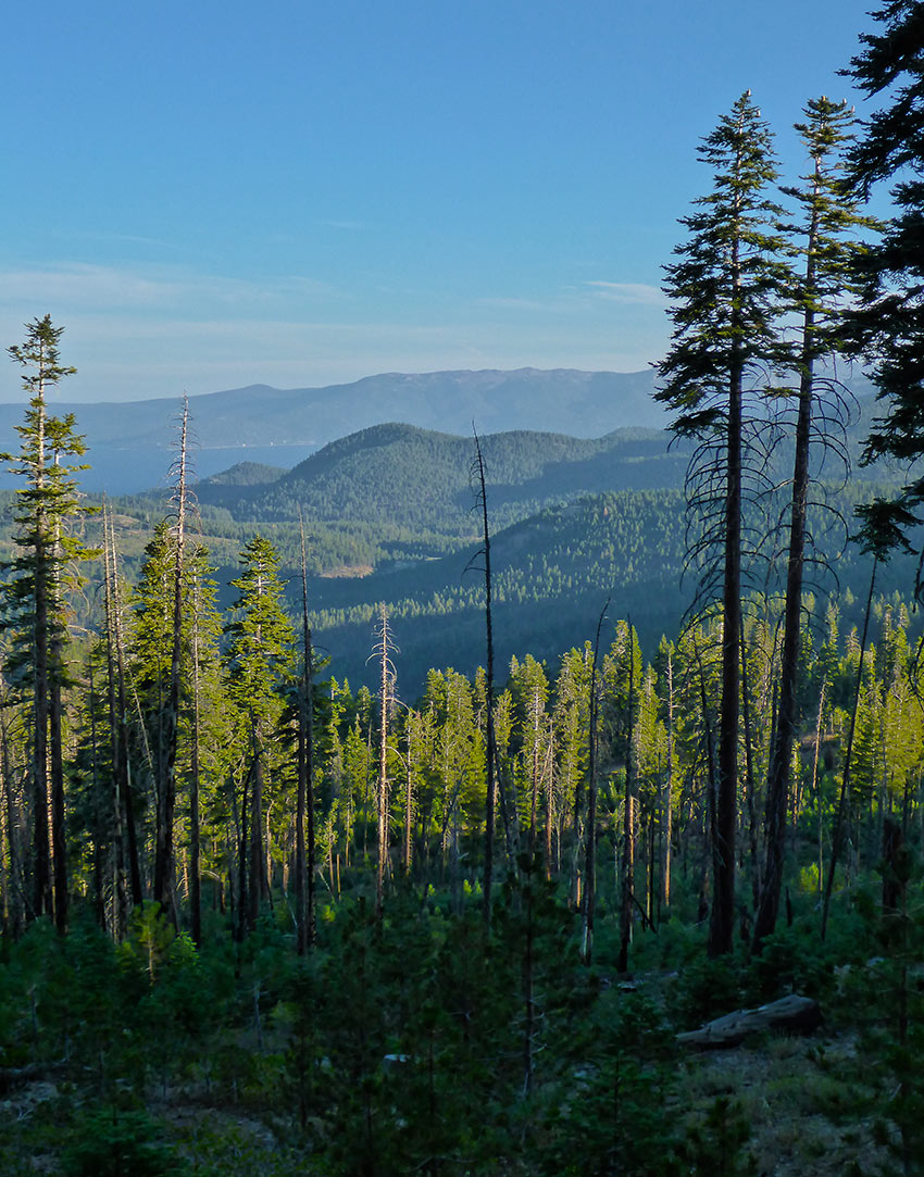
The best part, though, is that you’re afforded panoramic views of Lake Tahoe for a good portion of the hike.
Support Tahoe Trail Guide with a financial contribution via PayPal (single contribution) or Patreon (reoccurring contributions). Your support of Tahoe Trail Guide is very much appreciated!

South Camp Peak Trail Data (approximations):
- Location: East Tahoe – Spooner Summit
- Category of Hike: Day Hike
- Category of XC Ski/Snowshoe Route: Intermediate, Advanced
- Total Mileage: 10 miles (out-and-back)
- Total Elevation Gain: 1,800 feet
- Highest Point: 8,776 feet
- Trail Conditions: Alternating between sandy and hard-packed soil
Considerations for Hiking South Camp Peak Trail:
- The trail to South Camp Peak is very exposed. So protect yourself from the sun and wind, especially when hiking midday.
- The trail to South Camp Peak is only five miles and features less than 2,000 feet of total elevation gain. However, it’s all uphill.
- If you plan to camp overnight near South Camp Peak, pack in enough water to last you through the night. And be sure that you are tented between 100-300 feet from any trails.
- Adhere to all Leave No Trace principles.
- There are few trail signs and markers on public lands in the Tahoe region. So unless there are tracks to follow, the correct route may be difficult to identify. When in doubt, turn back.
- Be prepared for inclement weather by carrying plenty of warm clothes, food, and water.
- Leave an itinerary of your plans with someone who’ll call emergency services if you don’t return by your prescribed time.
- Dogs are allowed, but keep them on leash and pick up after them.

Parking Directions for South Camp Peak Hiking Trail and the Bench:
There’s an abundance of parking options at Spooner Summit. This is due to the fact that there are parking lots on either side of HWY 50.
I recommend parking on the south side of HWY 50. This is where you’ll start your trek to South Camp Peak.
In addition to multiple parking spots in the south lot, there are picnic areas, vault toilets, and informative displays about the local history.
The trailhead that leads to South Camp Peak is at the back of the south lot, near an information kiosk.
Here’s a map to help you find the Spooner Summit parking lot.
Travel along the South Camp Hiking Trail:
This day hike features only about 1,800 feet of total elevation gain. But until you reach the open area on the west side of South Camp Peak, you’re basically going to be hiking uphill the entire five miles (one-way).
So, be prepared to travel uphill as soon as you leave the parking lot.
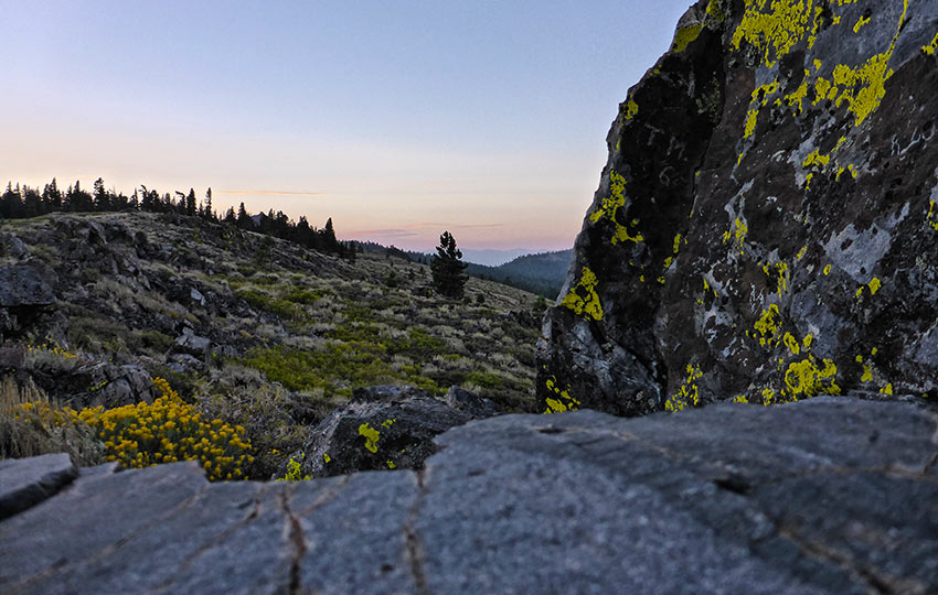
The trail is stable and obvious. And, even though it meanders in and out of forested areas, you’re never far from panoramic views of Lake Tahoe.
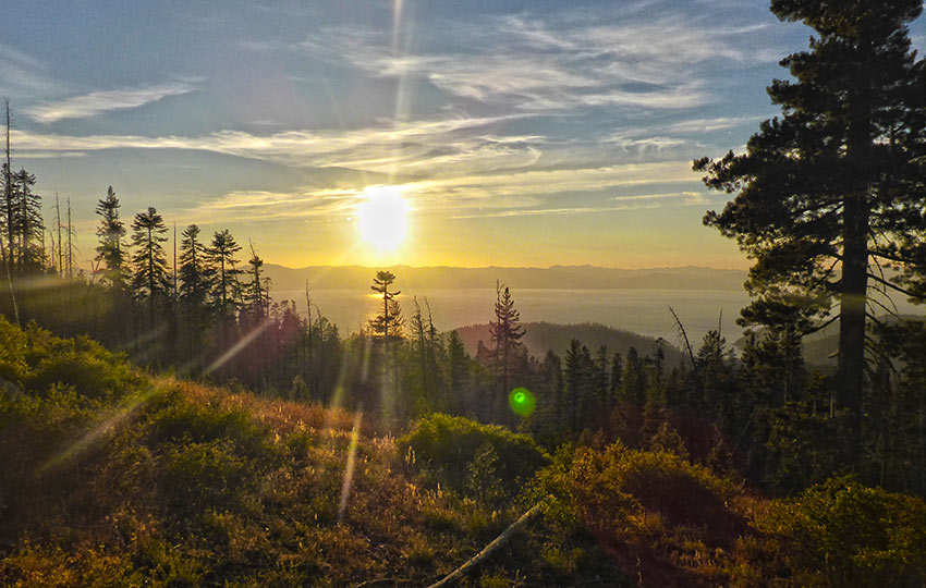
My favorite time of the day to hike this trail is at dusk. This is so I can catch the sunset, as the predominant views are to the west.
There’s no bad time, however, to travel this section of the Tahoe Rim Trail.
Just know that if you plan to watch the sunset from this location, you’re going to have to hike the five miles back to the parking lot in the dark. Or, plan to camp overnight.
Please note that even though the trail travels in and out of the trees, because there are so many unobstructed views, you’re going to be susceptible to exposure. Come prepared to protect yourself from the sun and wind when hiking this trail during the middle of the day.
South Camp Peak is on the east shore of Lake Tahoe, which I know is obvious. However, this means that it remains free of snow longer than other parts of Tahoe. So you can hike this route later in the fall and earlier in the spring.
Since this hike is only 10 miles long, most people just make a day hike of the route.
But this section is technically the Tahoe Rim Trail, so backpacking is fair game.
I’ve hiked the five miles to South Camp Peak in the evening to catch the sunset. Then I dry camped overnight (packed in all my water) and hiked out the following morning after sunrise.
For camping overnight along the Tahoe Rim Trail at South Camp Peak, tent between 100-300 feet from all trails. And make sure you use an existing tent site (i.e. don’t create any new sites).
Also note, if you hadn’t already figured it out, that there are no water sources near South Camp Peak. When planning to stay overnight, you’ll have to pack in your own water.
Lastly, on the kiosk near the trailhead I’ve always seen notices posted about bear and mountain lion activity in the area between Spooner Summit and Kingsbury Grade (where this trail eventually leads to).
Heed these warnings by being visible. Make noise every once in a while to announce your presence. And keep all of your scented items secured properly. The last bit of advice is primarily for those of you planning to camp overnight along this stretch of the Tahoe Rim Trail).
Do you have other insight, feedback, or trail updates about hiking South Camp Peak (and the Bench)?
If so, please post it in the comment section below for the benefit of everybody 🙂