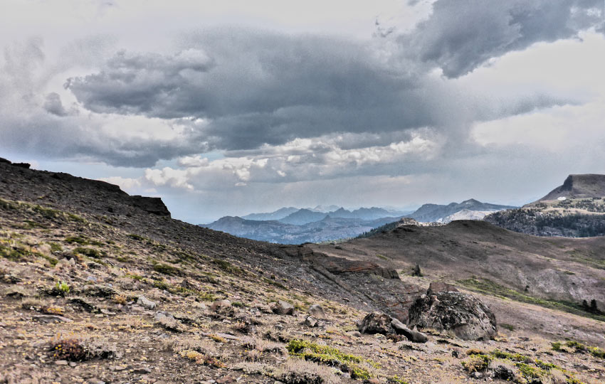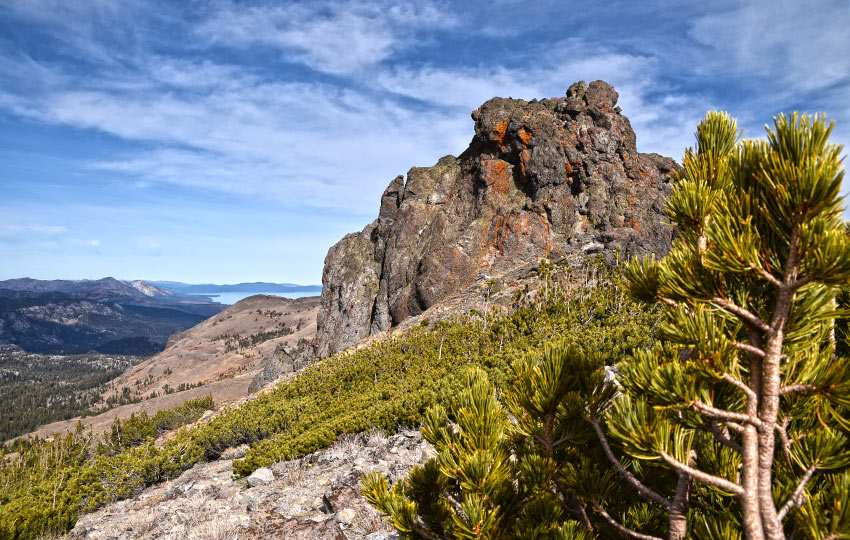
Red Lake Peak is an exceptional hike that includes on and off-trail travel. Although half of the route to Red Lake Peak is off-trail, those few miles are easy to navigate because they’re across open terrain allowing you to see for miles in all directions.
And, those views are incredible! You’ll see glimpses of Freel Peak, Lake Tahoe, Desolation Wilderness, and full panoramic scenes of Stevens Peak, Meiss Country (including Little Round Top and its ridge), Kirkwood, Caples Lake, The Sisters and Round Top, Elephants Back, further southeast into Alpine County, and Hope Valley and Hawkins Peak.
Red Lake Peak is a favorite among local backcountry skiers as the peak is relatively easy to access and provides amazing lines off of its eastern side. Although for cross-country skiers and snowshoers, travel to Red Lake Peak but return to the trailhead along the same route you took to reach it.
Support Tahoe Trail Guide with a financial contribution via PayPal (single contribution) or Patreon (reoccurring contributions). Your support of Tahoe Trail Guide is very much appreciated!

Red Lake Peak Trail Data (approximations):
- Location: South Tahoe – Carson Pass
- Category of Hike: Day Hike
- Total Mileage: 6 miles
- Total Elevation Gain: 1,900 feet
- Highest Point: 10,063 feet (the top of Red Lake Peak but not recommended to climb because the volcanic rock outcropping that constitutes the actual peak is very dangerous, so most people just hike around its base)
- Trail Conditions: Alternating between packed and sandy soil, with 3 miles of off-trail hiking across open terrain
Considerations for Hiking to Red Lake Peak:
- Carson Pass is year-round paid parking at either lot (north or south), so in the summer (May 31 – Nov 1) bring a credit/debit card for the self-pay kiosk at the south parking lot near the Visitor Center
- During the winter, bring a Sno-Park permit (you can’t buy them at the parking lot)
- Whenever traveling off-trail do everything possible to minimize your impact, such as avoiding stepping on delicate vegetation and toppling rocks
- I don’t recommend climbing to the actual top of Red Lake Peak because the volcanic rock of which its formed is dangerous and can crumble underfoot – hike around its base and call it “good”
- Adhere to all Leave No Trace principles
- There are few trail signs and markers on public lands in the Tahoe region, so unless there are tracks to follow, the correct route may be difficult to identify–when in doubt, turn back
- Be prepared for inclement weather by carrying plenty of warm clothes, food, and water
- Leave an itinerary of your plans with someone who’ll call emergency services if you don’t return by your prescribed time
- Dogs are allowed, but keep them on leash and pick up after them
Parking Directions for Red Lake Peak Hiking Trail:
Park in one of the lots at Carson Pass in order to hike to Red Lake Peak. I recommend parking in the north lot (trailhead is located here) in order to avoid having to cross SR 88.
Vehicles zip around SR 88 pretty quickly and there are some blind corners. So save yourself the hassle and just park in the north lot.
Besides, there will most likely be more available parking spots in the north lot. Most people who travel to Carson Pass hike south to Frog Lake or Winnemucca Lake. They park in the south lot since it’s closer for those hikes.
No matter the season, you’ll need to pay a $5 day-use fee at Carson Pass (south lot). In the summer, you can now only pay by credit/debit cards via a digital kiosk near the Carson Pass Visitor Center. Check times for when the shop is open if you want to buy any books or maps.
For winter months (November 1-May 30) you’ll need a Sno-Park permit ($5/day, $25/season). You have to purchase the permits elsewhere, such as online or in Meyers or South Lake Tahoe. There are no options to purchase Sno-Park permits at any of the Sno-Parks around the Lake Tahoe Basin, so come prepared.
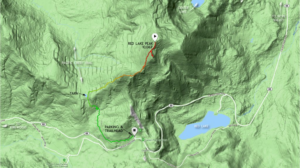
The trailhead for the route to Red Lake Peak is located in the northwest corner of the north parking lot on Carson Pass.
Here’s a map to help you find the parking area and trailhead for hiking to Red Lake Peak.
Travel Directions for Hiking to Red Lake Peak:
Beginning from the trailhead in the north parking lot at Carson Pass, hike north along the trail (which also happens to be the Pacific Crest Trail) for about 1.5 miles.
At about this mile and a half mark you’ll find a tarn just off to the left (west) of the trail. Believe it or not, this small mountain lake is the headwater of the Upper Truckee River. This location also forms the southernmost point of the Lake Tahoe Basin watershed area.
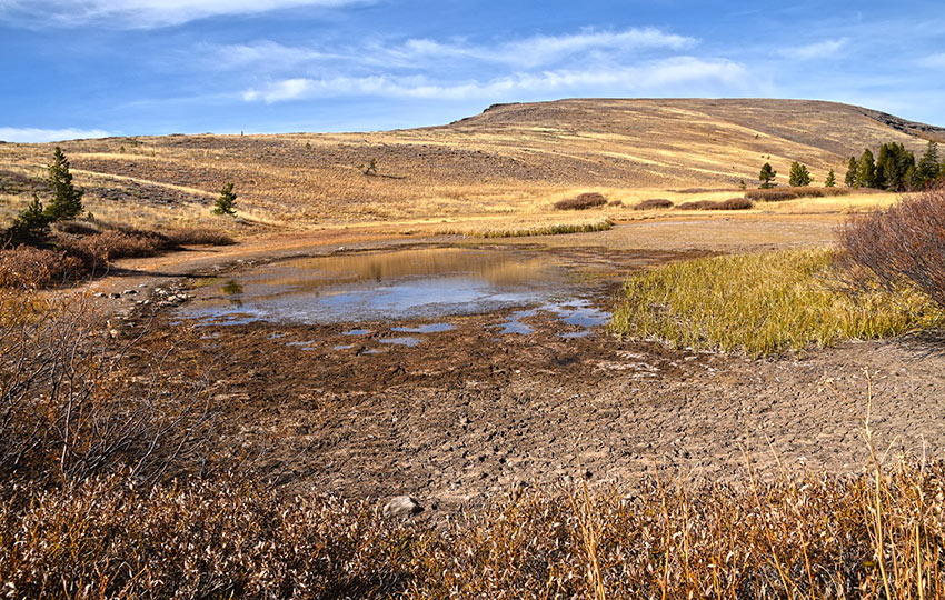
Once you reach the tarn, walk a few paces further along the trail to find a small creek or draw on the right (east). Head up this draw toward the false summit (prominent outcropping of volcanic rocks).
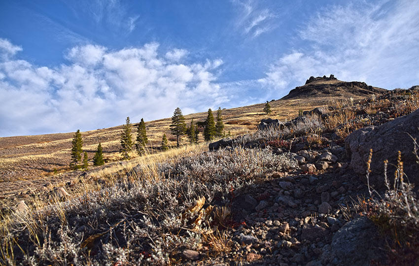
Most of the time I don’t trace a line right up the center of the ridge and hike directly up this false summit. Rather, I circumnavigate it and find a lower angle pitch to hike up it. Either way, you need to make your way to the top of this false summit so that you can continue hiking along its spine.
Once you’ve negotiated the false summit, Red Lake Peak should be obvious. It’s the volcanic rock outcropping that looks similar to a fin and appears off-center from the giant mound above you.
Follow the spine of the false summit to one of the foot paths. There are a couple options, but neither is any better or worse. And they all lead in the direction of Red Lake Peak.
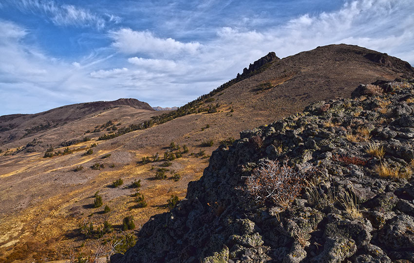
Don’t feel obligated to climb up the volcanic rock outcropping that actually forms the top of Red Lake Peak. In fact, I highly discourage it as the rock is too fragile and steep for most people to climb safely.
Generally, people (myself included) just hike around the base of the outcropping.
I do recommend hiking around its eastern side so that you can get an unobstructed view of nearby Stevens Peak.
I also recommend hiking just south of Red Lake Peak on the ridge. You’ll see some stunning views looking into Alpine County. The layers of undulating mountain ranges to the south are picturesque, to say the least.
Additional Considerations for Hiking to Red Lake Peak
Be mindful of your steps (and children) when hiking around the peak itself and its neighboring ridge. There are numerous tripping and slipping hazards adjacent to steep cliffs.
Whenever you hike off-trail, do everything in your power to minimize your impact on the land.
Leave all natural features alone. So, don’t roll, topple, or throw rocks and other naturally occurring structural features.
Only walk on durable surfaces, such as rock, gravel, and hard-packed soil. Avoid walking on delicate vegetation.
Don’t harass or otherwise tempt (by feeding) any wildlife.
For cross-country skiers and snowshoers, the route to Red Lake Peak is usually modified in some way in order to make it more direct. There’s no reason to stick to the official trail when everything is covered with snow!
But you do need to know where you’re going and how to return. So don’t completely rely on the tracks laid before you. As always, carry a map and be mindful of your surroundings.
Keep in mind that you don’t actually have to cross-country ski or snowshoe all the way to the top of Red Lake Peak. You’re going to have a great time no matter where you end up in this area. Often, I’ll just ski to the tarn (sometimes not even that far) to find a favorable angle of terrain on which to downhill cross-country ski. Then, I’ll have a blast taking a bunch of runs up and down the hill.
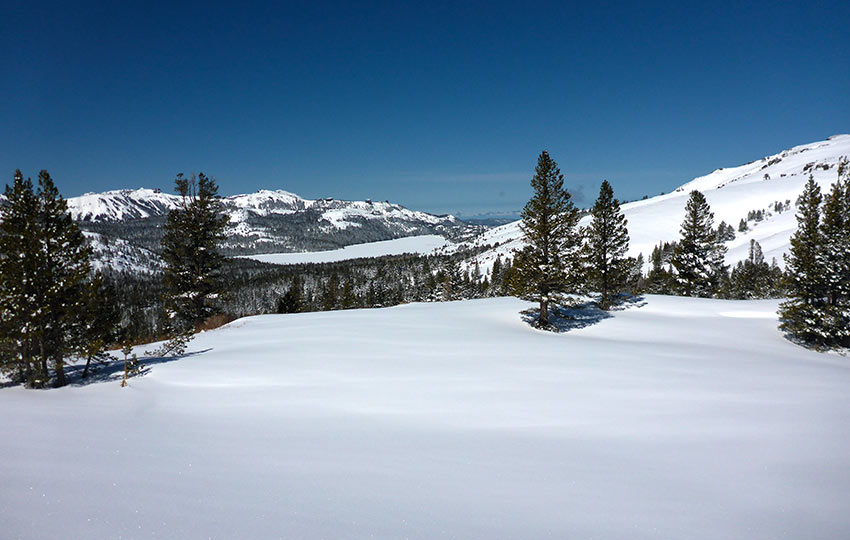
For advanced backcountry travelers using alpine gear such as Randonee, Alpine Touring, Telemark, split boards, and snowboards, look elsewhere for information about backcountry skiing down Red Lake Peak. This is not my forte, and there are other websites that can provide much more accurate and relevant information.
Do you have other insight, feedback, or trail updates about hiking Red Lake Peak?
If so, please post it in the comment section below for the benefit of everybody 🙂
