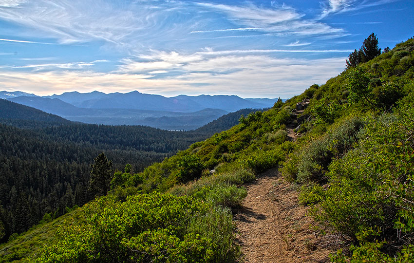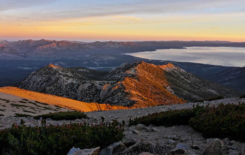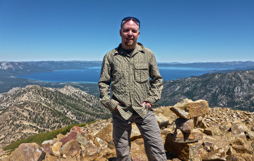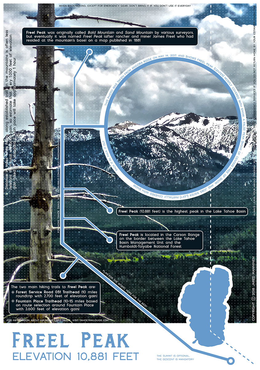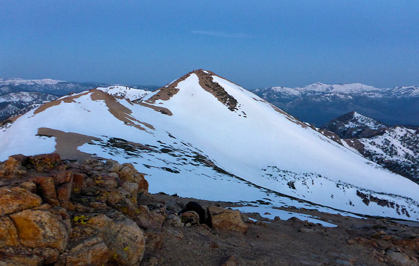
Freel Peak is the highest peak in the Lake Tahoe Basin, standing at 10,881 feet. It sits on the border between the Lake Tahoe Basin and the Humboldt-Toiyabe National Forest. As such, Freel Peak offers unparalleled 360 degree views of the entire region.
In addition to panoramic views, you’ll find a variety of Sierra Nevada wildflowers and high altitude birds. For example, Large-leaved Lupine grows tall in Armstrong Pass. And a couple of my favorite birds, such as the Clark’s Nutcracker and Rock Wren, live near Freel Peak.
Support Tahoe Trail Guide with a financial contribution via PayPal (single contribution) or Patreon (reoccurring contributions). Your support of Tahoe Trail Guide is very much appreciated!

The 10-mile round trip route (via FS 051) is aerobically challenging and features high exposure. However, it’s not technically demanding unless you’re attempting to summit it during the winter months.
In fact, probably more technically demanding is the dirt road leading up to the parking area!
Freel Peak Trail Data (approximations):
- Location: South Tahoe – Luther Pass
- Category of Hike: Day Hike, Multi-Day Hike
- Category of XC Ski/Snowshoe Route: Advanced, Ski Tour
- Total Mileage: 10 miles
- Total Elevation Gain: 2,700 feet
- Highest Point: 10,881 feet
- Trail Conditions: Alternating between hard-packed and sandy soil
Considerations for Hiking Freel Peak via FS Road 051:
- Confirm that the gate to Forest Service Road 051 is open and your vehicle is equipped for the road conditions. And plan for traveling an extra seven miles (roundtrip) if the gate is locked.
- Plan for the worst, hope for the best. This route features lots of fully exposed terrain above 9,000 feet.
- Begin your hike earlier than you would start a lesser day hike so that you have plenty of daylight. This will also enable you to get off of the peak before any afternoon storms roll in.
- Adhere to all Leave No Trace principles.
- There are few trail signs and markers on public lands in the Tahoe region. So, unless there are tracks to follow, the correct route may be difficult to identify. When in doubt, turn back.
- Be prepared for inclement weather by carrying plenty of warm clothes, food, and water.
- Leave an itinerary of your plans with someone who’ll call emergency services if you don’t return by your prescribed time.
- Dogs are allowed, but keep them on leash and pick up after them.
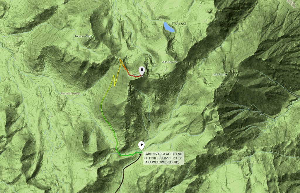
Parking for the Freel Peak Hiking Trail:
There are numerous routes of which you could travel in order to reach the summit of Freel Peak. However, starting from Forest Service Road 051 (aka Willow Creek Road) is the typical way. And it’s also the route I’m writing about in this article.
From the intersection of HWY 50/SR 89 in Meyers, CA, take SR 89 south. And drive approximately 9-10 miles until you reach FS 051. Forest Service Road 051 is easy to miss. Once you reach the official Luther Pass sign, drive about .75 miles down the hill in the direction of Hope Valley/Pickett’s Junction.
The road is on the north side of SR 89. This will be on your left as you drive downhill. FS 051 quickly turns into a dirt road after passing through the service road’s gate.
Before you leave the house, however, confirm that the gate is actually open. Keep in mind that it’s usually locked between November 1 and May 31 every year.
Also not that this is common for all Forest Service roads in the Lake Tahoe region. This is to minimize erosion of the roads. This also prevents people from getting their vehicles stuck/trapped during the wettest months of the year.
Contact the Humboldt-Toiyabe National Forest office in Carson City, NV, to determine whether or not the gate is open. If the gate is locked you can still travel the road. However, it will have to be on foot, ski, or snowshoe. And this means you’ll be adding an extra seven miles to an already long day!
Be aware that FS 051 is a rutted and rugged dirt road. The parking area for Armstrong Pass, Tahoe Rim Trail, and Freel Peak is roughly 3.5 miles up the dirt road.
In order to safely negotiate FS 051, drive a vehicle with a fair amount of clearance.
Standard two-wheel drive cars are not advised. This is because many of them don’t have the ground clearance to overcome the rocks and ruts you’ll encounter.
All-wheel drive and 4×4 vehicles aren’t necessarily a requirement, but inherent in most of their designs is good clearance.
The parking area is 3.5 miles up the road on the left side. It’s just past the second small bridge.
While standing on the road and facing the dirt lot, look to the far left of the parking area. From here, you should be able to locate the trailhead.
It may take a minute to find because there aren’t any signs and it’s tucked in some trees and bushes. You will know you’ve found the trailhead when you’ve located the small foot bridge that crosses Willow Creek. This is where you want to begin your hike.
This description for reaching the parking area and trailhead should be adequate enough to get you there.
However, if you’re unfamiliar with the Luther Pass area and the road conditions of FS 051, read my in-depth description of the route in hiking Freel Peak, Jobs Sister, and Jobs Peak (in a day).
Here’s a map to assist you in finding FS 051 for accessing the trail to Freel Peak. Note that this dirt road is also called Willow Creek Road.
Travel: along the Freel Peak Hiking Trail via FS Road 051:
Once you’re ready to step off, cross the small footbridge over Willow Creek and continued heading uphill toward Armstrong Pass. This section of the trail is approximately one mile long.
After you’ve traveled the mile, you’ll find yourself standing on the Tahoe Rim Trail (TRT). The TRT continues southwest (to the Big Meadow Campground near C 89) and to the north (past Star Lake).
Once you reach Armstrong Pass, take the north route. This will be the trail that contours the right side of Armstrong Pass as you’re facing north (in the direction of Lake Tahoe).
There’s another trail at this junction that travels around the opposite side of Armstrong Pass. This trail heads in a northwest direction. And it links up with Fountain Place Road and the Corral Loop mountain biking trail system. So, veer right and contour the west-southwest facing aspect of Armstrong Pass.
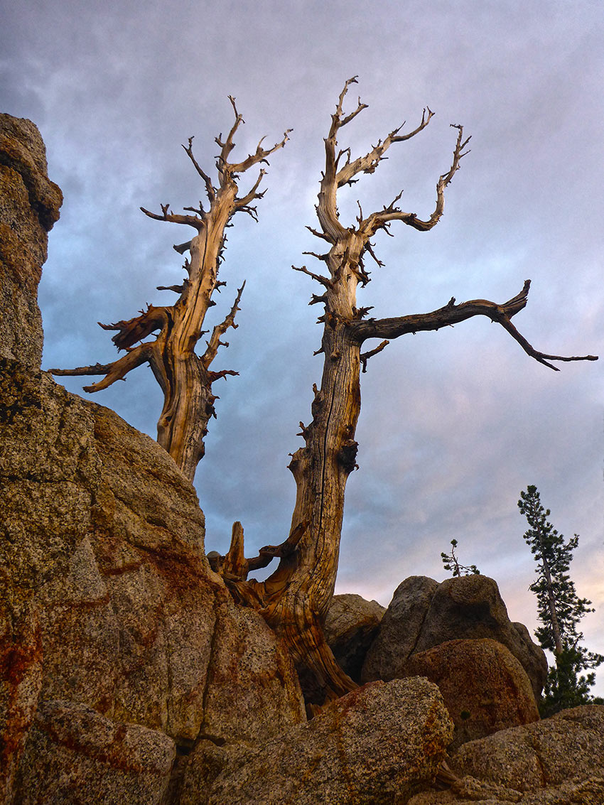
Along this section of the trail to Freel Peak, you’ll cross a couple seasonal streams. These are where you can find incredibly tall Large-leaved Lupine.
Another note about this section of trail is that it can feature ice patches. That is, if the recent temperatures have been freezing.
Don’t take these sections lightly because those streams turn into dangerous ice flows. In fact, my best friend, while hiking to Freel Peak in January 2012, slipped down a large ice flow and nearly wrecked himself. I slipped and fell on another brief section of ice right after his mishap. Fortunately we both were uninjured. But it was poor planning on our part for not treating these sections with more respect. Basically, we either should’ve hiked around them or wore some type of foot traction devices.
At the very least, throw gravel or other natural debris over the ice to decrease how slick it is.
Normally I might’ve chalked up my stupidity to being a dumb kid. But I really wasn’t that young at the time!
So, do yourself a favor by performing adequate research on weather and trail conditions and prepare accordingly.
Travel the Tahoe Rim Trail approximately 3 miles beyond the junction at Armstrong Pass. At this point, you’ll reach the saddle between Trimmer Peak (closer to Lake Tahoe) and Freel Peak.
If you continued to take the TRT north, you would end up at Star Lake. Instead, find the sign at the saddle indicating Freel Peak’s location as being 1 mile away.
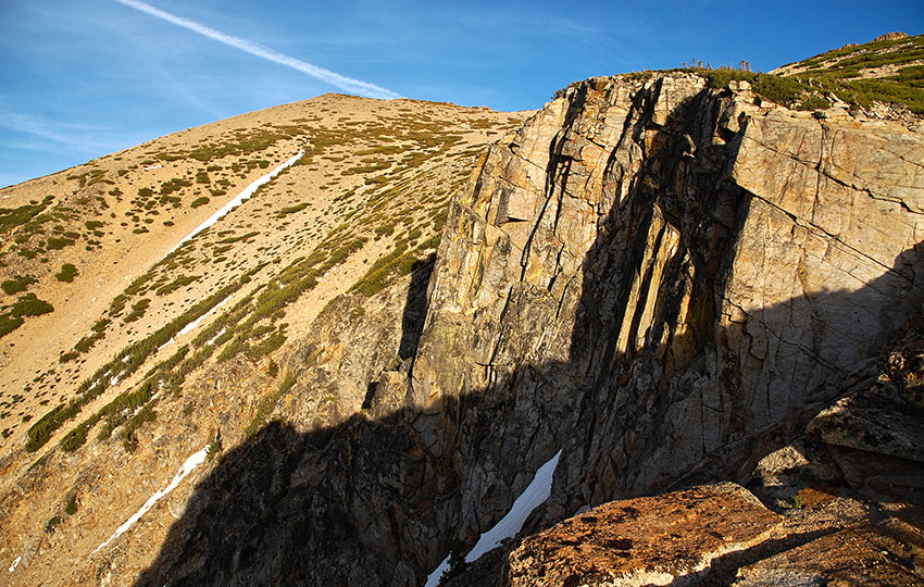
Take that trail and head uphill. The first half of this section travels along a number of switchbacks through weather-beaten trees. Because this aspect of Freel Peak is north facing, snow can remain here well into the summer. As a result, people make their own trails to either avoid or cross the various patches of snow they encounter. Often it will appear that the trail through this relatively steep section has become a free-for-all.
Do your best to stay on the actual trail. And be careful near this brief section as it does come fairly close to a steep edge.
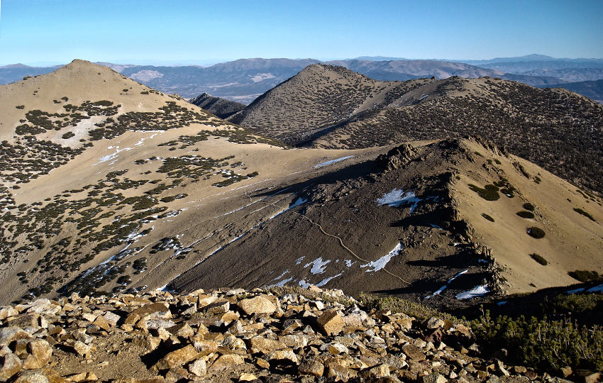
At this point of your journey you’ll have reached about 10,000 feet in elevation. As such, you’ll be fully exposed to the elements! The sun and wind can be punishing, so come prepared with adequate skin protection and water/food.
Keep a closer eye on the weather once you reach the saddle and start heading up the mountain. This is because there’s no place in which to run once you hit those switchbacks.
Also, monitor your hiking pace as well as your mental and physical states.
Again, there are no quick or easy ways in or out of this region of Lake Tahoe.
Once you reach the summit, Jobs Sister and Jobs Peak are easy to locate as they’re due east from Freel Peak. That said, you’ll notice how easy it looks to travel to those other two peaks.
You wouldn’t be the first to think that, nor the last. In fact, Freel Peak, Jobs Sister, and Jobs Peak make up the great Tahoe hike known as the “trifecta,” “three peaks,” or “Tahoe’s Triple Crown.” Save it for another day when you’ve come prepared as there are a handful of other considerations regarding that route.
I do recommend that you travel it one day. And when you do decide to take on the challenge read my article about it for more information.
History of Freel Peak’s Name
A quick note about Freel Peak’s name according to the book Tahoe Place Names: The origin and history of names in the Lake Tahoe Basin #ad …
Freel Peak was originally called Bald Mountain and Sand Mountain by various surveyors. However, on a map published in 1881 (based on the Wheeler Survey of 1876-77), the mountain was named Freel Peak. The name is of the rancher and miner James Freel, who had resided at the mountain’s base.
Lastly, when you’re driving through South Lake Tahoe on HWY 50, take a look back at where you traveled. Jobs Sister is the more defined looking peak as it appears as a sandy swash of earth with a pointy top.
Freel Peak is the larger and rounder topped mountain just to the west of Jobs Sister.
Many people mistakenly identify Jobs Sister for Freel Peak, so now you’ll know the truth!
Here is an infographic I created about Freel Peak. Order your copy at RedBubble.
Do you have other insight, feedback, or trail updates about hiking Freel Peak (via FS 051)?
If so, please post it in the comment section below for the benefit of everybody 🙂
